Quando descobri a existência deste círculo de pedras fiquei chateada porque poderia ter ido com minha amiga Vicky. Estivemos tão perto! Passamos por Berwick-upon-Tweed a caminho de Lindisfarne (Holy Island) e Bamburgh, gostamos da cidade e só não ficamos um dia ou dois porque já tínhamos feito outras reservas. O lugar ficou registrado na lista “Onde Voltaremos”. E acabei voltando sozinha.
When I found out this Stone Circle existed, I was sad because we could have gone there, me and my friend Vicky. We’ve been so close, through Berwick-Upon-Tweed on our way to Lindisfarne (Holy Island) and Bamburgh. We appreciated the town and would have stayed a couple days, but we already had bookings elsewhere. But we added Berwick to our wishlist “We’ll return”. Eventually I returned by myself.
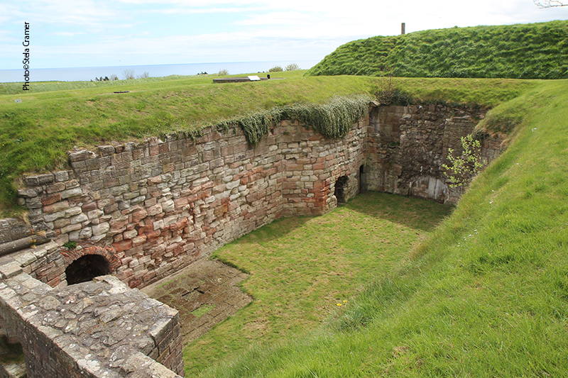
Berwick-Upon-Tweed é a cidade mais ao norte da Inglaterra, a 4 km da fronteira com a Escócia, bem no centro das guerras entre os dois países, tendo mudado de mãos mais de uma dúzia de vezes ao longo de 400 anos, até ser retomada definitivamente para a Inglaterra em 1482, por aquele que viria a ser o Rei Richard III. Mais adiante, a Rainha Elizabeth I investiu pesadamente na fortificação da cidade, construção de quartéis e muralhas, desenhadas para resistir à artilharia inimiga e favorecer o uso da própria pelos ingleses. Vicky e eu demos uma boa volta por essas muralhas enquanto esperávamos o transporte para Lindisfarne! Postarei fotos na sequência.
Berwick-Upon-Tweed is the northernmost town in England. 2.5 mi south of the Anglo-Scottish border. A central area to historic border wars between the Kingdoms, over a little more than 400 years, Berwick changed hands more than a dozen times until it’s been retaken for England by the future King Richard III in 1482. Later, Queen Elizabeth I invested heavily on its fortifications, barracks and ramparts, designed both to withstand artillery and to facilitate its use from within the fortifications. Vicky and I strolled around these ramparts while we waited on the transport to Lindisfarne. I will post the photos in the next entry.
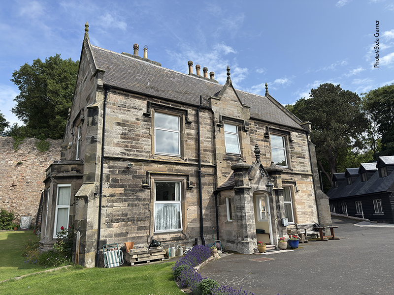
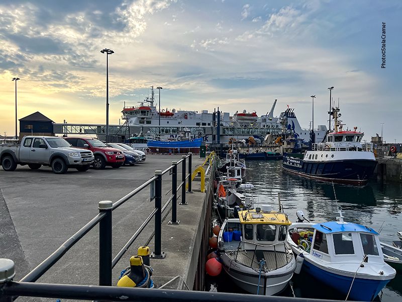
Dia 2 de julho de 2025 voltei a Berwick. Reservei duas noites num B&B estrategicamente localizado junto à estação de trem, Castle Vale House. Reservei duas noites num B&B estrategicamente localizado junto à estação de trem, Castle Vale House. É sempre bom ficar perto da estação, especialmente se você está carregando mais que uma mochila. Saindo de Edimburgh, tem trens praticamente de hora em hora. A viagem leva 40 minutos.
Cheguei por volta de meio dia. Estava nublado, mas eu estava ansiosa para chegar nas pedras e acreditei que o tempo pudesse abrir até chegar lá. Assim, fiz o check-in e a maravilhosa hostess Margaret foi checar o número do ônibus que eu devia pegar. Seria inconfundível pois o destino do ônibus era DUDDO. O ponto ficava a dez minutos de caminhada, no centro da cidade, bem em frente a um café onde aproveitei para comer um sanduíche e carregar meu celular enquanto esperava o ônibus. Este chegou um pouco antes das 14h… junto com os primeiros pingos de chuva.
I returned to Berwick on July 2nd, 2025. Booked a couple nights in the Castle Vale House B&B, strategically located next to the train station. It’s always wise to be near the train station, specially if you’re carrying more than just a backpack. From Edimburgh, trains depart hourly and the trip takes 40 minutes. I arrived around midday. It was cloudy, but I was anxious and hoping the weather would get better while I was on my way to the stones. So, after checking me in, the wonderful hostess Margaret helped me find out which bus I should take and where was its stop: a ten-minute walk downtown, right in front of a nice little café where I took my time to munch on a sandwich and recharge my mobile while I waited. The bus couldn’t be missed, its destination DUDDO written in capital letters. It arrived a bit before 2 p.m., and with it the first drops of rain.
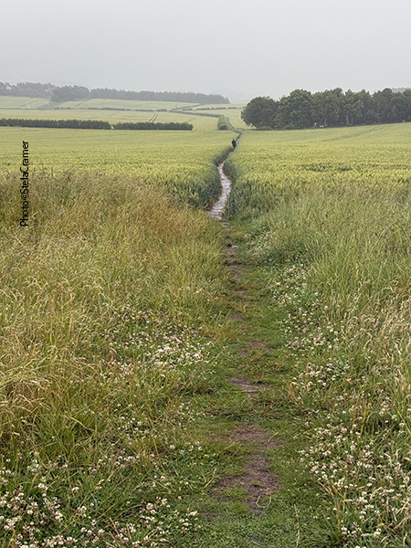
After a never ending half mile on this side road, I see the sign for the footpath, at last
A motorista era uma jovem – aliás, nesta viagem mais recente, constatei que um elevado percentual de motoristas de ônibus eram moças, em contraste com anos anteriores, quando eram sempre senhores de mais idade. Imagino que tenham se aposentado. De toda forma, ela me avisou onde eu deveria descer e apontou a estrada que levaria à trilha até as pedras. O ônibus de volta parava no mesmo ponto. Passaria um às 5 e meia e outro por volta das 7h. Embrulhei a mochila com a capa de proteção, botei o capuz e desci. A esta altura chovia torrencialmente.
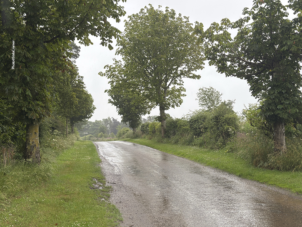
The driver was a young lady . Actually, in this latest trip I had noticed that a high percentual of bus drivers were young ladies, contrasting to former years when the drivers were always senior men. So, they are probably retired now. Anyway, she let me know where I was supposed to get off and pointed the road to the Stones footpath. The return bus would stop at the same place; there was one scheduled for half past five and another around 7 p.m. So I wrapped my backpack with the rain cover, put my hood on and got off. By now, hard rain was pouring down.
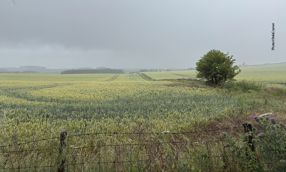
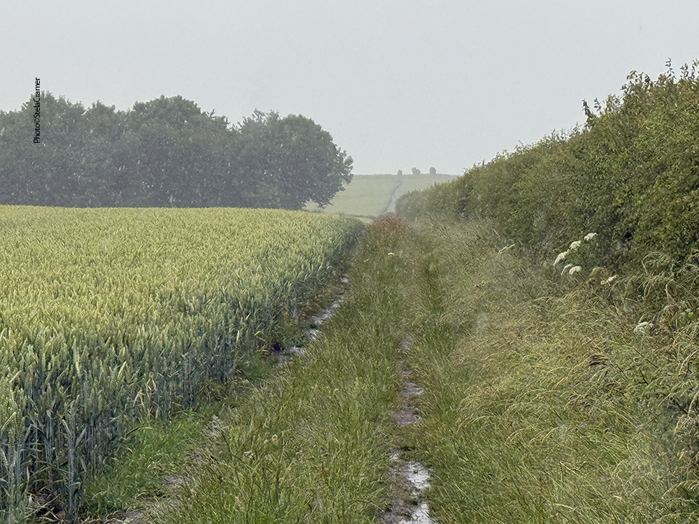
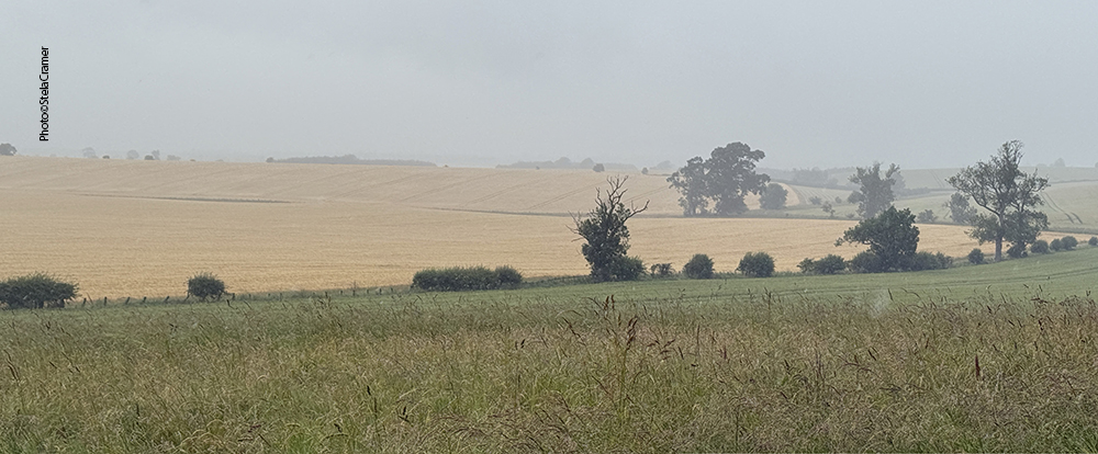
Um quilômetro depois, quando encontrei a placa apontando para a trilha que leva às pedras, já estava inteiramente encharcada. A chuva sempre acha um jeito de entrar dentro da roupa e dos sapatos. A princípio você nem vê as pedras; aliás não dava para ver quase nada com a névoa além da chuva, apenas trigo plantado de ambos os lados da trilha, e lama. Mais um quilômetro adiante minhas meias já tinham virado esponjas, fazendo aquele barulhinho shlop shlop nas poças que se formaram dentro dos sapatos. Mas por fim, depois de uma ligeira curva, a silhueta das pedras surgiu no horizonte. Bem longe. Segui feliz cantando It’s Raining Again, do Supertramp.
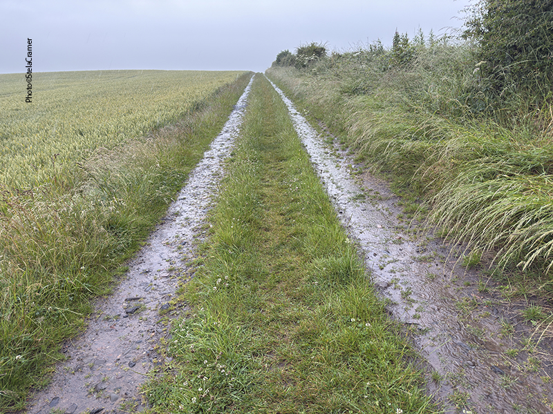
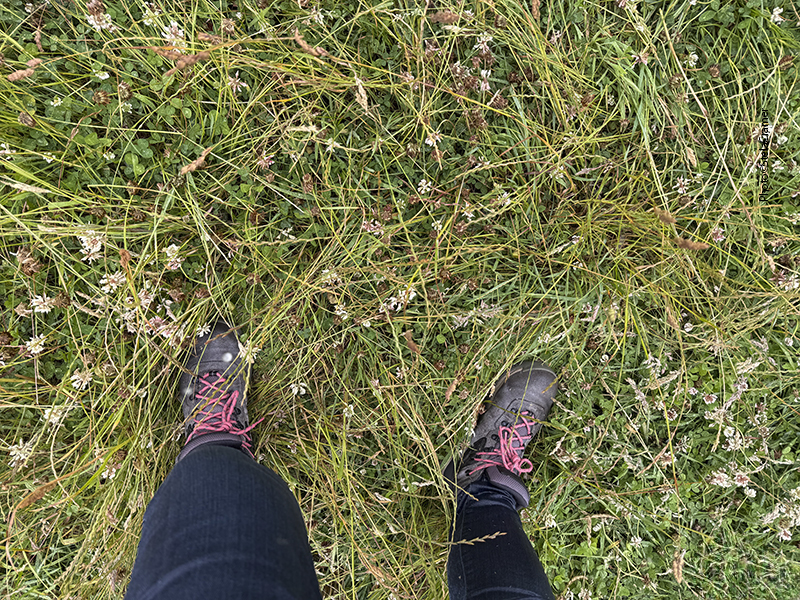
Half a mile later, when the sign for the footpath finally appeared, I was soaked. The rain always find its way into one’s clothes and shoes. At first you can’t see the stones; actually all I could see through rain and mist was wheat, both sides of the track. And mud. Half a mile ahead, my socks had turned into sponges, sploshing in the puddles inside my shoes. But after a slight turn, the stones silhouette could be seen in the horizon. Far away. But so far, I was happily singing Supertramp’s It’s Raining Again.
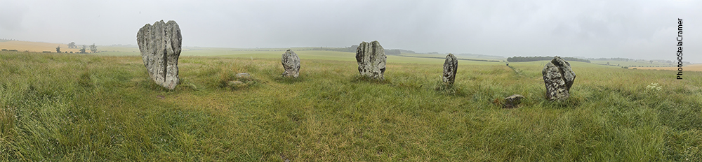
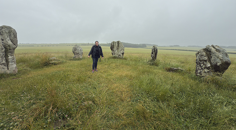
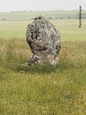
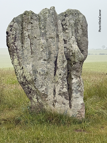
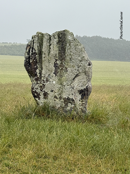
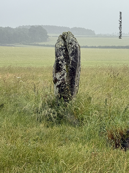
As Pedras de Duddo, na Northumbria, existem há pelo menos 4000 anos. Na verdade eram originalmente sete pedras. Os encaixes das duas que faltam foram encontrados numa escavação por volta de 1890. Até 1903 eram conhecidas como as Quatro Pedras, mas a quinta pôde ser restaurada.
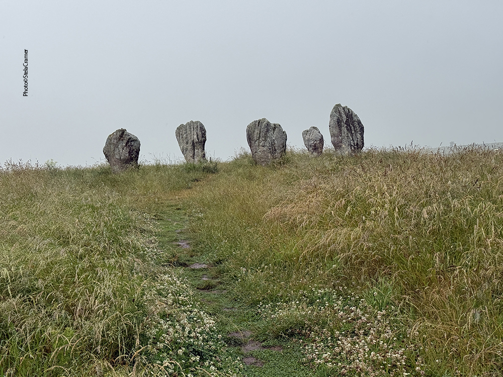
Duddo Five Stones,also known as “The Singing Stones'”and “The Women“
The Duddo Stones have stood in Northumberland for at least 4000 years. The stones were known as the Four Stones until 1903, when the fifth stone was re-erected. There were originally seven stones, the empty sockets of two stones being found on the western side during excavation in the 1890s.
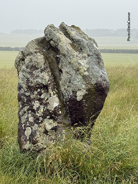
As pedras são arenito local, e todas apresentam profundos sulcos causados pela erosão. 4000 anos debaixo de chuva tal como eu estava presenciando, impressionante é não terem se desintegrado totalmente. Nem tive coragem de desembrulhar a mochila e tirar a câmera. Fiz as fotos todas com o celular.
The five stones are local sandstone, each etched with deep and weathered water run-tracks. 4000 years under such rain as it was pouring, it’s impressive they haven’t totally disintegrated. I decided not to unpack the camera; took all photos with the mobile.
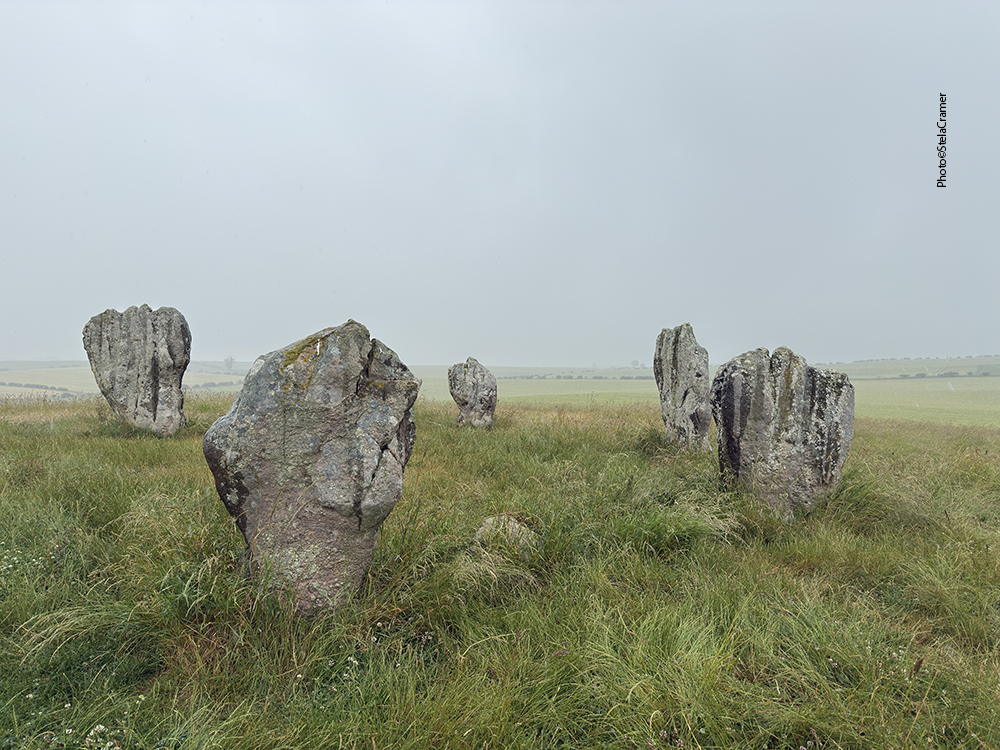
The tallest stone stands at 2.3 metres. The circle itself is 10 metres in diameter.
Dizem que as fissuras das pedras cantam quando o vento sopra de uma determinada direção.
Infelizmente não foi o caso nesse dia, mas assim mesmo o lugar tem algo de surreal. Especialmente quando, do nada, surgiu um casal igualmente ensopado! Nos olhamos e começamos a rir : “Não somos os únicos doidos aqui!” Não dava para conversar muito debaixo da chuva; apenas o suficiente para bater fotos uns dos outros e constatar que não seria possível pedir uma carona, pois eles iam para a direção oposta.
The fissures are said to sing when the wind hits them just so. Unfortunately, it didn’t happen that day. Still, the place has a surreal vibe. Yet more when a couple – as soaked as I was – just appeared out of nowhere. At the sight of each other we started to laugh: “We’re not the only mental here!” It wasn’t possible to talk too much under the rain, just enough to take pictures of one another and realize that there was no hope to get a ride, because they were going the opposite way.
Ao ver seus vultos sumindo na distância ( agora seguindo a trilha por onde eu viera) lembrei-me de ir embora também, pois deveria estar no ponto para pegar o ônibus de volta. Não tinha a menor chance de, por exemplo, o céu abrir e surgir um arco íris emoldurando as pedras. Voltei pela mesma trilha, agora ainda mais enlameada. Pareceu mesmo mais longa, embora fossem os mesmos 2 ou 3 km até o asfalto. Depois de uma curva, as pedras desapareceram de vista. Tratei de apressar o passo, embora não tanto que pudesse escorregar e levar um tombo pois estava tão enlameada que talvez tivesse que jogar aquela roupa fora. Mas não foi o suficiente. A 100 m da estrada principal vi o ônibus chegar, parar no ponto e seguir em frente, sem o motorista perceber uma figura na estrada lateral gritando e gesticulando.
Watching them vanish in the distance reminded me of going back too, because I wanted to catch the return bus. There was no chance of the skies opening and a bright rainbow appear framing the stones. So I went back the same way I had come, muddier by now. It seemed longer too. After a mile the stones were lost from view. I hastened, taking care not to slip and fall. I was dirty enough, maybe those clothes would have to be thrown away. But I wasn’t quick enough. A hundred yards from the main road, I saw the bus arriving. It stopped for a moment and left, the driver oblivious to someone screaming and gesturing by the side road.
Quando alcancei o ponto estava quase congelada, ensopada e miserável. Soprava um vento frio e, segundo o horário afixado, o próximo ônibus só passaria dali a duas horas. Já tinha bebido a água que trouxera e não tinha nada na mochila para mastigar. A chuva persistia. Entretanto, dez minutos depois um ônibus parou no ponto… com destino a Berwick! Era inclusive a mesma motorista. Ela tinha se atrasado! O ônibus que passara antes ia para outro lugar. No caminho de volta havia um ponto na estação de trem, ao lado do meu B&B. Corri para tomar um banho bem quente, ao final do qual constatei… que o céu tinha aberto e agora o sol estava brilhando.
When I eventually reached the bus stop, soggy, half frozen and miserable, a chilling wind was blowing. According to the timetable, next bus should only arrive in two hours. I had drank all my water, and there was nothing to munch on in the backpack. Rain kept falling down. However, ten minutes later, a bus stopped… going to Berwick! The driver was the same girl. She had been delayed! The bus I had seen before was going somewhere else. And this one, on its way back, had a stop at the train station right beside my B&B. I went immediately for a steaming shower. And, coming out of the bathroom, noticed that … the skies had opened, and the sun was now shining.