Feeds:
Posts
Comentários

Posts Tagged ‘Ilhas Orkney’


Broch de Gurness em Mainland visto de Rousay / Broch of Gurness in Mainland seen from Rousay

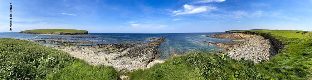
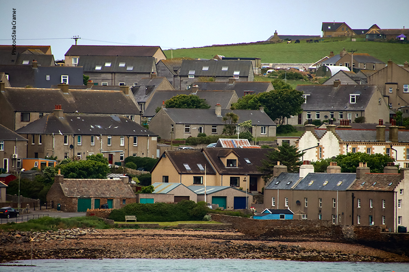
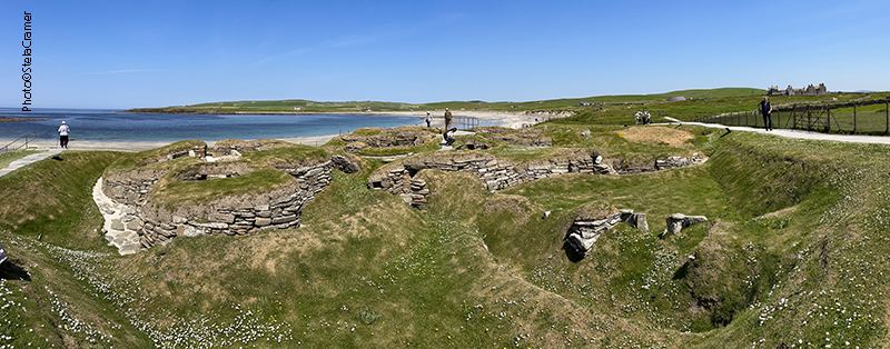
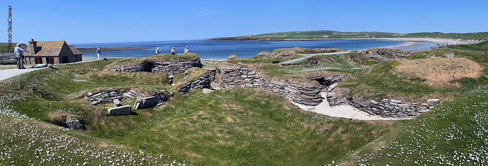
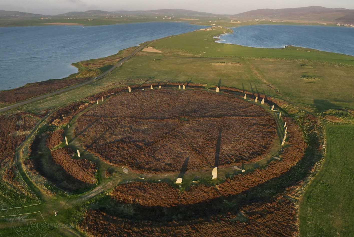
O Estreito de Eynhallow separa a ilha de Rousay de Mainland, a maior ilha das Orkneys, mas de uma se avista a outra. São apenas 3 km de distância. Dois Brochs ficam praticamente de frente um para o outro. Antes de visitar Midhowe vamos dar uma olhada em Rousay, apelidada de “Egito do Norte”, devido à quantidade e importância de sítios arqueológicos.

Eynhallow Sound divides the island of Rousay from Mainland, one in sight of the other, only 3 km apart. Two Brochs almost face each other across the water. Before visiting Midhowe, let’s take a look at Rousay. It has been nicknamed “Egypt of the North”, due to its archaeological diversity and importance.

O ferry liga as ilhas de Rousay, Egilsay e Wyre entre si e com Orkney Mainland. Pode levar até 10 carros e 95 passageiros (no inverno apenas 50). / The ferry links the islands of Rousay, Egilsay, and Wyre with each other, and with the mainland of Orkney. It can take up to 95 passengers (reduced to 50 in winter), and 10 cars.

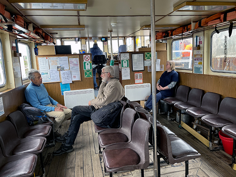
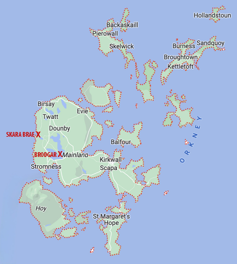
Depois de dois dias intensos em Westray e Papay (ver posts 167 a 170), peguei o ferry dia 6 de junho/2023 para Kirkwall apenas para pernoitar lá. Consegui um quarto no hotel Ayre, em frente ao terminal do ferry, e bem perto do terminal de ônibus de Kirkwall, assim pude ir andando até a condução para Tingwall, outro terminal de onde sai o ferry para Rousay. Os horários dos ônibus e dos ferrys são todos coordenados. Tinha planejado pegar o primeiro barco mas não foi possível porque precisei antes encontrar uma pessoa, que vinha de Westray trazendo o cartão de crédito que eu tinha perdido lá. O atraso acabou sendo fortuito: o guia Patrick, com quem eu tinha agendado um tour de Rousay, embarcou no mesmo horário. Foi o simpático marinheiro do ferryboat que nos apresentou. Ao me ver na prancha de embarque, correu para me ajudar com a mala e, na conversa que se seguiu, perguntei como chegar ao Taversoe, onde reservara duas noites. Ele respondeu que eu estava com sorte. Patrick era pai da dona do hotel, e me daria uma carona com o maior prazer!

A travessia leva de 20 a 25 minutos / The journey takes approximately 20-25 minutes.

After intense days in Westray and Papay ( see posts 167 to 170), I took the ferry to Kirkwall the 6thJune, just to spend the night there. Got a room at the Ayre hotel, in front of the ferry terminal and walking distance to Kirkwall Travel Centre, where I could take the bus to Tingwall, another ferry terminal that services the Rousay line. The buses and ferries’ schedules are all coordinated. My plan was to board the earliest one, but I couldn’t because I had to meet someone coming from Westray, bringing the Credicard I had lost there. The delay proved fortunate: the guide Patrick, with whom I had booked a Rousay tour, was in the same ferry I took. As I was walking aboard, a lovely sailor hurried to help me with my suitcase and, when I asked him how to get to The Taversoe (where I had booked two nights), he smiled and said that I was lucky. He introduced me to Patrick, who was the Inn owner’s father, and was happy to give me a ride.

Tingwall Terminal
Rousay Ferry Terminal
The Taversoe: o único hotel, bar e restaurante em Rousay, muito bom. / The Taversoe is the only Inn, Bar & Restaurant in Rousay, which I recommend.
Meu quarto era muito confortável, com um bom banheiro e varanda! Abaixo link para o site. / My room was very comfortable, with en-suite bathroom and a porch! Their website is:

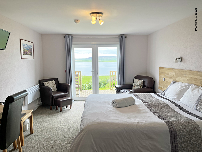
https://www.taversoehotel.co.uk/

A impressionante vista da varanda: Mainland do outro lado do estreito /
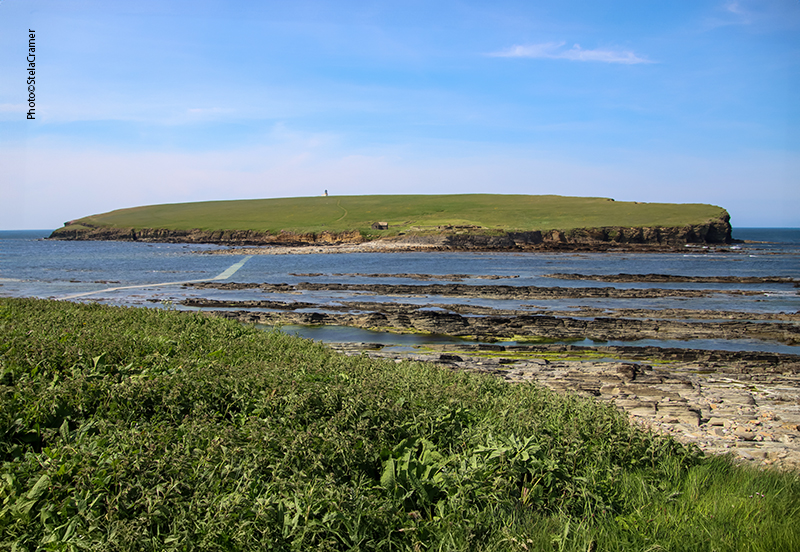
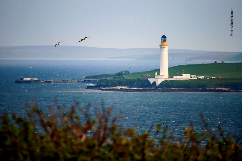
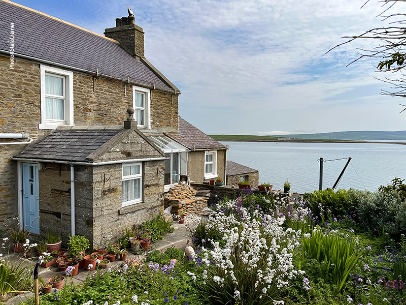
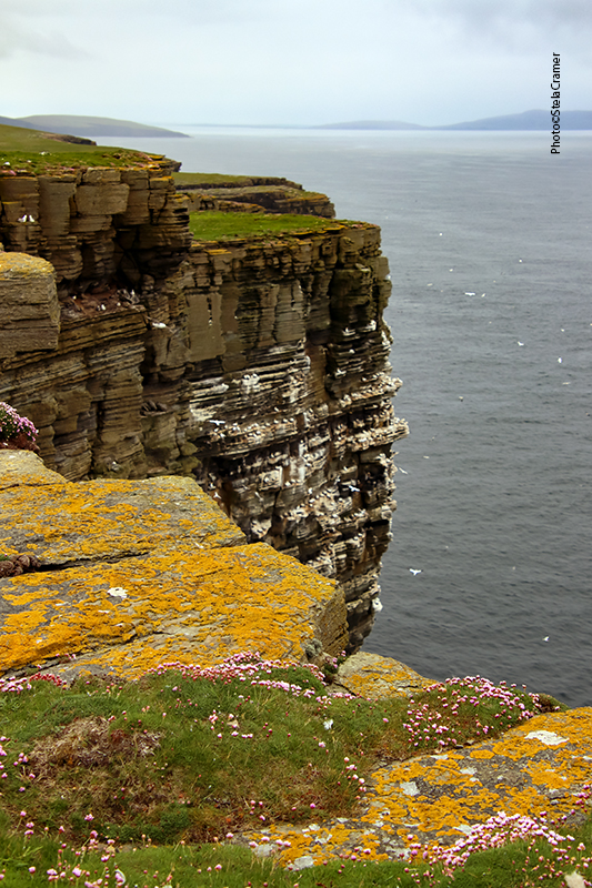
The stunning view from the porch: Mainland across the water
O Broch de Gurness, que eu iria visitar em breve (ver Post 176), visível da varanda / Broch of Gurness, which I was going to visit soon (see Post 176), in sight from the porch

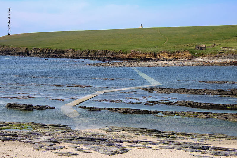
Foi uma sorte mesmo. Embora a distância fosse de apenas uns 2 a 3 km, consistia em subidas e descidas íngremes e estava chuviscando. Meu tour seria no dia seguinte, o que também foi uma sorte, pois abriu um lindo dia de sol. Aliás o sol apareceu naquele dia mesmo, um pouco mais tarde, apesar do mau tempo pela manhã. Eu já tinha tomado banho, uma pint e estava espichada na varanda do quarto apreciando a bela paisagem. À medida que caía a tarde pensei em dar uma volta, quem sabe capturar um belo por do sol! A mocinha na recepção me sugeriu subir uma trilha próxima, passando por uma pequena ponte, de onde eu teria uma linda vista. E lá fui eu toda contente.

Sol poente, ovelhas e moinhos de vento / Sunset, sheep and wind farm turbines

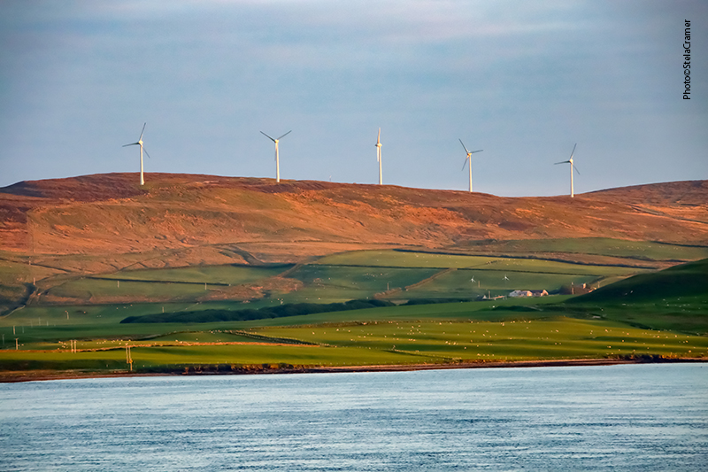
I was lucky indeed. Although the Inn was just one mile away, the road was steep and a cold drizzle had started. My Island Tour would be the next day, lucky as well because it was a gorgeous sunny day. But the sun reappeared that same day, a bit later, despite the previous bad weather. I had already taken a shower, a pint and was lazying on the porch, reveling in the awesome landscape. As the afternoon approached dusk, I thought of going for a walk, perhaps capture a beautiful sunset. The clerk suggested a trail nearby, that crossed a small bridge, from where I’d have a stunning view. So there I happily went...

A trilha levava a um túmulo! Mais contente ainda, prossegui.
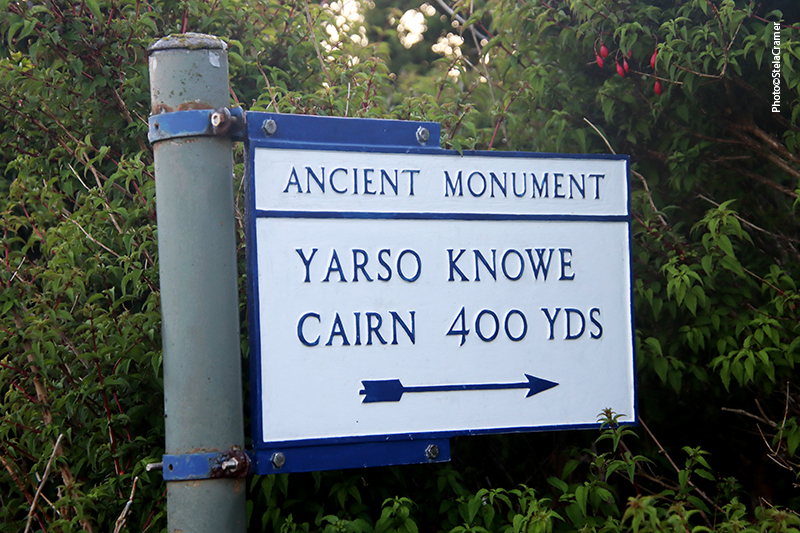
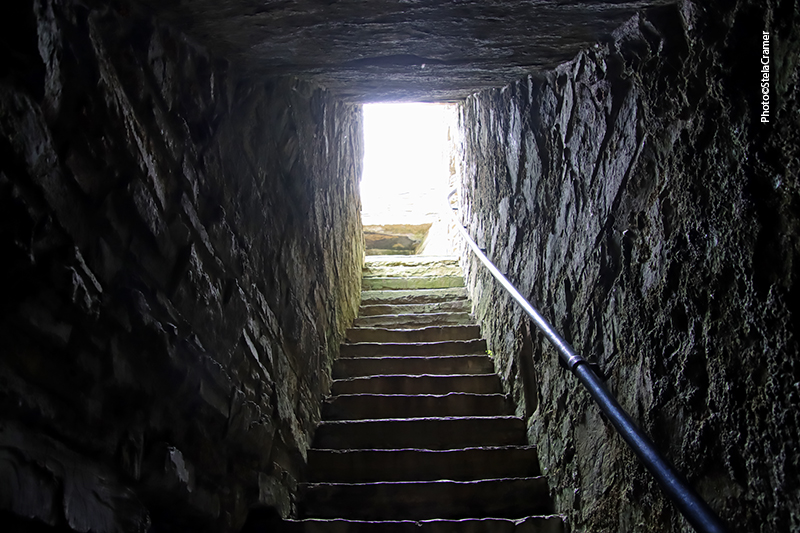
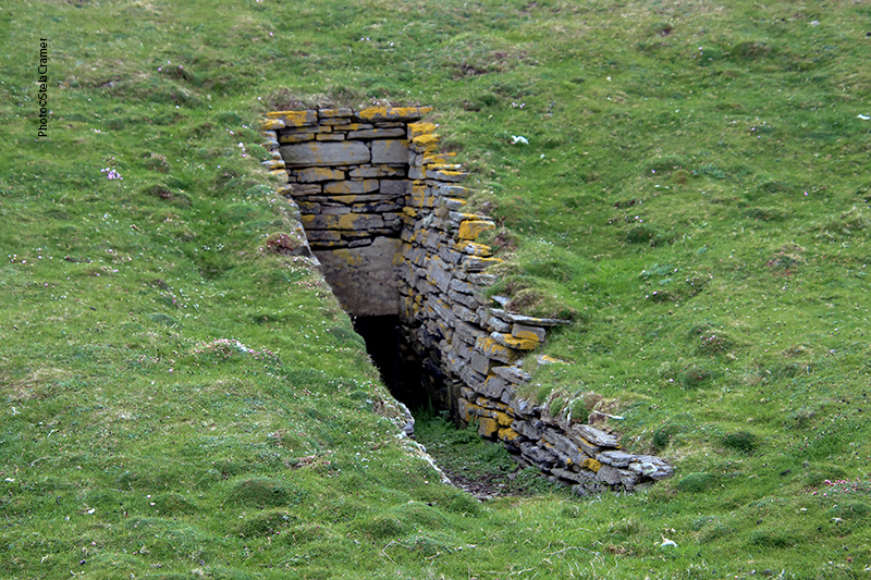
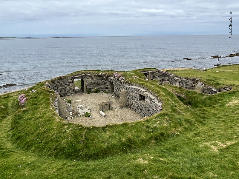
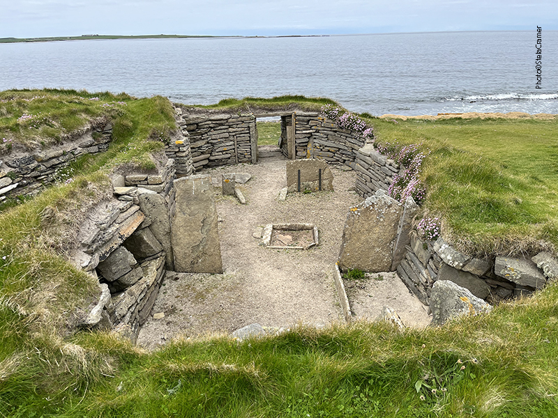
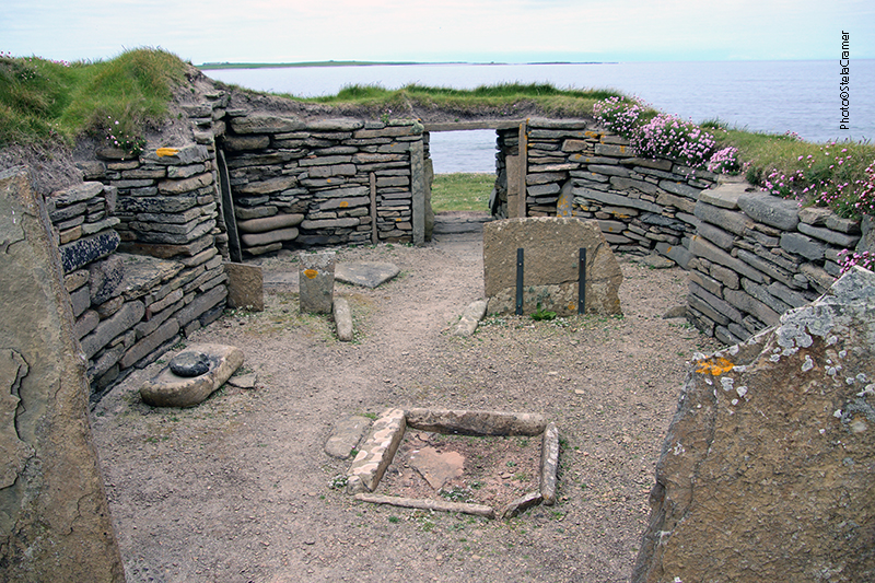
The trail led to a chambered cairn! Happier still, I went on.
A ponte indicada existia, mas não dava vista para nada além de mato / The little bridge was there but the view from it was just overgrown bushes
A trilha é quase invisível, mas a vista grandiosa/ The trail is almost invisible, but the view gorgeous

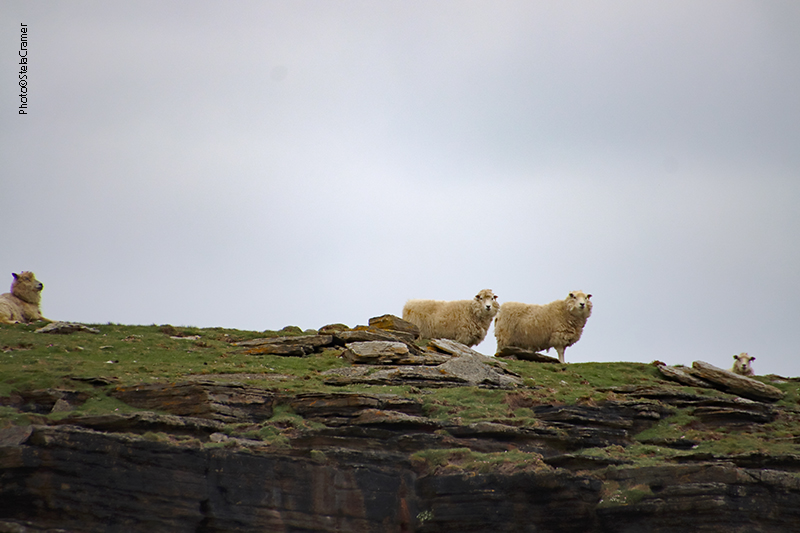
A trilha era praticamente inexistente, um caminho pedregoso no matagal, mais adequado para as ovelhas que por ali estavam do que para gente. Mesmo estas não me pareceram muito amistosas. Se afastaram quando passei, mas ficaram me encarando à distância. Levei quase meia hora para chegar à entrada do túmulo, quase suando apesar do vento frio.

The footpath was almost non-existant, steep, muddy and stony in the weeds, more appropriate to the sheep than to people. Even the sheep didn’t look very friendly. The got away as I went on, but kept staring at me from a distance. It took me around half an hour to reach the cairn. I was almost sweating despite the chilling wind.

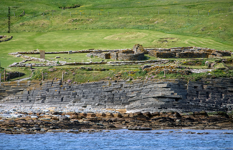
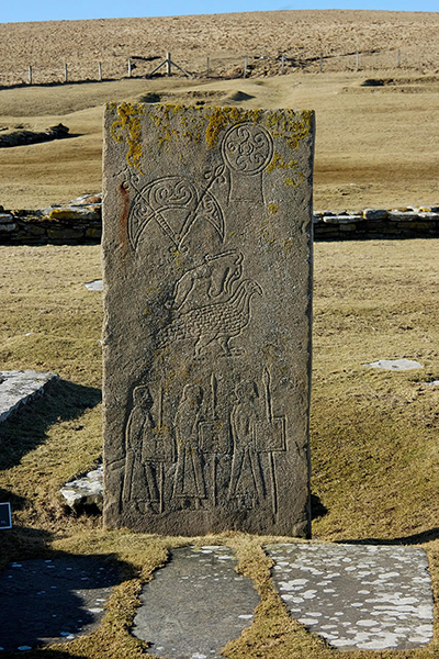
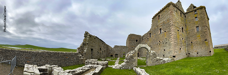
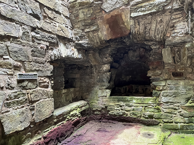
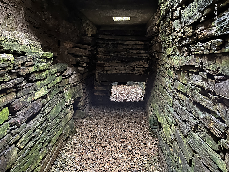
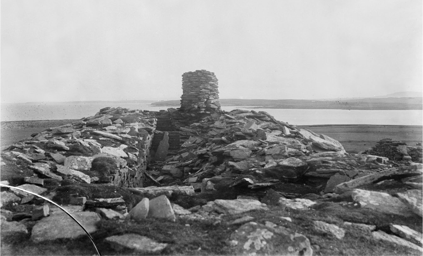
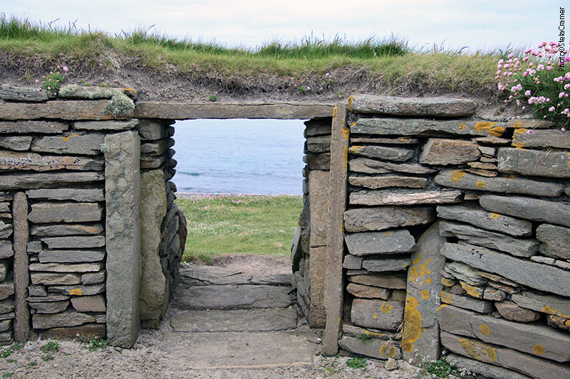
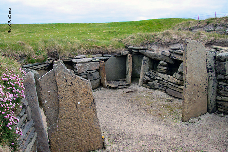
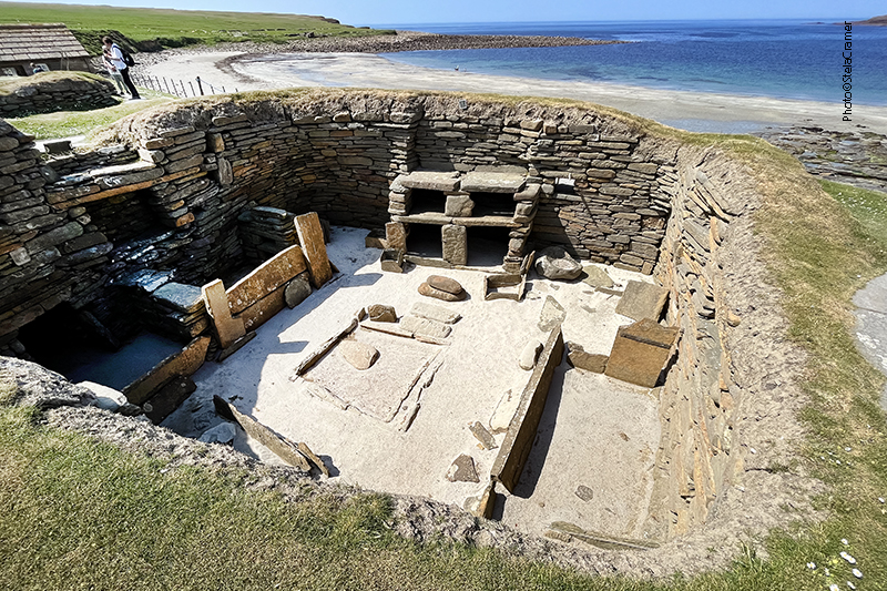
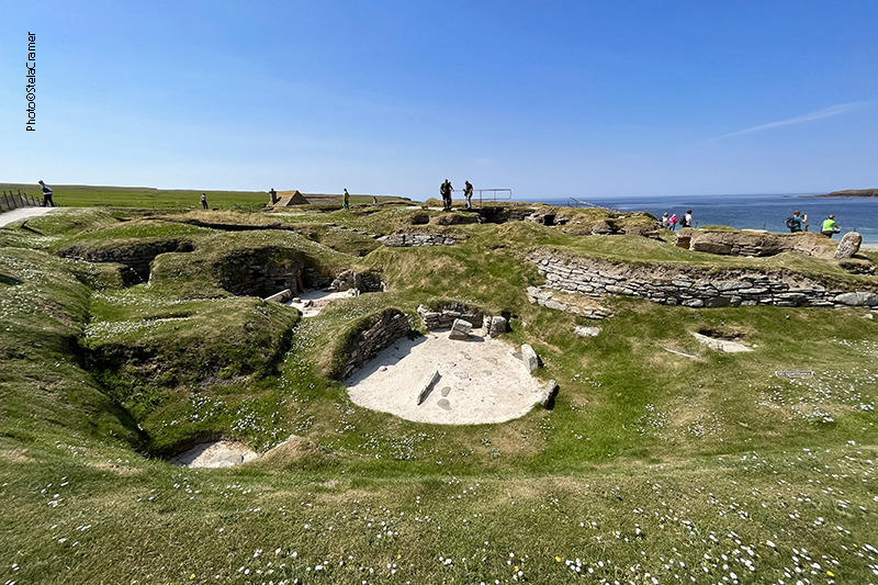
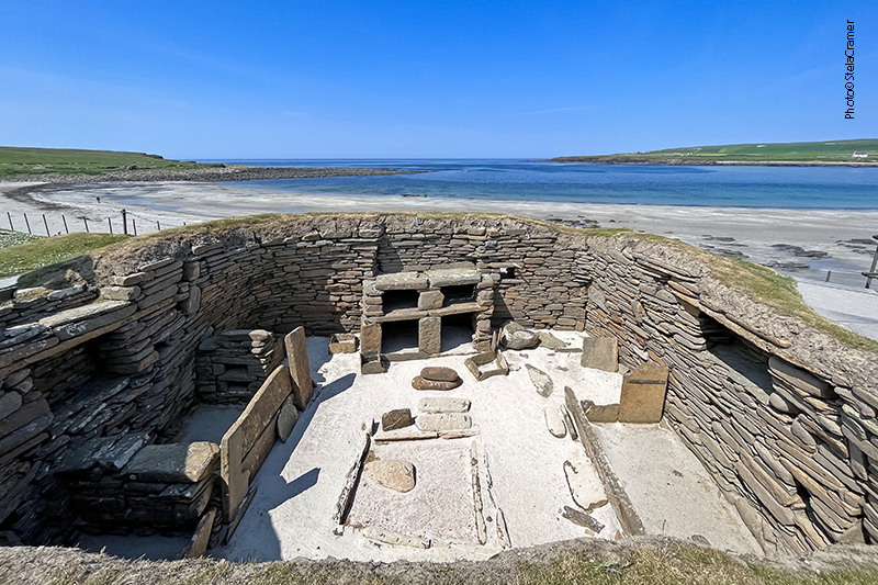
Knowe of Yarso data de 3500 a 2500 AC, mas cerâmica ali encontrada sugere que tenha permanecido em uso até 2000AC. O telhado não existe mais, mas as paredes permanecem mais ou menos da altura original. A câmara é dividida por lajes de pedra em compartimentos, semelhante a outras estruturas Neolíticas que visitamos.

Knowe of Yarso dates to between 3500 and 2500 BC, but pottery found inside the tomb suggests it remained in use until the late 2000s BC. Its roof is gone, but the walls still stand close to their original height. The chamber is divided into compartments by upright slabs, similar to other Neolithic structures we’ve seen before.

A entrada original ainda existe, embora o monumento tenha sido encapsulado numa estrutura de concreto com clarabóias e uma porta moderna. / The original entrance remains, although the monument is encapsulated in a sky-lit concrete cap with a modern door.
O fim da câmara / The chamber’s end

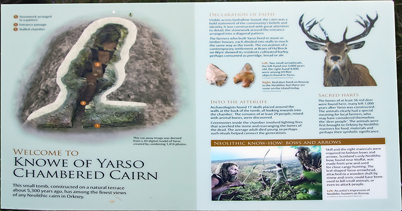
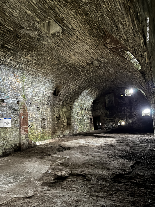
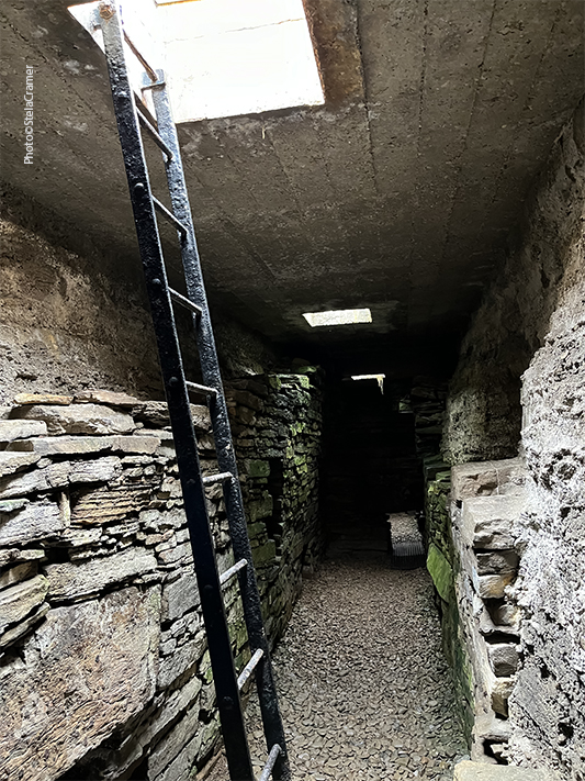
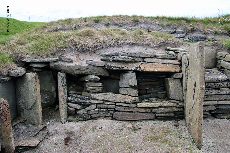
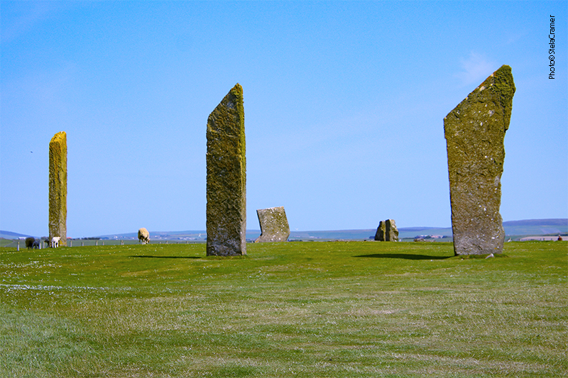
Knowe of Yarso é um entre pelo menos 15 outros túmulos semelhantes na pequena ilha. Arqueólogos acreditam que eram usados como cemitérios comunitários. Escavações na década de 30 encontraram os restos de pelo menos 29 esqueletos, e 17 crânios arrumados um ao lado do outro. Ossos de uns 36 cervos também foram desenterrados, assim como pederneiras, ferramentas de osso, pontas de flechas e pedaços de cerâmica.
Knowe of Yarso is one of at least 15 chambered tombs on the small island. Archaeologists believe these were used for communal burial. Excavations in the 1930s found the remains of at least 29 skeletons, with 17 skulls arranged side-by-side ; bones from at least 36 deer and also flint, bone tools, arrowheads, and shreds of pottery.

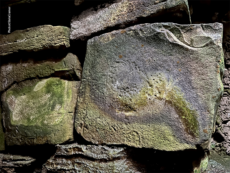
Assim, ali estava eu imersa em pensamentos, absorvendo a atmosfera e tentando bater umas fotos apesar da pouca luz, pois esta vinha por clarabóias cheias de sujeira acumulada, além disso estava escurecendo. Eis que escuto um barulho do lado de fora. As ovelhas tinham vindo até a porta de entrada. Imediatamente meu cérebro foi bombardeado por pensamentos assustadores: e se alguma delas esbarrasse na porta, fechando-a, e eu ficasse presa dentro da tumba? A tranca ficava pelo lado de fora. Meu celular estava com a carga no vermelho, tipo 10%, e ali não tinha sinal. Eu poderia gritar por socorro, mas não havia uma alma por perto para ouvir. Só iriam dar pela minha falta na manhã seguinte, na hora do tour, quando eu já teria com certeza morrido de fome (talvez) e de frio (certamente). Não trouxera mochila nem outro casaco. Rapidamente fiz mais um clique ou dois – inúteis, pois as fotos obviamente ficaram tremidas – e saí correndo.

So, there I was, deep in my thoughts, absorbing the atmosphere and trying to take some pictures in spite of the sparse light flowing through dirt covered skylights; besides, it was dusk. Then I heard a noise outside. The sheep had gathered next to the door. Horrible thoughts came to mind: what if one of them bumped the door closed and I got stuck inside the cairn? The lock was on the outside. My mobile was nearly dead – only 10% charge, and there was no signal. I could scream for help, but there was not a single soul around to hear me. I would only be missed in the morning, for the tour, and by then I’d be dead by starvation (maybe) or cold (definitely). I had no backpack or spare coat. So, I quickly took a couple more pictures – useless, obviously blurred – and ran away.

Run, Stela, run!

Demorei mais para descer a trilha do que para subir, pois já estava quase escuro. Não queria tropeçar e ir rolando os quase 400m até lá embaixo. Ou ir parar dentro do rio, que embora estreito devia ser gelado. As ovelhas ficaram lá de cima me olhando. Mas escapei.
It took me longer to get down the trail, because it was almost dark. I didn’t want to risk stumbling and rolling down 400 yards to the road. Or to the river, that was not broad but probably freezing. The sheep stood up there, still staring. But I had escaped.

A salvo, pousada à vista / Safe, the Inn within sight

Read Full Post »


Point of Buckquoy panorama, Brough of Birsay to the left / Panorama, Brough de Birsay à esquerda

Alugar um carro é fundamental para se locomover em Orkney. Eu tinha reservado um com a Drive Orkney em contato anterior por e-mail, e fui buscá-lo assim que botei o pé em terra firme, em Kirkwall. Por economia, havia escolhido um modelo com câmbio manual. Ao retirar o carro, o gerente me perguntou se eu tinha certeza disso, e respondi que não haveria qualquer problema, pois a vida toda dirigira apenas carros manuais. A cara dele me pareceu meio incrédula, mas a ficha só caiu depois de iniciar a jornada rumo a Stromness, onde ficaria hospedada por três noites: no UK, o volante fica do lado direito, portanto a alavanca de câmbio é acionada com a mão esquerda. Até adquirir um mínimo de destreza creio que fiz algumas barbeiragens. Felizmente não havia muito movimento na estrada.

Rent a car is mandatory to get around in Orkney Mainland.
I had booked one online with Drive Orkney, and picked it up as soon as I set foot in Kirkwall. For economy, I had chosen an old model with manual gear. The manager asked if I was sure about that, and I answered that it wouldn’t be a problem, because all my life I had driven manual cars. He made a skeptic face. Too late I realized that in the UK the steering wheel is on the right side, thus the driver uses the left hand to change gear: I was already on the road to Ring of Brodgar – before heading to Stromness, where I’d stay the next 3 nights. I made some horrible mistakes until I started to get used to it.
Fortunately the road was quite empty.

Brough of Birsay, com o farol ao fundo / Lighthouse on the background

No dia seguinte, que amanheceu azul e ensolarado, fui visitar de novo o Ring of Brodgar, pois na véspera estava cheio de ônibus de turistas, e o dia muito nublado, o que atrapalhou as fotos. Acabei ficando a manhã toda lá, assim o sol já estava alto quando segui para visitar os Broughs (ou Brochs) de Birsay e de Gurness.
“Brough” e “Birsay” são palavras originadas do Norueguês antigo “Borg”, que significa “forte”, mas significam coisas diferentes. “Brough” se refere às defesas naturais da ilha; “Birsay” quer dizer ilha com um único acesso, por uma estreita faixa de terra. Assim sendo, Brough of Birsay é uma ilha cujo acesso só é possível durante a maré baixa, quando o caminho de concreto que a liga à terra firme fica exposto. Quando lá cheguei, a maré já estava subindo.

Next day was sunny, sky was blue, so I went back to the Ring of Brodgar. In the eve, it was crowded with tourism buses, the day was grey, my photos were therefore shitty. So I took my time under the sun, which was already high when I left, on my way to the Broughs of Birsay and Gurness. It’s not far.
The words ‘brough’ and ‘birsay’ both come from the Old Norse ‘borg’ (‘fort’), but their meanings are slightly different. ‘Brough’ refers to the natural defences of the island. ‘Birsay’ (previously byrgisey) means an island accessible only by a narrow neck of land. Brough of Birsay is a tidal island only accessible for around two hours in low tide, and it’s linked to headland by a concrete causeway visible only when the sea retreats. By the time I got there, tide was rising.

Antes de Kirkwalll se tornar a capital, no séc. XII, Birsay era o centro do poder em Orkney. Escavações mostram uma camada de ocupação Nórdica por cima da anterior, pelos Pictos. /
Before Kirkwall became the centre of power in the 12th century, Birsay was the seat of the rulers of Orkney. The extensive remains of an excavated Norse settlement and church overlay the earlier Pictish settlement.

O caminho de concreto tem 150 m de comprimento. Fica submerso na maré cheia, e as fortes correntes tornam a travessia perigosa. Antes de se aventurar é preciso checar os horários da maré, expostos no Centro de Informações de Turismo em Kirkwall, no Centro de Visitantes em Skara Brae ou no site da meteorologia (link abaixo) .

The concrete causeway is approximately 150m long.During high tide is submerged underwater and the strong tides here make it dangerous to cross. Low tide times are displayed in the Kirkwall Tourist Information Office and at the nearby Skara Brae Visitor Centre, or on the Met Office website:

https://www.metoffice.gov.uk/weather/forecast/

A ilha abriga vestígios de um importante assentamento Picto. Escavações comprovaram que este povo viveu aqui no fim do século VII. Os Nórdicos chegaram 200 anos depois, no século IX, e ainda são visíveis as ruínas de suas casa, celeiros, e mesmo uma sauna. Mais tarde, uma igrejinha e monastério foram construídos, mas usados por pouco tempo: não foram encontrados muitos artefatos medievais e a torre oeste da construção nunca foi completada.

The island hosts the remains of a substantial Pictish settlement. Excavations show that Picts lived here in the late 7th century. Norse people settled on the brough 200 years later, in the 9th century, and the remains of their houses, barns and even a sauna can still be seen. Later, a small church and monastery were built on Birsay. The church was only used for a short time; there were very few medieval artefacts discovered there, and the west tower of the building was never complet

Parte das construções foi destruída pela erosão recentemente, o que levou à construção de um reforço de concreto, construído de forma a parecer rocha natural /
Some of this settlement was washed away by coastal erosion in recent years, what has led to the construction of a concrete reinforcement cleverly sculpted to resemble the natural sandstone.
Foto aérea de Charles Tait / Aerial photo by Charles Tait

Os Vikings chegaram no século IX e seu assentamento se desenvolveu ali por três séculos. O processo de construção e reconstrução de estruturas criou um verdadeiro labirinto de paredes de pedra, umas por cima das outras. Ainda são visíveis algumas das “casas longas” Nórdicas, celeiros, oficina de ferreiro e mesmo uma sauna do século XI com piso aquecido! A ultima estrutura construída pelos Vikings foi a igreja, no século XII.

The Vikings arrived on the Brough of Birsay during the 9th century and their settlement there was developed over the next three centuries. The process of building and rebuilding structures has left a complicated maze of stone walls, one on top of the other. Remains of several Norse longhouses, barns and a smithy can still be seen today, as well as an 11th century sauna with underfloor heating! A 12th century church was the last of the structures built by the Vikings.

Os vestígios deixados pelos Pictos são um pequeno poço, as fundações por baixo das construções posteriores e uma importante coleção de artefatos, incluindo um conjunto de moldes sofisticados para fundição de metais, como bronze. Os Pictos eram exímios artesãos que tinham um estilo de vida refinado séculos antes da chegada dos Vikings. Fragmentos de vidro, alfinetes de osso e pentes foram encontrados misturados com os artefatos Nórdicos nas casas no Brough. Havia um cemitério Picto por baixo do cercado em volta da igreja Nórdica. Ali também foram encontrados os pedaços de uma pedra entalhada pelos Pictos, retratando três Pictos vestidos com túnicas longas, portando espadas e escudos quadrados, e outros símbolos. Em Birsay mesmo puseram uma réplica; a original está no Museu Nacional da Escócia, em Edimburgo.

The Pictish settlement is attested by a small well, foundations under the later buildings and an important collection of artifacts, including a group of moulds for fine metalworking. Pictish people were skilled craftsmen who led a sophisticated lifestyle for several centuries before the Vikings arrived. Fragments of glass, bone pins and combs were found amongst Norse artefacts in houses on the Brough.
The enclosure round the Norse church overlies a Pictish graveyard .
An important Pictish carved stone was found in pieces in this enclosure. It shows a striking procession of three Picts dressed in long robes and bearing spears, swords and square shields. The stone in Birsay is a cast; the original is in the National Museum of Scotland, Edinburgh.

Pictish stone replica, Photo by Charles Tait
O farol , projetado para funcionar automaticamente, era movido a gás antes de ser convertido para energia solar em 2001 /The lighthouse was gas-powered (converted to solar power in 2001) and designed to be unmanned.
Paisagem do local / Site landscape
Venha comigo se tiver coragem! Come with me if you’re brave enough!

Read Full Post »


Frutos do mar deliciosos nesta pequena cidade portuária / Yummy seafood in this harbor village

Estávamos falando sobre o Coração Neolítico de Orkney, e após o post sobre Maeshowe decidi encaixar as fotos de Newgrange (e o vizinho Knowth, na Irlanda) por ser o maior e mais importante dos monumentos tipo “Túmulos de Passagem” no Reino Unido e mesmo na Europa. Mas antes de abordar a viagem à Irlanda terminarei de falar sobre a Escócia, para não ficar confuso.

I was talking about the Neolithic Heart of Orkney, and after the entry on Maeshowe I decided to bring forward Newgrange (and its neighbor Knowth, in Ireland) because it’s the biggest and most important of Passage Tombs in the UK and Europe. But before approaching Ireland’s trip I will resume the Scotland’s, so it will not get confused.

Minha melhor foto de rua em Stromness/ My best street photo

O motivo para visitar as Orkneys, tempos atrás, foi obviamente o fato de aparecer nas Brumas de Avalon. Na verdade eu nunca tinha pensado muito sobre isso até o dia em que, andando em Inverness durante minha primeira viagem, vi um ônibus de excursão com o letreiro “Ilhas Orkney” e resolvi embarcar nele (ver posts 043 e 044). Em 2023, ou seja, 20 anos depois consegui voltar lá para uma visita mais adequada. Embora não seja exatamente um lugar Arthuriano, as ilhas reúnem quantidade de monumentos Neolíticos alucinantes, menires e círculos de pedras. Tudo isso é séculos anterior à existencia dos Druidas, tais como Merlin, mas no imaginário popular ambos estão indiscutivelmente associados.

The reason for visiting the Orkney Islands back in the day was, of course, the Mists of Avalon. I actually hadn’t given it too much thought until one afternoon, walking in Inverness in my first trip there, I saw a tour bus with the sign “Orkney Islands” and decided to take it (see posts 043 and 044). In 2023, that is, 20 years later I could go back there for a proper tour. If not exactly an Arthurian location, the islands are home to awesome Neolithic monuments, stone circles and standing stones. All these are centuries older than the druids, but there is an indelible association in the popular imagination between Druids (such as Merlin) and stone circles.

Cidade vista do Ferry / Village view from the Ferry

De qualquer forma, é tudo fantástico, e tentei visitar tantos monumentos quanto foi possível, assim como as principais cidades: Kirkwall e Stromness, em Mainland – a maior ilha do arquipélago Orkney. Aqui seguem algumas fotos, antes de prosseguir com a Arqueologia.

Anyway, it’s all more than interesting, awesome, and I tried to visit as many monuments as possible, as well as the main cities: Kirkwall and Stromness, in Orkney Mainland. Here you can see some photos, before going back to Archaeology.

O Farol / the Lighthouse
Victoria Street, rua principal, onde ficava meu hotel / The main street, where my hotel was located
Hotel muito bem localizado, mas precisando uma reforma urgente/ Perfect location, but needs a thorough renovation
Em frente ao Terminal fica o Ferry Inn, excelente restaurante / In front of the Ferry Terminal is an awesome restaurante, the Ferry Inn
Comi muito bem nessa viagem / I ate very well in this trip
Terminal do Ferryboat / Stromness Ferry Terminal
Tive uma ótima surpresa depois do jantar: esta banda estava tocando no estacionamento do Terminal do Ferry./ What a great surprise! After dinner, I saw this pipe Band playing at the Ferry Terminal Car Park.
Ferryboat chegando no Terminal / Ferry arriving at the docks
Dr John Rae was an Orcadian Arctic Explorer who never received the same recognition for his achievements as other Arctic Explorers, because Rae discovered the fate of the Franklin Expedition, concluding that the missing sailors had been forced to resort to cannibalism. The British establishment condemned Rae’s findings and questioned his integrity. In 2013 Stromness celebrated Dr John Rae’s 200th Anniversary by unveiling this statue, created by sculptor Ian Scott of North Ronaldsay.
Dr John Rae foi um explorador do Ártico, mas seus feitos nunca tiveram o mesmo reconhecimento que os de outros exploradores. Isto porque ele descobriu que fim levou a desaparecida Expedição Franklin, concluindo que os marinheiros tinham sido forçados a praticar canibalismo como último recurso de sobrevivência. O Governo Britânico refutou suas descobertas e questionou mesmo sua integridade. Para comemorar os 200 anos do explorador, em 2013, foi inaugurada esta estátua criada pelo escultor Ian Scott, de North Ronaldsay.
Seguindo Victoria Street: à esquerda, entrada do Centro de Artes Pier, galeria aberta à visitação gratuita / Following Victoria Street: to the left, entrance of The Pier Arts Centre, an entrance free Gallery
A galeria tem obras de artistas Britânicos do século 20 tais como Barbara Hepworth e Ben Nicolson/ The Pier Arts Centre contains works by 20th century British artists such as Barbara Hepworth and Ben Nicolson
Casas em Stromness num dia de verão/ Stromness Houses in a summer day

Não descobri a razão para esta “fatia” faltar em algumas paredes

I couldn’t find a reason for this “missing slice” in some walls

Victoria Street vira Dundas e depois Alfred Street / Victoria Street becomes Dundas Street and then Alfred Street
Tive sorte em encontrar este atelier maravilhoso, recomendo a visita: Vintage Paper Co., 4 Alfred Street / I was lucky to find it, and strongly recommend you visit this wonderful print shop: Vintage Paper Co., 4 Alfred Street
Já esta lojinha parece ter, infelizmente, fechado / Unfortunately, this little shop has apparently closed
O Museu de Stromness abriga objetos e curiosidades incluindo itens dos navios da Segunda Guerra, ferramentas de sobrevivência dos exploradores, assim como fósseis, conchas e pássaros que nos contam um pouco da história natural de Orkney. / Stromness Museum displays artefacts and curios including wartime items from the ships in Scapa Flow, survival tools for Arctic Explorers and sea chests. It also covers the natural history of Orkney, displaying fossils, shells and birds.
Este Canhão fica numa pracinha um pouco adiante do Museu. Era de um navio americano, o Liberty. Costumavam disparar sempre que chegava a Stromness um navio da Hudson’s Bay Company. / The Cannon sits on a grassy verge a few steps ahead of the Museum. It comes from an American Privateer, The Liberty. In the past it was fired whenever a Hudson’s Bay Company ship arrived in Stromness.
O lugar é perfeito para apreciar a vista do mar. / A great place to stop to enjoy the sea view.
Armadilhas para lagostas, caranguejos, etc / Lobster traps
Ferry chegando a Stromness / Ferry arriving

Read Full Post »


Noltland Castle
Farol de Noup Head / Noup Head Lighthouse

O motorista, que também é dono de um dos dois mercados da cidade, já tinha compromissos naquele dia e não podia fazer um tour completo para mim, mas sugeriu me levar aos lugares, me deixando por uma ou duas horas enquanto fazia outras coisas. Desta forma pude visitar o Castelo de Noltland, o farol em Noup Head e Castle O’Burrian- o habitat dos puffins – antes da forte chuva que caiu à tarde. Dei graças aos céus por não ter conseguido alugar uma bicicleta.

Depois de visitar o Castelo, avistei a van vindo me buscar no horário combinado. O motorista, ao abrir a porta, perguntou se eu tinha perdido alguma coisa… e já me entregou uma lente, que havia caído da minha mochila sem eu perceber! Me dei conta que o zíper ficara aberto, e quase imediatamente avistei na grama do chão o par de meias extra que também tinha guardado no mesmo bolso da mochila.

79 metros acima do nível do mar, o farol de Noup Head fica no alto de penhascos onde habitam milhares de pássaros. / 79 metres above sea level, Noup Head Lighthouse stands above cliffs that are home to thousands of birds.

The driver, who also owns one of the two local stores, could not take me to a full day tour because he already had commitments, but suggested to take me to some places of interest, leave me there and pick me up after a while, in-between his appointments. So I could visit the Noltland Castle, Noup Head Lighthouse and Castle O’Burrian, the puffins habitat, before the hard rain that fell in the afternoon. I praised the Gods for having NOT found a rental bicycle.

After visiting the Castle, when the van came to pick me up, the driver asked if I had lost anything… and handed me one of my lens, that had fallen from my backpack without me noticing it! I realized that the zipper was open, and almost immediately saw, lying on the grass of the parking lot, the extra pair of socks that I had put in the same pocket.

Mainland vista do alto dos penhascos de Noup Head, antes da chuva / Mainland view from Noup Head cliffs, before the rain

O que não percebi foi que tinha posto, por pressa ou por engano, meu cartão de crédito no mesmo bolso. Como tinha pago quase todas as despesas online, não precisei do cartão até o dia seguinte, quando desembarquei do ferry em Kirkwall, e percebi que não estava em parte alguma. Tirei tudo da mala e da mochila, e nada. Já ia contactar o banco para fazer o cancelamento, quando recebi uma mensagem do motorista em Westray. Um casal de turistas tinha encontrado o cartão no estacionamento do castelo, e deixado com a atendente no mercado dele! Nem acreditei. E o melhor, eu nem precisaria voltar a Westray para buscar, pois no dia seguinte um funcionário ia com o caminhão para buscar produtos em Kirkwall. Ficou combinado que eu o encontraria na chegada do primeiro ferry. Mandei uma foto e minha descrição para a pessoa me reconhecer e fui tomar uma pint para comemorar. Aliás tomei uma taça de champagne.

Se tivesse que voltar a Westray, perderia mais da metade do dia seguinte no ferry, entre ida e volta. Ia arruinar meu cronograma, pois tinha reserva de duas noites em Rousay, outra das ilhas Orkney, conhecida como o “Egito escocês” devido à quantidade de sítios arqueológicos. O ferry para Rousay saía de outro porto, Tingwall, e embora os horários dos ônibus fossem coordenados com a chegada e saída dos barcos, eu só chegaria lá no fim da tarde. Felizmente, às 10 da manhã do dia seguinte, quando o ferry atracou vindo de Westray, logo vi o caminhão do mercado encostando numa vaga e um escocês bonitão vindo ao meu encontro. Nos identificamos, e ele, sorrindo, me entregou um envelope, no qual alguém escrevera meu nome e descrição: cabelos castanhos, óculos, com uma mala, uma mochila e uma câmera pendurada. Na verdade acho que estava rindo da minha cara. Quem poderia ser tão pateta para perder o cartão de crédito no meio de uma viagem?!? De toda forma, agradeci a ele e a todos os demais envolvidos e me despedi com dois beijinhos. Dentro do envelope estava meu cartão, intacto.

Construído em 1898, o farol foi o primeiro na Escócia equipado com uma lente flutuante sobre mercúrio líquido, para melhor estabilidade. Foi automatizado em 1964 e convertido para energia eólica e solar em 2000 / Built in 1898, this was the first Scottish lighthouse to have a lens carried on a mercury float for better stability. It became automatic in 1964 and was converted to wind and solar power in 2000.

What I didn’t remember was that, for some reason, I had put my Credicard in that same pocket instead of keeping it in my wallet as usual. As most expenses had been paid online, I didn’t think about it until the next day, after getting off the ferry in Kirkwall. I searched thoroughly all my luggage. The card was nowhere to be seen. I was going to contact the bank to cancel it when a message came through. It was my guide Jonathan. A couple of tourists had found my card in the parking lot and returned it to the clerk in the driver’s store. I couldn’t believe my ears. People knew I had made the Papay tour with Jonathan, therefore he had my contact.
The best was that I would not need to go back to Westray to retrieve my card. The next day, 7th June, was a Wednesday, the store truck was going to Kirkwall for supplies. I should just meet the driver at the ferry station, which was right across the street. So I sent him my picture and description, and went for a celebration pint. Actually, I ordered a glass of Champagne.

If I had to go back to Westray I’d practically lose the next day, taking the ferry there and back. That would ruin my plans. I had a booking for next two nights in Rousay, another of the Orkney Islands, called “the Scottish Egypt” for its archaeological sites. The ferry to Rousay left from another harbour, Tingwall, and although the bus timetables were coordinated with the vessels, I’d only get there late in the afternoon.
Fortunately, next day at 10 a.m. I saw the ferry docking and, among the disembarking vehicles, the store truck. It parked and out of it came a handsome Scotsman walking towards me. He had my description ( brunette, prescription glasses, with a suitcase, a backpack and a camera) written in an envelope, which he gave me with a smile. I believe he was actually laughing at me. Who could be so stupid as to lose the credit card in a trip? Anyway, I was so thankful! Returning the smile, I expressed my everlasting gratitude and kissed him goodbye. Inside the envelope was my credit card, safe and sound.

A construção do Castelo de Noltland data do sec. 16, mas jamais foi totalmente completada. O que se vê hoje é o resultado do trabalho em diferentes etapas e momentos distintos./
The castle dates mainly to the later 16th century, although it was never fully completed. what is on view today was the work of different hands at different times.
O Castelo impressiona por sua incomum arquitetura para defesa, tendo as paredes mais de 2 m de espessura. Construído no alto de uma colina, com visão total da Baía de Pierowall, qualquer pessoa ou grupo se aproximando do castelo seria avistado imediatamente. 71 seteiras possibilitavam atirar nos inimigos de todos os ângulos. Os andares de baixo não possuem janelas por onde invasores pudessem entrar. /
The Castle is notable for its defensive architecture, unusual for the period, with 7 ft thick walls.
Built on a slope overlooking Pierowall Bay, anyone approaching the castle, from any direction, would be spotted easily. 71 gunloops provided the opportunity to shoot at enemies from any angle. The lower floors, hav no accessible windows that could be exploited in an assault.
Gilbert Balfour, que construiu o Castelo, não era uma boa pessoa. Estava sempre envolvido em tretas políticas. inclusive na conspiração para assassinato do segundo marido de Mary, a rainha da Escócia… embora trabalhasse para ela! Balfour acabou executado por traição, em 1576, na Suécia. /
Gilbert Balfour, who built the castle, was not a good person. Master of the Royal Household to Mary, Queen of Scots, and was involved in the plot to kill her second husband. Balfour ended up executed for treason in Sweden in 1576.
As sinistras escadarias / Sinister stairways
Cozinha / Kitchen
Antigo moinho no início da trilha para Castle O’ Burrian /
Old mill at the entrance to Castle O’ Burrian footpath

Read Full Post »


Pierowall, a cidade mais importante de Westray / Pierowall, Westray’s main village
O hotel onde fiquei, no centro de Pierowall. Ao fundo, à esquerda, o Centro Histórico. / My hotel in downtown Pierowall. Heritage Center in the background, left.

O Hotel Pierowall pertence a uma senhora que o gerencia com as filhas, todas muito simpáticas. Há outras opções de hospedagem, mas basicamente casas para alugar, mais distantes do centro. Viajando sozinha, fazia mais sentido ficar perto de transporte, com café da manhã e restaurante para jantar. Aliás, a comida era excelente! O restaurante estava sempre movimentado, com turistas e locais. Encontrei o hotel, assim como contato dos guias, no site Orkney.com .

Pierowall Hotel is a family business; the lady who runs it and her daughters are just lovely. There are other lodging options, but mostly self-catering and houses for rent, further away. As a solo traveller, it was convenient to stay near all transport, with breakfast included, and restaurant on site for dinner. By the way, excellent food. Place was busy on daily basis with visitors and locals. I found the hotel and guide’s contact in the Orkney.com website.

O delicioso prato de frutos do mar consiste em camarão, caranguejo, lagosta,salmão, haddock e vieiras, tudo fresquinho, pescado no local. / Yummy Seafood plate with fresh local shrimp, crab, lobster, salmon, haddock and scallops.
Centro histórico / Heritage Center
“Westray Wife”, em exibição no Centro histórico / on display at the Heritage Centre

Uma pequena estatueta entalhada em arenito foi encontrada numa escavação em Westray (Links of Noltland) em 2009 e logo batizada “Vênus de Orkney”, ou “Mulher de Orkney”. É a mais antiga representação da figura humana encontrada na Escócia. A escavação abre durante a temporada, fiquei triste por ainda estar fechada, mas nessas situações penso sempre que é um bom motivo para voltar lá um dia. Retornar é sempre mais fácil do que ir pela primeira vez. Enquanto isso, aqui fica um link para visualização em 3D.

A tiny carved sandstone figurine was found at the Links of Noltand excavation in 2009 and immediately named ‘the Orkney Venus’ (known locally as ‘the Westray Wife’). It’s the earliest representation of a human found in Scotland. The Links of Noltand excavation is open seasonally; I was frustrated because it wasn’t open yet. But that’s a good reason to go back there one day. Returning is always easier than going for the first time. Meanwhile, the link above provides a 3D view of the site.

Também em exibição no Centro histórico está a “Pedra de Westray” – uma pedra entalhada encontrada numa câmara mortuária Neolítica cujo motivo é semelhante ao tipo encontrado no Vale Boyne, na Irlanda, que visitaremos mais adiante/ The Heritage Centre also exhibits The ‘Westray Stone’ – a neolithic carved stone from a chambered tomb which closely resembles the art style of the Boyne Valley in Ireland, which we’ll visit soon.
Acervo de objetos marítimos no Centro Histórico / Maritime collection in display at the Heritage Center
Lindo quilt em exibição / A gorgeous quilt in exhibit
Ossada de baleia no jardim do museu / Whale skeleton in the Center’s garden
Tangle dykes

“Tangle dykes” eram estruturas de pedra onde eram armazenadas longas algas (tangle), parecidas com corda, que eram coletadas na praia e ficavam ali secando durante o inverno, e no verão despachadas por navio para processamento. Faziam espessantes e estabilizantes utilizados na fabricação das coisas mais variadas, desde sorvete até massa para modelagem de dentes. A atividade se encerrou em 1998; nesta época as pessoas que coletavam as algas recebiam 176 libras por tonelada de alga seca, equivalente a 4 toneladas da alga original.

Tangle dykes were stone structures where locals used to gather long rope-like seaweed over the winter and dried them on the dykes before being shipped away for processing into thickeners and stabilizers in items as diverse as ice cream and modelling material for teeth impressions. By the time the tangle industry ceased in 1998,the tangle gatherers were paid 176 pounds per dry tonne, equivalent to 4 tonnes of wet tangle.

“Boat Noust”, also in the Center’s garden / também no jardim do Centro Histórico

Boat Noust é um abrigo para barcos, a fim de protegê-los da maré alta e das tempestades, construídos de pedra num corte em forma de ferradura. A quantidade de nousts em Westray mostra que em 1870 haviam 254 barcos na ilha. Noust é uma palavra de origem nórdica, como muitas outras, assim como nomes de pessoas e lugares. As Ilhas Orkney pertenciam à Noruega. Em 1468, as ilhas foram cedidas ao rei James III da Escócia, como garantia de pagamento do dote da sua noiva, Margaret da Dinamarca, filha do rei Christian I da Noruega. Passou o tempo e o dote nunca foi pago, assim o arquipélago foi definitivamente absorvido pelo Reino da Escócia em 1472. Atualmente – disse-me um dos guias com quem conversei – existe uma facção popular (mais forte nas Ilhas Shetland) pedindo sua reintegração à Noruega.

Boat Noust is a hull shaped opening cut into the bank, to shelter a boat and keep it safe from storms and high tides. The number of nousts in Westray indicates that in 1870 there were 254 boats on the island. Noust is a nordic word, as many others, including names of people and places. The Orkney Islands were once part of Norway. In 1468, the islands were pledged by Christian I, King of Norway, as security against the payment of the dowry of his daughter Margaret of Denmark, betrothed to James III of Scotland. Time went by and the dowry was never paid, so Orkney was absorbed by the Kingdom of Scotland in 1472. Nowadays, according to one of the tour guides I’ve met, there is a group (stronger in the Shetlands) claiming reinstatement to Norway.

Gill Pier, Pierowall, Westray
Armadilha para caranguejo / Crab trap
Vistas da B9066, rua principal, na orla de Pierowall / Pictures taken along B9066, Pierowall’s shoreline main street.
Lady Kirk Pierowall’s Church and Cemetery

Westray possui cerca de 600 habitantes, e milhares de aves marinhas. Há muito mais aves do que gente. Aqui o santuário dos puffins, que consegui por fim avistar e fotografar.

Westray’s resident population is around 600 people, and thousands of seabirds. There are way more birds than people. Here is the puffins’ sanctuary, where I was able to, at last, watch and depict them.

Castle O’Burrian
Puffins!!!
” Hello, Stela!!!”

Read Full Post »


Pegamos o barco para Holm of Papa Westray (também chamada de Papay Holm), uma ilhota na costa leste, atravessando a baía de South Wick, conhecida por ter três câmaras mortuárias Neolíticas, das quais a maior (ao Sul) é impressionante, com uma longa passagem de entrada e diversas pequenas câmaras acessíveis pela área central.

Jonathan preparando o barco para a travessia. Longe ao fundo, a Câmara ao Norte / Jonathan preparing the boat for the crossing; the North Cairn far in the background

A short boat trip across South Wick took us to the Holm of Papa Westray, an islet off the eastern shore notable for its three Neolithic Chambered Cairns, the largest of which (South Cairn) is the most impressive, with a very long entrance passage and numerous burial chambers off a central area.

North Cairn
Contornamos a ilha para ver os penhascos do outro lado, formações impressionantes, ricas em vida selvagem / We went around the islet to see the impressive geos, abundant with wildlife
Segundo Jonathan, aqui aportavam os barcos Vikings/ Viking boats moored here, according to Jonathan

Cerca de 150 espécies de pássaros podem ser avistados na ilha, que é Área de Interesse Científico Específico, além de Área de Proteção Especial, para a reprodução de aves como a Arctic Skua (nas fotos).

Around 150 species of bird have been seen around the island, which is a Site of Special Scientific Interest, and a Special Protection Area as an important breeding site for birds as the Arctic Skua (in the photos).

Simpáticas focas e outros bichos vieram nos receber / Lovely seals and other assorted creatures showed up to welcome us

Após cinco minutos de caminhada chegamos à Câmara Mortuária ao Sul, um monumento de 5.000 anos. Consiste numa câmara principal retangular, com subdivisões, da qual saem outras doze pequenas câmaras. Foi escavado em 1849, mas depois disso ficou exposto aos elementos e estava se deteriorando, até que em 1930 passou a ser protegido pelo Estado. Construíram uma cobertura de concreto com turfa por cima para preservar a estrutura.

A five-minutes walk took us to The Holm of Papa Westray South Chambered Cairn, a 5.000 years old monument comprising a large subdivided rectangular chamber, from which twelve small cells open out. It’ been excavated in 1849, but after that, left open to elements, the site deteriorated badly until it was taken into State Guardianship in 1930, roofed in concrete and turfed over to preserve it.

Atualmente o visitante desce por uma das escotilhas na cobertura, que tem uma escada, mas a entrada original construída no Neolítico era por uma longa e estreita passagem. Este acesso agora está bloqueado por uma grade.

Today, visitors descend into the chamber through a hatch in the cairn’s reconstructed roof and down a vertical ladder, but in Neolithic times entry was through a long, low and narrow passage, now blocked by a grill.

Entrada original do monumento / Original entrance
Câmara central, ao fundo a parede transversal noroeste /
Main chamber, north-west transverse wall in the background

A câmara principal se divide em três, sendo a parte central com 13.5m de comprimento. De cada lado, uma estreita passagem aberta numa parede transversal dá acesso a uma câmara menor. O compartimento a noroeste (foto acima) mede 2,2m, enquanto a sudoeste (foto abaixo) temos um espaço maior, com 3,4m.

Câmara central, ao fundo a parede transversal sudoeste /
Main chamber, south-west transverse wall in the background

The main chamber is divided into three parts, with the largest, central part measuring 13.5m in length. At either end are smaller spaces entered by small openings in the transverse walls. At the north-east end this compartment is 2.2m long, at the south-west end (photo above) it is 3.4m.

Os desenhos encontrados neste monumento são da maior importância. Na câmara menor a sudoeste, temos um lintel decorado com o motivo que pesquisadores chamam de “sobrancelhas” (um par de círculos sob dois arcos).

The artwork found in this cairn are extremely important. In the south-west end cell, a decorated lintel bears two pecked ‘eyebrow’ motifs (a pair of cup-marks under double arcs).

Motivos entalhados em zigzag / Zigzag incised motifs

É muito raro encontrar tais exemplos de arte em seu lugar original. Os desenhos aqui são variados e encontram paralelo em artefatos de outros sítios, como Skara Brae, Links of Noltland e Ness of Brodgar. Entretanto, Papay Holm ao Sul é o único monumento funerário Neolítico em Orkney onde ambos os motivos (furados e entalhados) foram encontrados juntos.

It is very rare for such artwork to survive in its original setting. The designs here are varied and can be paralleled at artifacts from other sites such as Skara Brae, Links of Noltland and the Ness of Brodgar. However, Papay Holm South is the only Orcadian Neolithic funerary site in which both pecked and incised decoration have been identified.

Passagem na parede transversal noroeste / Passage in north-west transverse wall

Não há provas quanto à finalidade do monumento; entretanto, comparando com outros sítios semelhantes em Orkney, se acredita que foi construído para abrigar os restos mortais de uma comunidade.

No evidence for the uses of the cairn survives, however it is assumed, on comparison with other similar sites in Orkney, that it was constructed with the intention of holding the mortal remains of a community.

Câmara menor a noroeste / North-west smaller chamber

A Câmara Mortuária de Papay Holm ao Sul é um exemplo bem preservado da chamada “Câmara tipo Maeshowe”: uma câmara retangular com entrada por uma longa passagem pela lateral, com acesso a cubículos menores, decoração em muitas pedras e uso de blocos muito grandes na construção, posicionados cuidadosamente em determinados pontos, usando inclusive pedrinhas de fixação para ajustar com precisão o alinhamento e orientação. Tais monumentos mostram a habilidade dos construtores Neolíticos, tanto no planejamento como na construção em si. Veremos Maeshowe na sequência.

Detalhe de pedra bem maior, precisamente utilizada na construção / Detail: a much larger stone skillfully placed in the building

Holm of Papa Westray South chambered cairn is a well-preserved example of a “Maeshowe-type of Cairn”: a rectangular chamber entered at the side via a long passage, with cells leading off the chamber, several decorated stones and many very large blocks of stone used in the construction, carefully placed in certain locations, often using small pinning stones to precisely adjust their alignment and orientation. These monuments displays the skill of the Neolithic builders in both planning and construction. We’ll visit Maeshowe next.

O nível do mar elevou-se desde que Papay Holm foi construído, formando a quantidade de pequenas ilhas que hoje formam o arquipélago Orkney. Durante o período Neolítico, entretanto, seria composto de menos e maiores extensões de terra. É provável que Papay Holm, Papa Westray e Westray fossem uma coisa só.

Sea levels have risen since the cairn was constructed, giving rise to the large number of small islands which today form the Orkney archipelago. During the Neolithic period, however, Orkney would have comprised of fewer, larger landmasses. It is likely that the Holm of Papa Westray formed part of a larger landmass which also took in what today are the islands of Papa Westray and Westray.

Foto tirada em 1930, aproximadamente, antes da construção do teto de proteção em concreto / Photo taken around 1930, before building the protective concrete roof

As focas vieram se despedir quando embarcamos para retornar a Papa Westray. Uma delas nos acompanhou por um bom tempo!

The seals came to say goodbye when we boarded the boat back to Papa Westray. One kept us company for a long time!

Read Full Post »


Holm of Papa Westray, ou apenas Papay Holm, construído e habitado um milênio antes das pirâmides / Papay Holm, built and occupied a millennium before the pyramids

Mais ao norte, em Papa Westray, outra ilhota do arquipélago Orkney, existe outro sítio, tipo uma miniatura de Skara Brae, porém ainda mais antigo: Knap of Howar. Chegar lá, entretanto, exige um pouco mais de esforço. Como eu estava em Glasgow, optei por voar para Westray (pois em Papa Westray não havia acomodação), fazendo conexão em Kirkwall. A companhia aérea escocesa LoganAir tem voos entre diversas ilhas do Norte da Escócia, assim como entre as principais cidades e as ilhas. A princípio estava preocupada pois o tempo de conexão entre os dois voos era de apenas 20 minutos, mas a atendente da Logan Air no aeroporto me garantiu que não haveria problema. De fato, o aeroporto de Kirkwall cabe todo na Praça de Alimentação do Galeão. Passageiros embarcam, desembarcam e recolhem bagagem no mesmo lugar. A atendente que faz o check-in também leva as malas para a aeronave, empurrando um carrinho. Existem mesas, mas a lanchonete estava fechada, talvez em reforma. Duas máquinas de bebidas e snacks eram a salvação dos famintos. O aeroporto foi construído em 1940, originalmente para atender à base naval em Scapa Flow.

Kirkwall Airport

Further North, in Papa Westray, another islet of Orkney archipelago, there is another site such as a miniature Skara Brae, still older: Knap of Howar. Access to it demands a bit additional effort. As I was in Glasgow, my choice was take a flight to Westray (there is no lodging at Papay itself), connecting in Kirkwall. The Scottish airline Logan Air flies between most islands, as well as the main Scottish cities. I was worried because there was only 20 minutes for the connection, but LoganAir’s clerk reassured me that it wouldn’t be a problem. Indeed, Kirkwall Airport is a small one. Passengers arrive, depart and reclaim baggage in the same room. The lady who checks you in also pushes the luggage cart to the aircraft. There are tables but no snack bar, it’s perhaps in renovation. A couple of vending machines are the only option for starving passengers. Built in 1940, the airport was originally used for the defence of the Scapa Flow naval base. 

Voo Westray-Papay

O voo de Kirkwall para Westray fazia escala em Papa Westray. Foi muito interessante porque o trecho Westray-Papay é o voo mais curto do planeta: leva dois minutos. A aeronave comporta oito passageiros, amontoados entre o piloto e as bagagens; o ruído do motor é a trilha sonora. Uma verdadeira aventura! Ao meu lado ia sentado o diretor da escola primária de Westray, um rapaz muito simpático a quem perguntei se havia condução, ou se era possível ir andando do aeroporto até meu hotel, pois no mapa parecia muito perto. Ele riu e me disse que haveria um táxi esperando por ele, que poderia me levar também, pois morava ao lado do meu hotel. A carona foi fortuita pois começou a chover.

Aeroporto de Westray . A van azul marinho é o taxi / Westray Airport. The blue van is the taxi

The flight from Kirkwall to Westray stops at Papa Westray. That was interesting because the stretch Westray-Papay is the world’s shortest commercial route: a distance of 1.7 miles, takes 2 minutes. The plane carries up to 8 passengers, crammed between the pilot and the luggage; the engine noise is the soundtrack. A real adventure! Sitting by my side was Westray’s School Principal, a nice guy to whom I asked if there was transport from the airport to my hotel, or if it was possible to walk, because in the map it looked very close. He laughed, and said that there would be a taxi waiting for him, and I could take it too, because he lived next to the hotel. That was fortunate, because it started to rain as soon as we landed.

Ferryboat que liga Westray a Papay / Ferryboat linking Westray to Papay

O Pierowall é o único hotel da cidade, chamada Pierowall, talvez a única cidade na ilha de Westray, que possui 600 habitantes. Todo mundo na verdade é vizinho. A economia local é baseada na pesca, fazendas de peixe e gado, assim como turismo. Jonathan, o “Papay Ranger”, é o guia que leva visitantes a Papay (apelido de Papa Westray, a ilhota que possui cerca de 90 habitantes). Eu tinha reservado o passeio dois meses antes. Assim, dia 6 de junho, conforme combinado, o encontrei na rampa do ferryboat que também liga as duas ilhas. A travessia leva 25 minutos, mais uns 15 de van, até Knap of Howar.

Este ferry leva apenas passageiros/ This vessel takes footpassengers only

The Pierowall is the only hotel in the city called Pierowall as well, maybe it is the only city in the island. Westray has 600 residents. So, everyone are kind of neighbors. The island’s main industries are fishing, fish and cattle farming and tourism. Jonathan, known as “Papay Ranger”, is the tour guide who takes people to Papay (nickname of Papa Westray, islet with around 90 residents). I had booked this tour two months in advance. So, the 6th June, I met him at the pier, to take the ferryboat between the islands. The crossing takes 25 minutes, plus 15 minutes drive in his van until the Knap of Howar.

Fazenda de pescado entre as ilhas / Fish farm between the islands

Assim como Skara Brae, atualmente Knap of Howar se situa no litoral, mas durante sua ocupação estaria bem mais afastado, atrás de dunas de areia, numa vasta pradaria. Esta teoria foi confirmada por arqueólogos e geólogos com base nas evidências encontradas no local e em estudos dos padrões de erosão na ilha. Naquele tempo, provavelmente as ilhas de Westray e Papay eram ainda unidas por uma planície.

Just like Skara Brae, today the Knap of Howar sits by the coast but, in its days of occupation, it would have been inland from the sea in what was probably a wide meadow behind a wall of sand dunes. Archaeologists and geologists have confirmed this theory based upon evidence at the site and geological studies of erosion patterns on the island. At that time, the isles of Papay and Westray were probably still joined together by a bridge of low-lying land.

A casa principal é a estrutura maior e mais antiga/ The mainhouse, a larger and older structure
Acredita-se que a construção adjacente era uma oficina ou outra casa. /The neighbor building has been interpreted as a workshop or a second house.
Entrada das casas, agora de frente para o mar / Entrances of both houses now face the sea
Detalhe da pedra que deveria ser para moer grãos e da engenhosa alvenaria em pedras para formar o canto do aposento. Abaixo, “estante” e divisórias, tudo construído sem o uso de qualquer tipo de cimento / Detail of the stone quern, probably to grind grain, and of the skillful masonry to create the room’s corner. Below, “cupboard” and partition screens, all built without any kind of cement.
Esta fazenda Neolítica pode ser a mais antiga casa de pedra preservada do Norte da Europa. Datação por radiocarbono mostra que foi ocupada de 3700 a 2800 AC, isto é, antes das casas semelhantes em Skara Brae. / This Neolithic farmstead which may be the oldest preserved stone house in northern Europe.Radiocarbon dating shows that it was occupied from 3700 BC to 2800 BC, earlier than the similar houses in the settlement at Skara Brae.

Lareiras, divisórias, camas e estantes estão praticamente intactas, e foram encontrados postes indicando a estrutura do telhado, que era provavelmente feito de madeira, palha ou turfa, por isso desintegrou com o tempo.

Fireplaces, partition screens, beds and storage shelves are almost intact, and post holes were found indicating the roof structure. The roof is missing, but it was likely made of wood and thatched or turfed, because it eventually disintegrated.

Assim como Skara Brae, o Knap of Howar esteve séculos encapsulado pela areia. Os escavadores precisaram retirar uma camada de 2,4 metros que preenchia totalmente as estruturas. Revelou-se a existência de uma passagem conectando as duas casas, que em algum momento foi desativada e teve as entradas bloqueadas com pedras. Nas fotos abaixo você pode ver as entradas, perto das portas da frente nas paredes adjacentes.
As escavações revelaram também que estas casas podem ter sido construídas sobre os vestígios de outra estrutura ainda mais antiga.

Like Skara Brae, the Knap of Howar had been for centuries cocooned by sand. The excavation team had to clear a 2.4-metre-deep layer that completely filled both buildings. It came to light that the structures were linked by a passage through the joined walls, that was eventually deactivated and both entrances blocked with stones. In the photos below, in both rooms you can see the doors, near the front ones, on the adjacent walls.
The excavations also revealed that the current houses were not the first on the site, but may actually have been built upon the midden remains of an earlier, even older, structure.

A visita a Papa Westray estava apenas começando. A ilhota é rica em arqueologia assim como em aves e animais marinhos. Vamos encontrá-los no próximo post.

The Papay tour was just begginning. The islet is as plentiful of archaeology as it teems with wildlife. We’ll meet them in the next post.

Mapa de rotas, destacando meu trajeto de Kirkwall, Mainland para Westray, com a escala em Papay. As linhas tracejadas em cinza são trajetos de ferryboat. / Route map highlighting my flight from Kirkwall, Mainland, to Westray, with stop at Papay. Gray dotted lines indicate ferry routes.

Read Full Post »


Skara Brae já era habitado antes da construção das pirâmides do Egito e Stonehenge /
Skara Brae was inhabited before the Egyptian pyramids and Stonehenge were built

A aldeia Neolítica de Skara Brae foi descoberta no inverno de 1850 quando uma tempestade carregou a grama e areia de dunas junto à Baía de Skaill, expondo as ruínas de construções de pedra. Skara Brae é considerada, até os dias de hoje, a mais bem preservada aldeia Neolítica no Norte da Europa – não apenas pela antiguidade, mas especialmente pelo grau de preservação. As estruturas das casas e o mobiliário, enterrados na areia, se mantiveram em condições impressionantes. Em nenhum outro lugar no norte da Europa foi encontrado testemunho tão rico da vida desses povos ancestrais.

Bay of Skaill

The Neolithic village of Skara Brae was discovered in the winter of 1850. Wild storms ripped the grass from a high dune beside the Bay of Skaill, and exposed an immense midden (refuse heap) and the ruins of ancient stone buildings. The discovery proved to be the best-preserved Neolithic village in northern Europe. And so it remains today. Skara Brae is remarkable because of its age, and even more so for the quality of its preservation. Its structures, buried in sand, survived in impressive condition – as did, incredibly, the furniture in the village houses. Nowhere else in Western Europe can we see such rich evidence of how our remote ancestors actually lived.

Arqueólogos acreditam que a aldeia ficava bem mais longe do mar, junto a um pequeno lago. Depois de séculos de erosão, agora se encontra bem na orla da Baía de Skaill, e não se sabe o tamanho original da aldeia, nem a extensão destruída pelo mar. Apesar do muro de proteção que foi construído, o sítio ainda é bastante vulnerável à elevação do nível do mar, fortes chuvas e tempestades.

Archaeologists believe it was originally built next to a small loch, farther from the sea than it is today. After centuries of erosion, Skara Brae now stands right by the shore of the Bay o’ Skaill and we don’t know how large the settlement was nor how much of it has been lost to the sea. The site is now protected by a seawall, but it’s still extremely vulnerable to rising sea levels, increased rainfall and severe storms.

A aldeia é formada por habitações de apenas um cômodo, medindo aproximadamente 40 m2, retangulares com os cantos arredondados, e apenas uma entrada estreita, que podia ser fechada com um bloco de pedra – a mesma “flagstone” da qual todas as casas eram construídas. As unidades eram interligadas por passagens que vieram a ser cobertas ao longo do tempo, trazendo mais estabilidade e isolamento térmico, tipo um abrigo subterrâneo, super necessário no rigoroso inverno de Orkney.

The village consisted of several one-room dwellings, each 40 square metres (430 sq ft) average rectangle with rounded corners, entered through a low, narrow doorway that could be closed by a stone slab. All houses are well-built of closely-fitting stone slabs. They were set into large mounds of midden (household refuse) and linked by passages. Research shows that the passages were covered at some point, providing the houses with more stability and insulation against Orkney’s harsh winter climate (earth-sheltering).

A mobília toda em alvenaria consiste numa “estante” em frente a uma lareira central para cozinhar alimentos e aquecimento; duas camas caixote, assentos, caixas de armazenagem e pequenos “tanques” pelo chão, onde talvez armazenassem iscas para pesca. Algumas casas apresentam um sistema de esgoto primitivo com “vasos sanitários” : uma pequena ante-câmara, parcialmente coberta, com água e drenagem. Os encanamentos de todas as casas se conectavam num sistema de esgoto que escoava a sujeira para fora da aldeia.

The ‘fitted’ stone furniture within each room comprised a “cupboard” in front of a hearth centrally placed for heating and cooking, two box beds, seats, storage boxes and small tanks set into the floor, perhaps for preparing fish bait. A number of dwellings offered a small connected antechamber, with access to a partially covered stone drain, with water used to flush the waste away. The drains from the individual huts emptied into a sewer system which connected the entire village.

Ossos encontrados no local mostram que os habitantes comiam principalmente carne de gado e ovelha. Caçavam também cervos e javalis. As peles de todos esses animais eram aproveitadas. Consumiam peixes, crustáceos e carne de foca, assim como ovos de aves marinhas, e também as próprias aves. Cultivavam cevada e trigo nos campos próximos. Para fazer fogo usavam estrume e algas marinhas secas e, talvez, madeira trazida pela correnteza, embora madeira fosse algo muito valioso para ser usado como combustível – praticamente não há árvores em Orkney.

Bones found in the place show that cattle and sheep formed the main part of the Skara Brae diet. Deer and boar were also hunted for their meat and skins. Fish, shellfish and seal meat were consumed and people probably collected the eggs of seabirds as well as the birds themselves. Barley and wheat were grown in the surrounding fields. Animal dung and dried seaweed were burned in their hearths and perhaps driftwood too, although that was a valuable asset to be used as fuel, because trees are practically non-exhistant in Orkney.

Escavações trouxeram à luz uma enorme variedade de artefatos, feitos de ossos (de animais, peixes, aves e mesmo baleia), marfim de baleia e de morsa, dentes de orca. Eram dados, miçangas, ferramentas (facas, agulhas, pás, enxadas); cerâmica e jóias – colares, pendentes e alfinetes de marfim de até 25cm. Destacam-se objetos de pedra ricamente entalhados. Os habitantes de Skara Brae eram fazendeiros, caçadores e pescadores capazes de, com ferramentas toscas e tecnologia rudimentar, fazer objetos belos e sofisticados.

A rich array of artefacts – made of animal, fish, bird, and whalebone, whale and walrus ivory, and orca teeth – has been discovered during the various archaeological excavations: gaming dice, hand tools like awls, needles, knives, beads, adzes, shovels; pottery and jewellery including necklaces, beads, pendants and ivory pins up to 9.8 in long. Most remarkable are the richly carved stone objects.These villagers were farmers, hunters and fishermen, capable of producing items of beauty and sophistication with rudimentary technology.

Skara Brae foi habitado durante 600 anos, coincidindo com a época em que os demais monumentos que formam o Coração Neolítico de Orkney foram construídos e estiveram em uso. As casas na aldeia foram construídas, reformadas e reconstruídas até 2500 AC, quando o clima ficou muito mais frio e úmido, possível razão para o abandono do local.

The site was continuously occupied for around 600 years (from 3180 BC to about 2500 BC), around the time the other four sites making up “The Heart of Neolithic Orkney” were built and in use. Houses were built, altered, replaced by new structures until around 2500 BC, when the climate changed, becoming much colder and wetter, so the settlement have possibly been abandoned by its inhabitants for this reason.

Aerial view of Skara Brae in Orkney – photo © Copyright Charles Tait
Mapa do sítio / Site map
Junto ao Centro de Visitantes foi construída uma réplica do interior de uma dessas habitações, onde as pessoas podem entrar, já que em Skara Brae os visitantes tem que se manter na trilha construída em volta do sítio.
Next to the Visitor Centre, a replica construction allows people to visit the interior of one of those prehistoric houses. In Skara Brae visitors must keep to the trail built around the site.
Café no Centro de Visitantes. Mais de 100.000 pessoas visitam skara Brae anualmente. /
Cafe at Visitor’s Centre. Skara Brae greets more than 100.000 visitors/ year.
Loja de souvenirs no Centro de Visitantes. Cervejas artesanais locais fazendo sucesso! / Souvenir Shop at Visitor’s Centre, featuring local Craft Beers

Read Full Post »


Standing Stones of Stenness: the oldest monument at the World Heritage Center./
O monumento mais antigo deste Patrimônio Mundial.

Escavações mostraram que este sítio era, originalmente, um círculo de pedras – possivelmente o mais antigo nas Ilhas Britânicas. Embora atualmente não exista mais o fosso ao redor das pedras – desgastado por séculos de lavoura – confirmaram que o mesmo tinha dois metros de profundidade, cercando uma área de 44m de diâmetro. Originalmente havia pelo menos 11 monolitos, dos quais restam apenas 4, e alguns cotocos.

Although the site today lacks the encircling ditch and bank, excavation has shown this site was a henge monument, possibly the oldest in the British Isles. In Neolithical times, the stone ring had been entirely surrounded by a ditch, two metres (6.5 ft) deep, surrounding an area 44 metres (144 ft) in diameter. Centuries of ploughing have almost entirely removed the henge which once enclosed the (at least 11) standing stones, of which only four survive today, and some stumps.

A Sentinela, às margens da lagoa (de água salgada) de Stenness. Do outro lado da estrada temos o lago de Harray, de água doce, o maior das Orkneys./ The Watchstone, by the shore of Loch of Stenness – a salt water (saline) lagoon. The freshwater Loch of Harray, on the other side of the road, is the largest loch of Mainland Orkney.

Em dezembro de 1814, um fazendeiro resolveu remover as pedras, pois lhe incomodava a quantidade de gente que invadia a propriedade para fazer rituais junto às pedras. Ele começou demolindo a Pedra de Odin, para ultraje geral. Quando, por fim, conseguiram fazê-lo parar, ele já tinha derrubado duas outras pedras.

A Pedra de Odin, à qual se atribuíam poderes mágicos, ficava ao norte do círculo. A pedra tinha um furo circular, através do qual casais tradicionalmente davam as mãos para assumir seu compromisso. Outras cerimônias eram realizadas ali, inclusive promessas e juramentos eram feitos pondo a mão na pedra – o chamado Voto de Odin.

Ilustração do sec.18 mostrando a Pedra de Odin e a Sentinela, no caminho para ao Anel de Brodgar. / A 18th-century illustration shows the lost Odin Stone and the Watchstone, by the road to the ring of Brodgar.

In December 1814 a tenant farmer in the vicinity of the stones, decided to remove them on the grounds that local people were trespassing and disturbing his land by using the stones in rituals. He started by smashing the Odin Stone. This caused outrage and he was eventually stopped, but two more stones had already been destroyed.

The Odin Stone, believed to have magical power, stood in the field to the north of the henge. It was pierced with a circular hole, and was used by local couples for plighting engagements by holding hands through the gap. Other ceremonies took place there, including the “Vow of Odin” – a tradition of making oaths or promises with one’s hand in the Odin Stone.

Na década de 70 a pedra que ficava sobre estas duas, como o tampo de uma mesa, foi retirada pois havia dúvida quanto à sua autenticidade. Os “pés” da mesa permanecem no lugar. / In the 1970s, a dolmen structure was toppled, since there were doubts as to its authenticity. The two upright stones remain in place.

Análise geológica dos monolitos revelou que cinco diferentes tipos de pedras foram utilizadas. Esta descoberta reforça a teoria de que, assim como em Brodgar, as pedras foram trazidas de diferentes lugares, provavelmente significativos, para a construção do monumento.
A construção de um círculo de pedras envolvia considerável esforço da comunidade, envolvendo atividades “especializadas” como planejamento, extração das pedras, transporte, construção de fundações e a construção final. Os círculos mais antigos no Reino Unido – Stenness e Callanish (este na Ilha de Lewis) – foram construídos alinhados com a posição do Sol e da Lua. Mas não há consenso entre os arqueólogos quanto à sua função. Poderiam ter sido locais cerimoniais, rituais, sociais, mortuários, para reuniões comunitárias…ninguém sabe ao certo. Eu acrescentaria pontos de comércio a essa lista de possibilidades.

Geological examinations of the surviving stones revealed that five different types of stone were used – a discovery that reinforces the theory that the stones for the monument, just like Brodgar, were brought to the site from various different, perhaps significant, locations.

A stone circle construction often involved considerable communal effort, including specialist tasks such as planning, quarrying, transportation, laying the foundation trenches, and final construction. The two oldest stone circles in Britain – Stenness and Callanish (this on the Isle of Lewis) – were constructed to align with solar and lunar positions. But no consensus exists among archaeologists regarding their intended function: places of ceremony, worship, burial grounds, social gathering places… nobody knows for sure. I’d add trade spots to the list.

Lareira no centro do círculo, semelhante à da Estrutura 8 em Barnhouse Village, que veremos no próximo post / Hearth at the center, similar to the one found in Barnhouse Village’s Structure 8, topic of our next post.
Placas informativas em Stenness. A de baixo mostra a conexão entre os monumentos, incluindo Barnhouse Village, que visitaremos a seguir. /Signs at the Stenness site. The one below shows how interconected the monuments were, including the Barnhouse Village, which we’ll visit next.
Eu fui! / I’ve been there!

Read Full Post »


Vista aérea do Círculo de Brodgar, no istmo entre os lagos de Stenness e Harray. / Aerial view of Ring of Brodgar, in a istmus between the Lochs of Stenness and Harray.

O impressionante Anel de Brodgar não é uma estrutura solta na paisagem. Faz parte de um conjunto de monumentos Neolíticos em Mainland (maior parte do território) das Ilhas Orkney, na Escócia. O conjunto foi batizado de Coração Neolítico de Orkney, nome adotado pela UNESCO quando o sítio foi oficialmente declarado Patrimônio Mundial, em Dezembro de 1999.

The impressive Ring of Brodgar is not a single structure in the landscape. It stands as one of the Neolithic monuments on the Mainland of the Orkney Islands, Scotland. The group is called Heart of Neolithic Orkney, name adopted by UNESCO when it proclaimed these sites as a World Heritage Site in December 1999.

O Coração Neolítico de Orkney / The Heart of Neolithic Orkney

Os quatro monumentos que formam o Coração Neolítico de Orkney estão, sem sombra de dúvida, entre os mais importantes da Europa Ocidental: uma câmara mortuária (Maeshowe), dois círculos de pedras (Stones of Stenness and the Ring of Brodgar) e um povoado em excepcional estado de preservação (Skara Brae), além de túmulos, habitações e locais cerimoniais ainda não escavados. Juntos, constituem uma formidável paisagem pré-histórica que nos permite vislumbrar como viviam as pessoas neste longínquo arquipélago ao norte da Escócia, há cerca de 5000 anos atrás.

The Barnhouse Stone, Maeshowe Chambered tomb in the background

The four monuments that make up the Heart of Neolithic Orkney are unquestionably among the most important Neolithic sites in Western Europe: a large chambered tomb (Maeshowe), two stone circles (the Stones of Stenness and the Ring of Brodgar) and a remarkably well-preserved settlement (Skara Brae), together with a number of unexcavated burial, ceremonial and settlement sites. The group constitutes a major prehistoric cultural landscape which gives a graphic depiction of life in this remote archipelago in the far north of Scotland some 5,000 years ago.

Standing Stones of Stenness
Skara Brae, mais antigo que Stonehenge e Pirâmides de Gizé / A settlement older than Stonehenge and the Great Pyramids of Giza.

Quando comecei a escrever este blog, estava unicamente fascinada pela história do Rei Arthur, pela sua carga mitológica e arquetípica. À medida que fui viajando, lendo e aprendendo, meu foco foi mudando para o conteúdo de realidade que poderia estar contido nos mitos, e as descobertas arqueológicas que os embasavam.

Orkney é um verdadeiro paraíso para pesquisadores e arqueólogos. As 70 ilhas deste arquipélago que agora parece tão remoto já foram um centro de civilização e desenvolvimento, justamente por estarem localizadas ao longo da rota do Mar do Norte, que povos pré históricos trilharam indo do norte da Europa para o atual Reino Unido.
Por exemplo, a sofisticada cerâmica de fundo chato, com sulcos (grooved-ware pottery) teria sua origem em Orkney, 5,100 / 5,300 anos atrás, e esta “tecnologia” dali teria se espalhado para todo o resto da Britânia – assim como outras tecnologias, idéias e estilos de arte. Outro exemplo é o grau de complexidade das habitações em Skara Brae – que possuíam isolamento térmico, mobília e mesmo o mais antigo sanitário britânico.
Este cantinho da Escócia não era apenas um centro de civilização Neolítica. Bem pode ter sido O Centro.

Mapa do Ártico destacando as Orkneys, ao norte da Escócia, Reino Unido /
Arctic Map highlighting the Orkneys, North of Scotland, UK

When I started writing this blog, I was utterly fascinated by King Arthur’s legends, by their mythologic and archetypal contents. As I went on travelling, reading and learning, my focus shifted to the reality that could have been behind the myths, and the archaeological discoveries that supported those.

Orkney is a paradise for researchers. Today, the remote location of the archipelago’s 70 islands seem so remote but, once, it was this very location that made them a centre of civilization. The islands were along the North Sea route that prehistoric people would have taken from northern Europe to Britain and back. Archaeologists have already found, for example, that Orkney invented grooved-ware pottery some 5,100 to 5,300 years ago – a development that later made its way all across Britain, probably accompanied by other types of technology, art and ideas. For example, the buildings of startling sophistication at Skara Brae – the setttlement had insulation, furniture and even what’s thought to be Britain’s earliest toilet ever discovered. This corner of Scotland wasn’t just a centre of Neolithic civilization in Britain. It may have been the centre.

Mapa das Ilhas Orkney destacando Skara Brae e Brodgar /
Orkney Islands map highlighting Skara Brae and Brodgar

Entre o anel de Brodgar e os monolitos de Stenness, há outro importante sítio arqueológico: Ness of Brodgar. Embora não esteja incluído no Patrimônio Mundial, está conectado aos demais monumentos. Estive lá também e breve compartilharei as fotos aqui.

Between the Ring of Brodgar and the Stones of Stenness there’s another important archaeological site: the Ness of Brodgar. It’s connected to the World Heritage Site, although it’s not part of it. I’ve been there too, and the photos will be shared here very soon.

Read Full Post »

Older Posts »