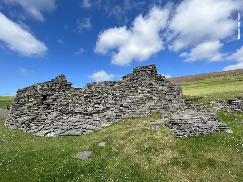
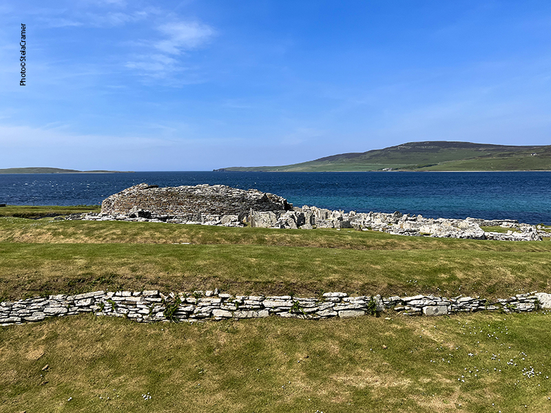
O tour de Rousay terminou com a visita a mais duas câmaras mortuárias: Blackhammer e Taversoe Tuick. Ambas estão protegidas da erosão por uma redoma de concreto. Blackhammer era meio mais do mesmo mas T Tuick foi uma surpresa.
Rousay tour ended with two more burial chambers: Blackhammer e Taversoe Tuick. Both are protected from erosion by a concrete dome. Blackhammer was pretty average but T Tuick held a surprise!


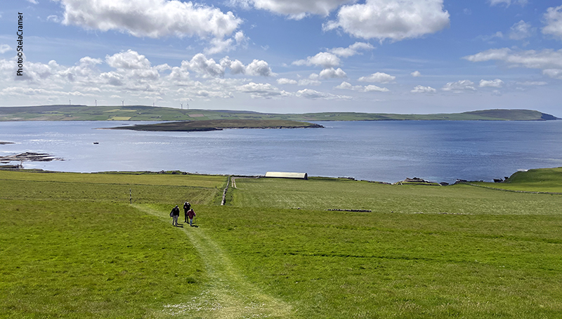
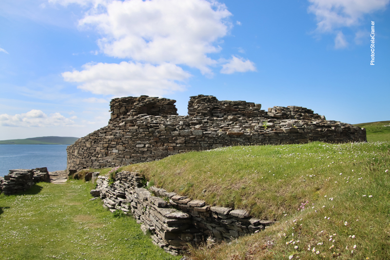
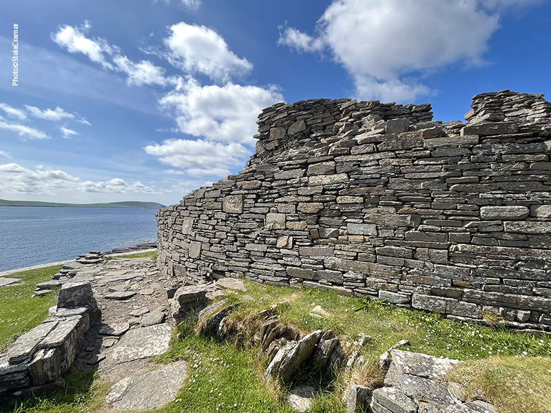
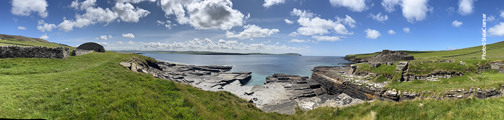
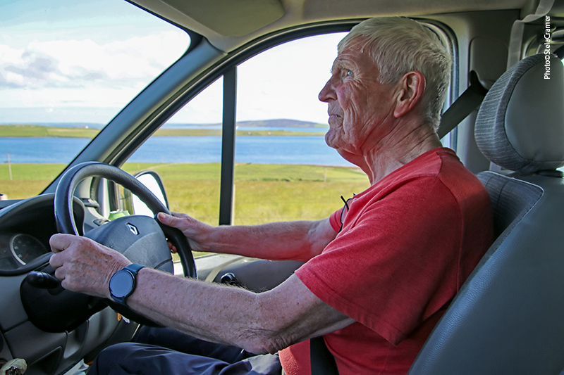
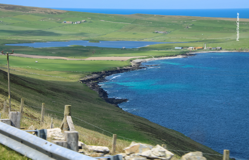
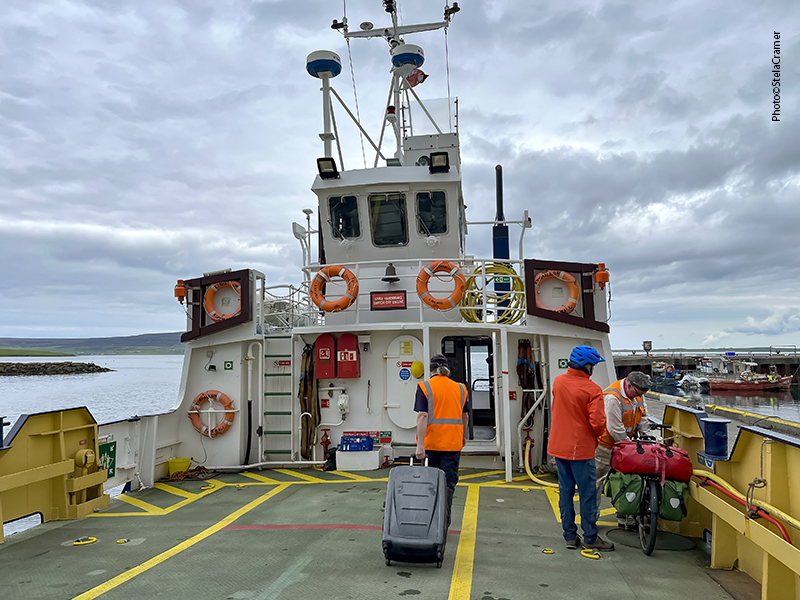
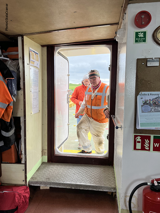
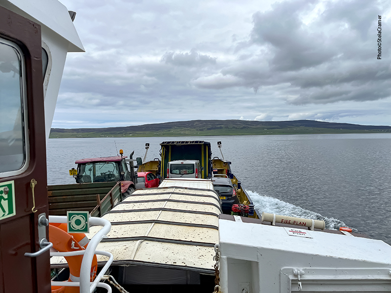
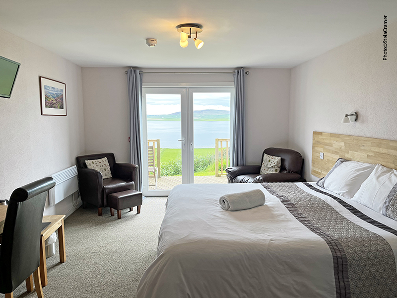
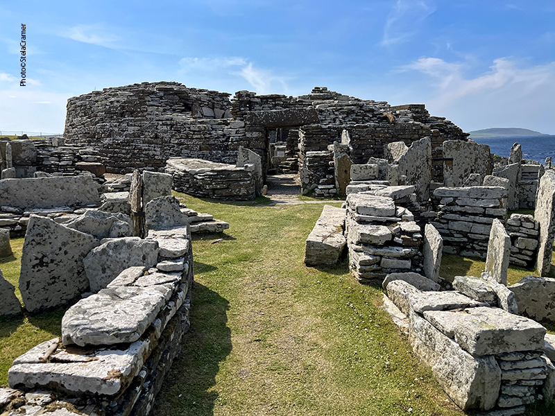
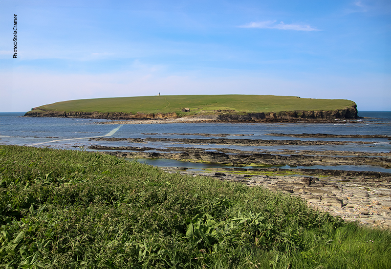
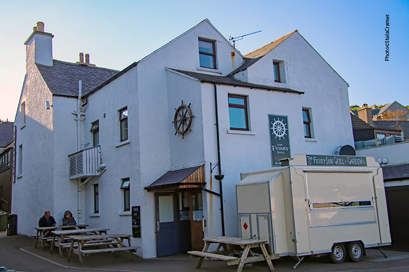
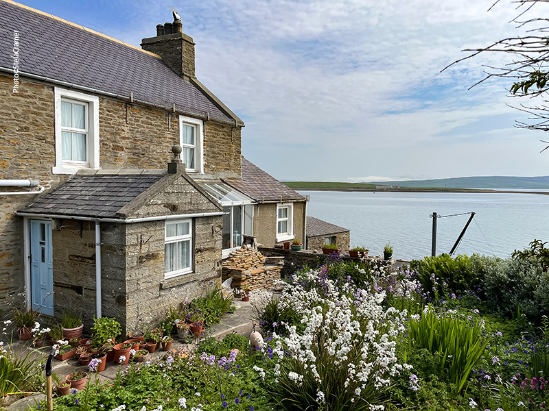
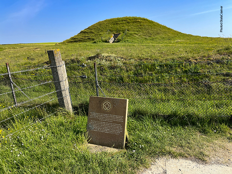
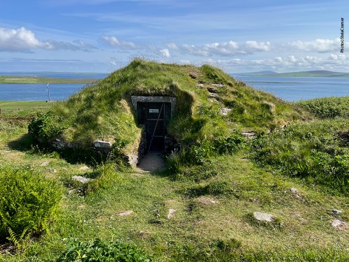
Pouco mais adiante chegamos a Taversoe Tuick, o grand finale do tour. Daqui, Patrick levaria o grupo para pegar o ferry em Trumland Pier de volta a Kirkwall. Eu ainda pernoitei no B&B The Taversoe , só retornaria a Kirkwall na manhã seguinte.
We eventually arrived at Taversoe Tuick, tour’s grand finale. From here, Patrick would drive the group to Trumland Pier, to take the ferry back to Kirkwall. I still stayed the night at The Taversoe B&B, only leaving for Kirkwall the next morning.

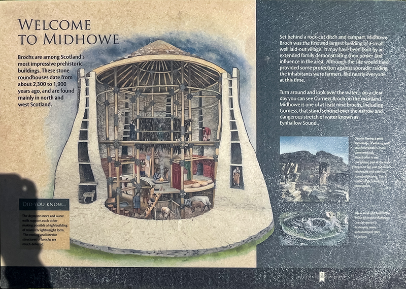
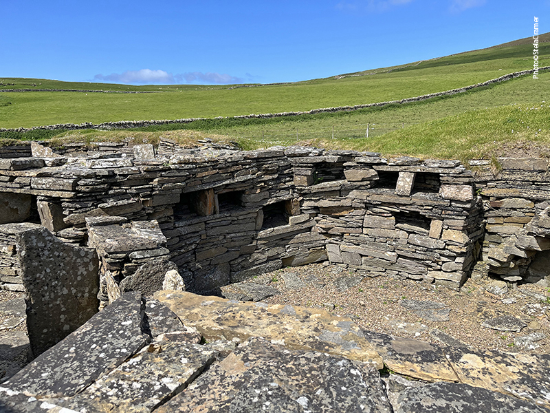
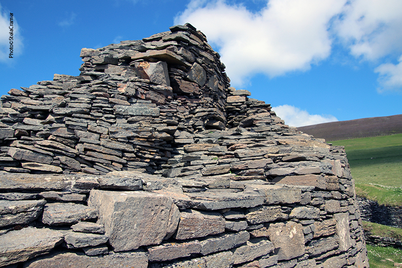
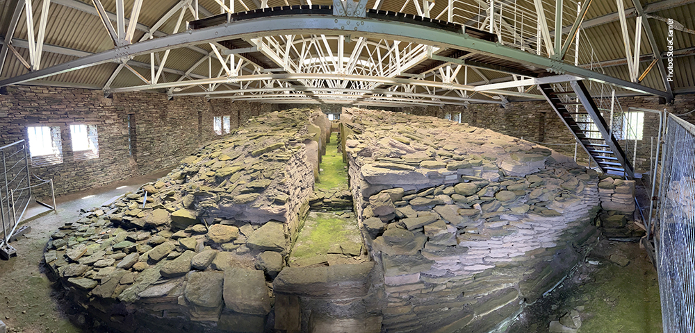
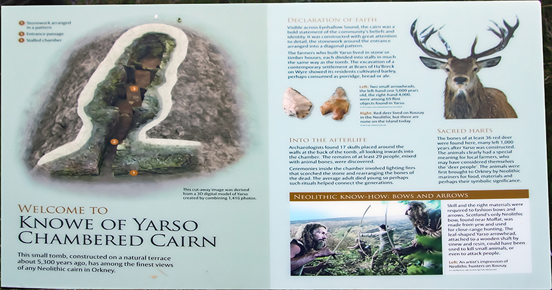
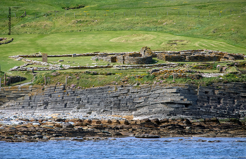
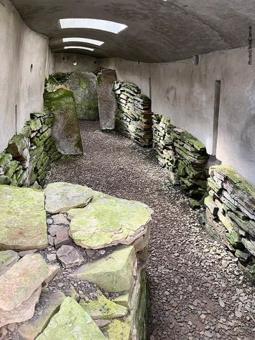
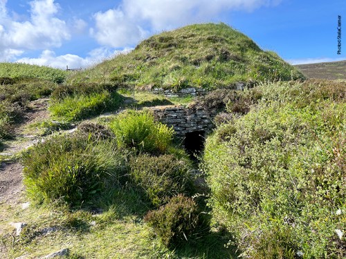
Este é o mais extraordinário dos túmulos em Orkney, pois apresenta dois andares. Este design é incomum: até hoje, apenas um outro foi encontrado com a mesma característica, em Eday.
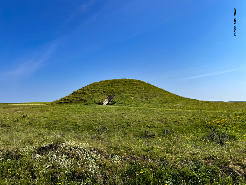
It’s the most remarkable of all the Orkney cairns: a two-storeyed chambered cairn. This design is highly unusual, only another one like it was found ,so far, on Eday.

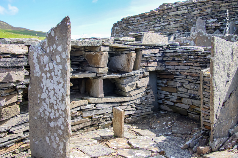
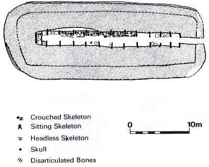
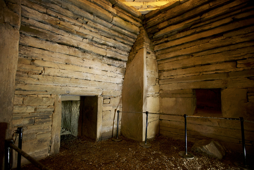
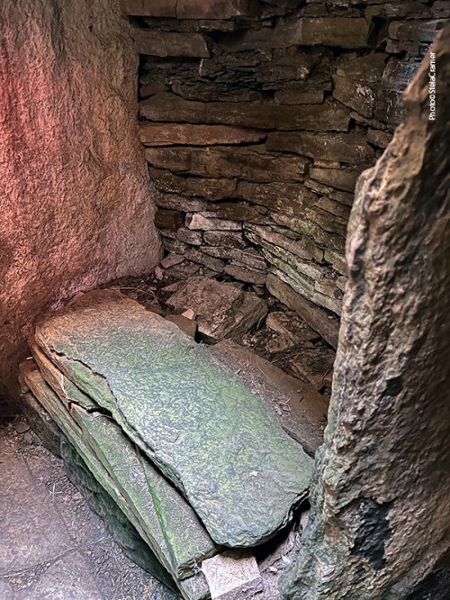
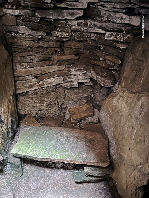
Restos humanos foram encontrados nas duas câmaras, e cacos de cerâmica numa pequena câmara externa, conectada à estrutura principal por um canal feito de pedra. Arqueólogos ainda não sabem qual era a função desta.
Excavations uncovered human remains in both chambers, and pottery shards in an outer chamber too. This outer chamber is connected to the rest of structure by a stone-channel, but there is still discussion about what it was actually used for.
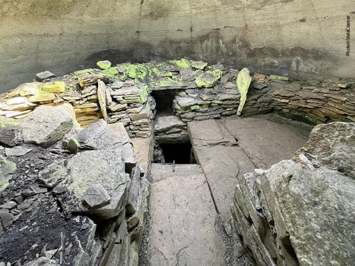
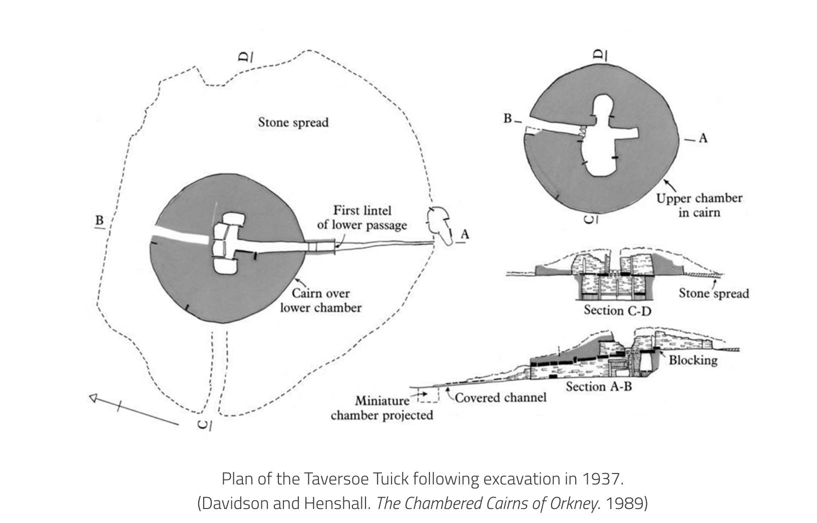
As primeiras explorações no séc XIX encontraram ” uma parede bem preservada, com lajes de pedra inseridas verticalmente sobre a câmara subterrânea”. Na época não ficou claro do que se tratava, embora tenha-se discutido a possibilidade de ser uma segunda câmara. Os arqueólogos hesitaram em acreditar serem duas estruturas contemporâneas, pois nunca havia sido encontrado antes uma câmara mortuária de dois andares. Entretanto, as escavações de 1937 confirmaram que era exatamente isso: um andar de cima e um andar de baixo, ambos construídos na mesma época, dentro do mesmo monumento, um bem em cima do outro, cada um com sua entrada separada.
During their 19th century explorations, a “well-preserved, rough-built wall with uprights of stone slabs was found on the ground above the underground chamber”. At the time, what this represented was not clear. It was subsequently mooted to have been a second chamber, but antiquaries were reluctant to believe that the two chambers were contemporary, since “a two-storeyed burial vault would be unprecedented”. The 1937 excavations, however, confirmed that was exactly what it was – an upper storey contemporary with the subterranean chamber, both constructed and enclosed within the same stone cairn, one placed almost exactly over the other and each with a separate entrance passage.
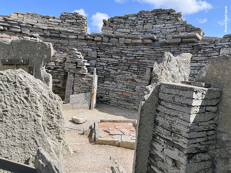
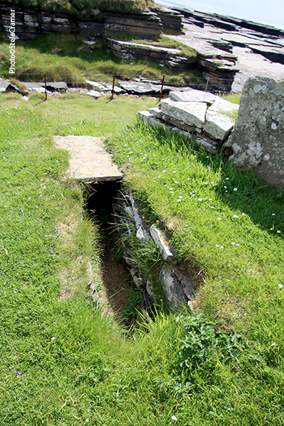
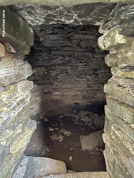
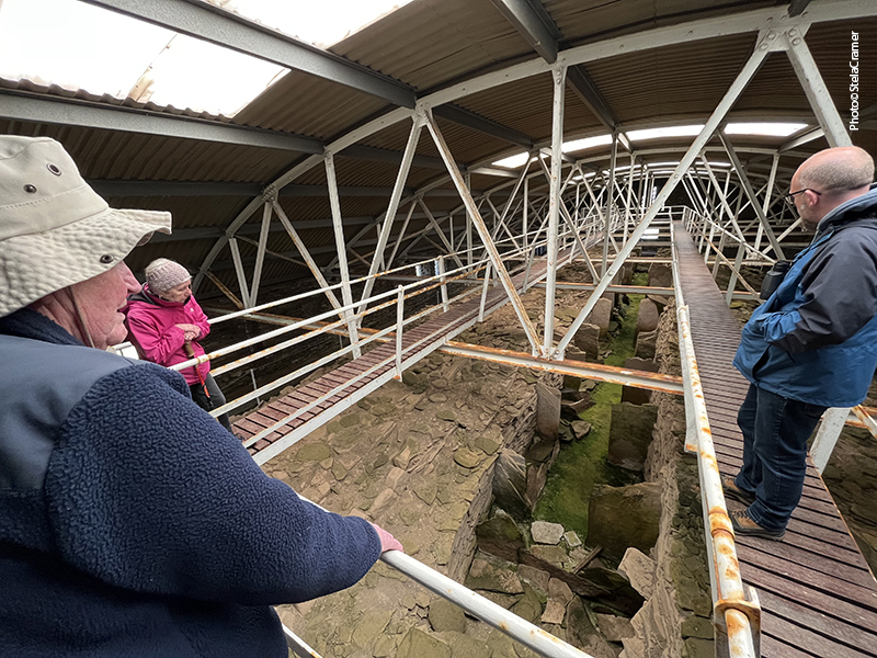
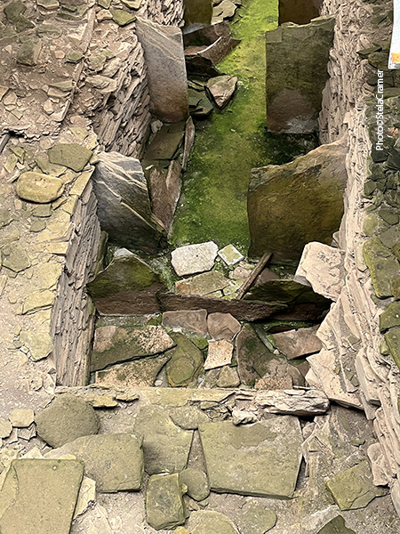
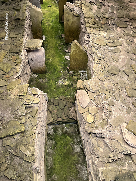
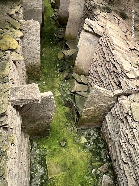
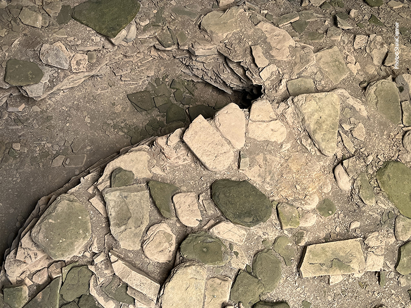
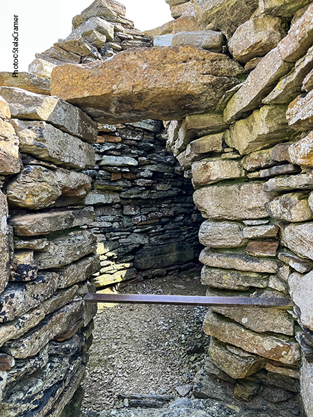
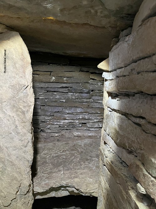
Os dois andares não eram originalmente conectados. Criou-se um acesso por meio de uma escadinha de ferro, num alçapão no chão do andar de cima. A entrada da câmara superior fica do lado norte, voltada para o interior; o acesso à inferior era por uma longa passagem voltada para o sudeste, na direção do mar.
The two layers of the interior were inaccessible from one another. Today they are connected by a hatch in the floor of the upper tomb and a short iron ladder. The upper chamber had its entrance on the north side of the cairn,facing inland, while the lower chamber was entered via a longer passage facing south-east towards the sea.
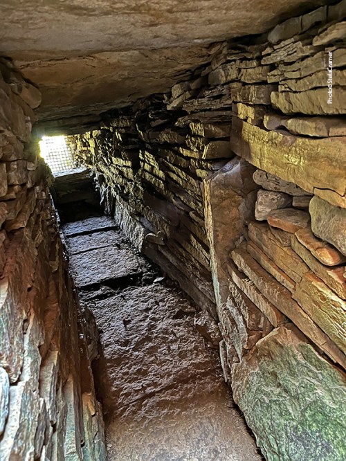

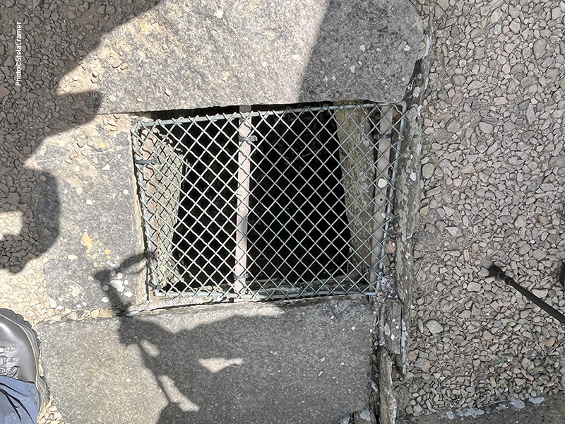
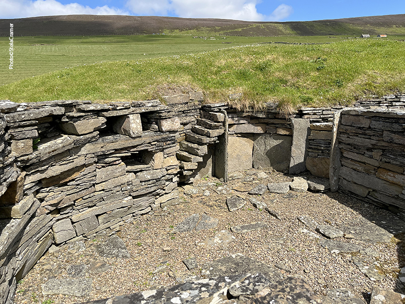
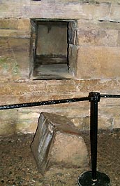
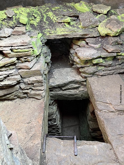
A entrada da câmara inferior foi fechada por uma grade de ferro. / The lower chamber entrance passage has been closed with an iron grate.
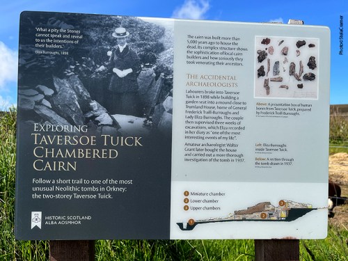
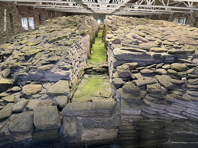
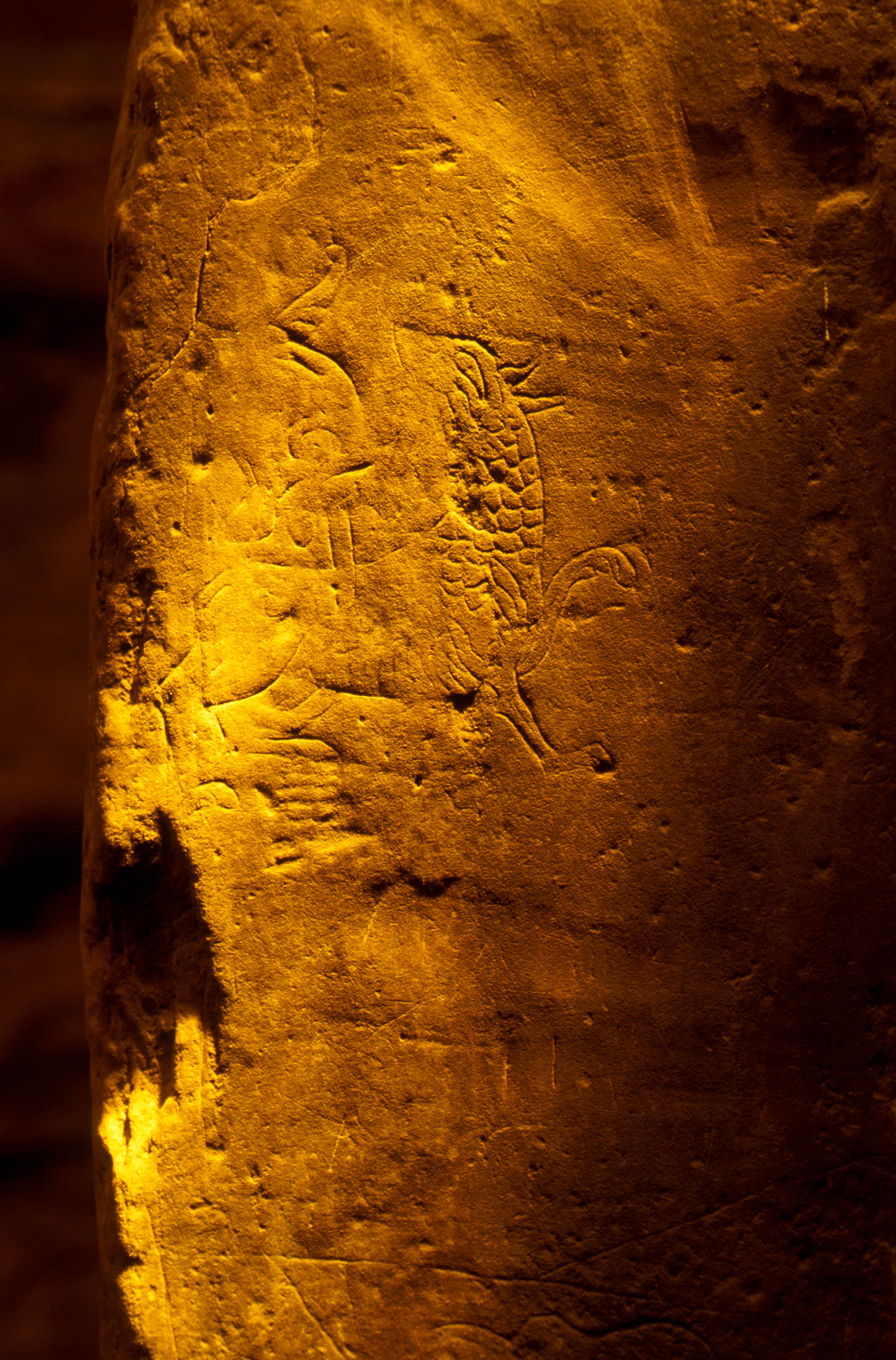
A escavação em 1937 revelou também que a entrada da câmara superior havia sido bloqueada com alvenaria. Isto não é incomum em túmulos Neolíticos, mas as evidências apontavam claramente para a câmara ter sido selada na Idade do Bronze. Sob a alvenaria, mas 30 cm acima do chão na passagem, estavam os vestígios de um colar: 35 contas e um pendente de pedra-pome perfurados, identificados como da Idade do Bronze, isto é, contemporâneo às urnas de cerâmica que tinham sido encontradas na primeira escavação, 40 anos antes. O fato do colar estar acima do material, mas debaixo do bloqueio, prova que a passagem foi selada na Idade do Bronze. Este e outros achados levam a crer que a importância desta estrutura permaneceu para além do Neolítico e que, aparentemente, foi largamente modificada na Idade do Bronze.
The 1937 excavation also found that the inner end of the upper entrance passage had been blocked with masonry. Again, this is not uncommon in Neolithic chambered cairns but at the Taversoe Tuick the evidence clearly pointed to the chamber being sealed in the Bronze Age. Beneath the blocking material, but 30cm above the passage floor, were the remains of a necklace – 35 stone disc beads and a perforated pumice pendant recognised as Bronze Age, prompting that the necklace, and its deposition, was contemporary with the cists found almost four decades before. The fact the necklace lay on top of material, but beneath the blocking, is proof the passage was sealed in the Bronze Age. This, and other recorded finds, strongly suggests the structure remained a focus long after the Neolithic and, it appears, was also extensively modified in the Bronze Age.
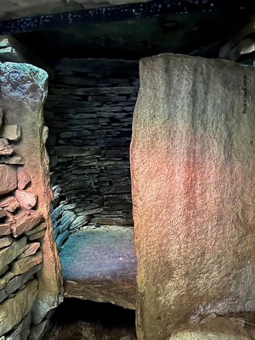
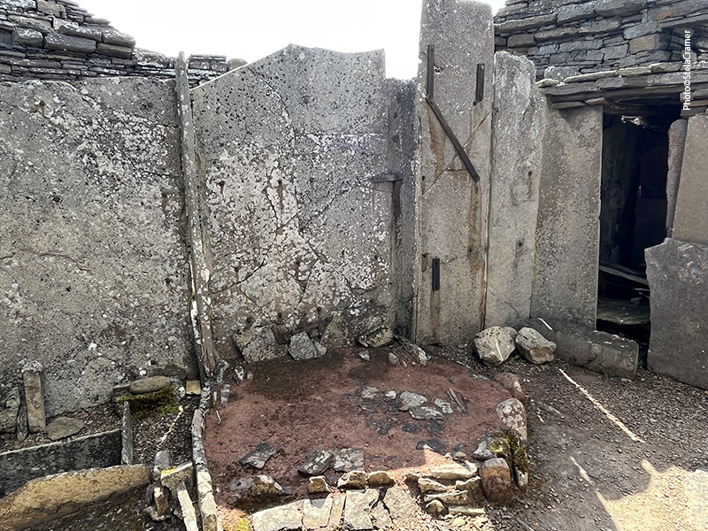
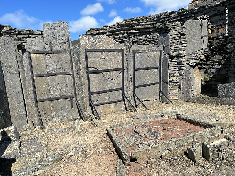
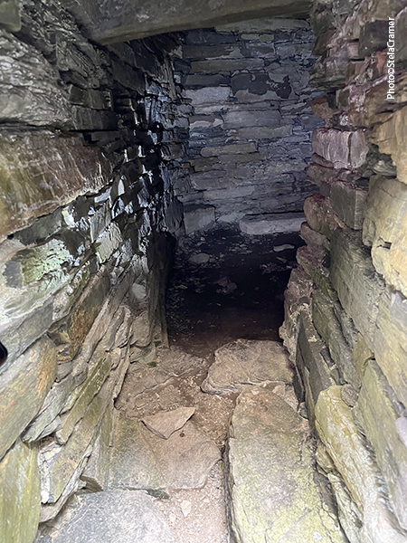
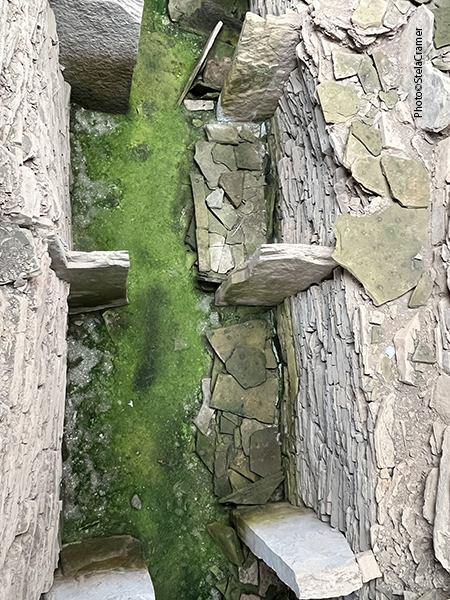
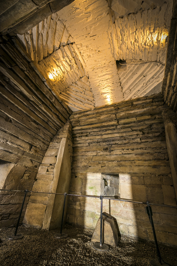
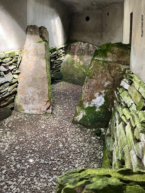
O andar de cima consiste numa área central rodeada por quatro compartimentos. / The upper chamber consists of a central area surrounded by four compartments.
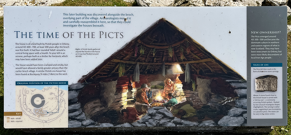
E se fosse o primeiro edifício de apartamentos conhecido na História? Uma família em cada andar…E se os cairns não fossem túmulos, mas simplesmente dormitórios, construídos subterrâneos como proteção contra o frio e predadores? Que falta faz uma máquina do tempo, para nos proporcionar respostas a tantos mistérios.
What if this was History’s first known apartments building? One family on each floor? What if the cairns were not graves but just bedrooms, built underground to protect the inhabitants from the cold and predators? How useful would be a time-machine, to provide us with answers to so many mysteries.
Abaixo um link para o modelo em 3D de Taverson Tuick.
Link to Taversoe Tuick 3D model: