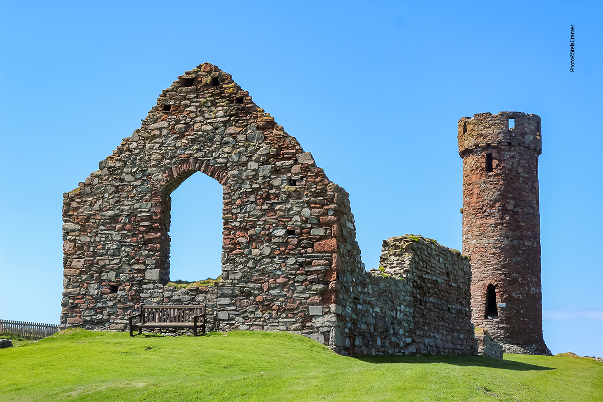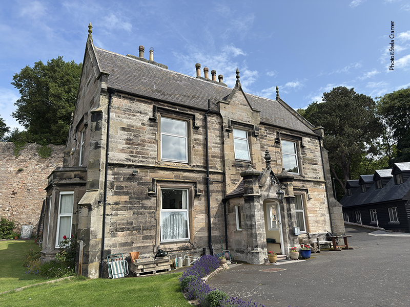
A Neolithic tomb in someone’s backyard! And we found it by chance…
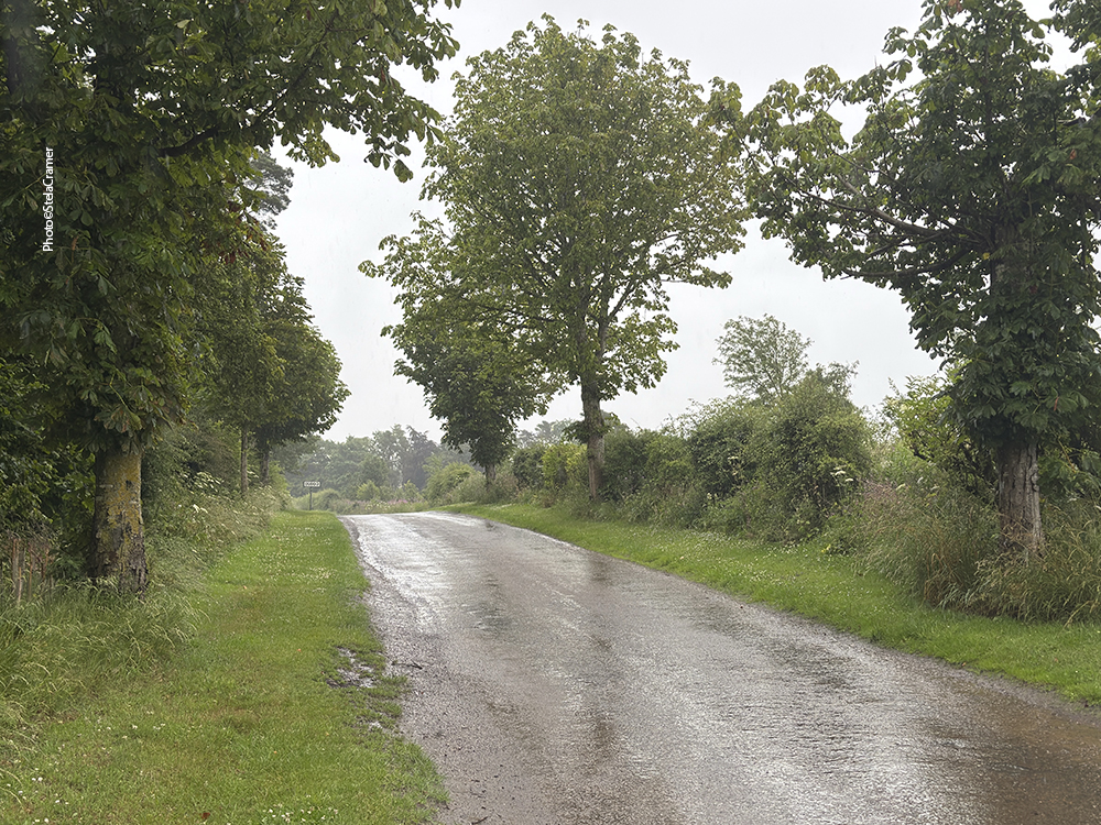
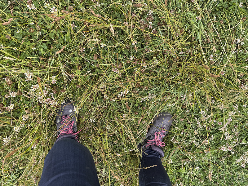
Sabíamos que na Ilha de Mann havia mais um círculo de pedras e, embora incapazes de pronunciar o nome do lugar, saímos dispostas a encontrá-lo. O GPS não era nada confiável e saía do ar, obviamente nas horas em que mais precisávamos de direções. Assim, tentando chegar ao povoado de Maughold, nos perdemos numa estradinha de terra aparentemente no meio do nada.
We’d learnt that there was another stone circle in the island, and, although not being able to pronounce its name, we decided to go find it. Our GPS wasn’t trustworthy at all. Whenever we needed it most, connection was lost. So, trying to reach Maughold village, we got lost in a narrow dirt road in the middle of nowhere.
Mesmo que eu quisesse, era impossível fazer um retorno… assim seguimos em frente até dar de cara com um caminhão de serviço, com um guincho ou coisa parecida, os dois ocupantes uniformizados com aqueles coletes refletivos. Perguntamos, todas sorridentes: “Estamos procurando um círculo de pedras, vocês saberiam nos indicar o caminho?”
There was nowhere to turn around, even if I wanted to, so we kept going until, out of the blue, a kind of tow truck – with big tools in the trunk – appeared in front of us. Inside it, two guys wearing reflective working vests. Smiling, we addressed them: “We’re looking for a Stone Circle, can you tell us how to get there?”
Os rapazes olharam para nós, se entreolharam, e perguntaram de onde éramos. A palavra “turista” devia estar estampada em nossas testas, além do sotaque. Ao ouvir que éramos brasileiras, os dois arregalaram os olhos. “Vocês poderiam estar agora numa praia ensolarada no Brasil? O que estão fazendo aqui atrás de pedras?” Explicamos nossa busca por monumentos antigos, e os dois ainda incrédulos pensaram um pouco, responderam que de fato havia algo parecido um pouco mais adiante e se ofereceram para nos guiar até a estrada correta. Não sei como, mas conseguiram dar meia volta com o caminhão e disseram que os seguíssemos. E lá fomos nós.
They looked at us, at each other, frowned and asked where we were from. We probably had the word TOURIST engraved in our foreheads, besides the accent. When we said we were Brazilians, they apparently understood Martians. “So you could be right now in a sunny beach in Brazil? WTF are you doing here? visiting stones?!?!” We explained our interest for ancient monuments, the guys thought for a while and, still bewildered, said there were indeed some stones ahead, and they could lead us there. Somehow they managed to turn the truck around and told us to follow them. So there we went.
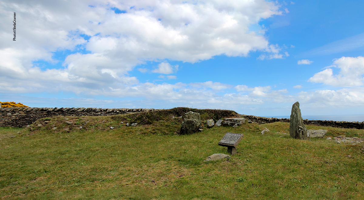
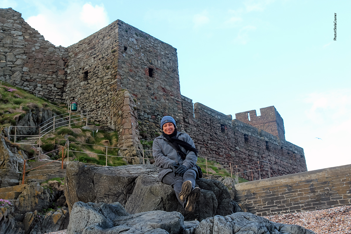
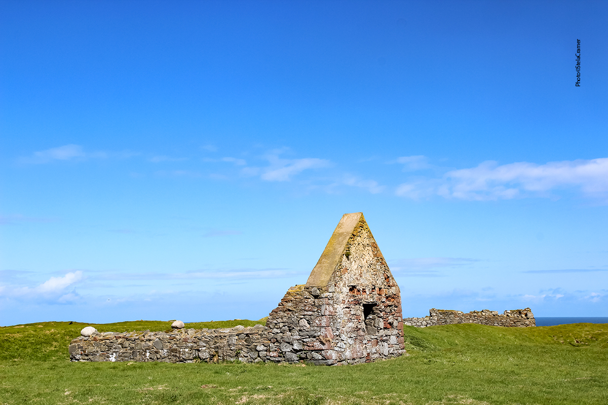
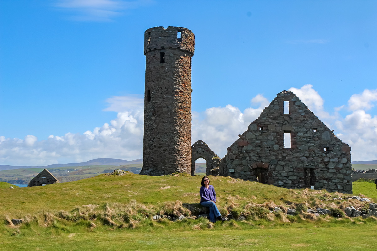
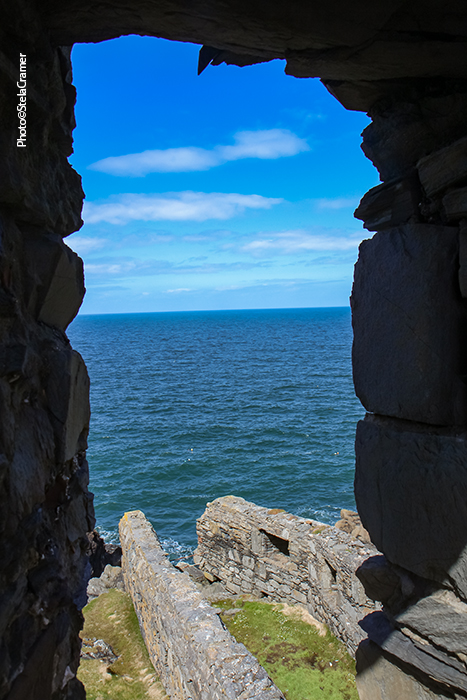
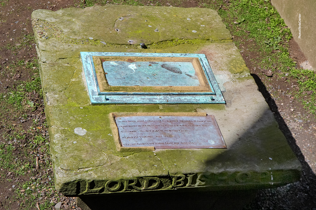
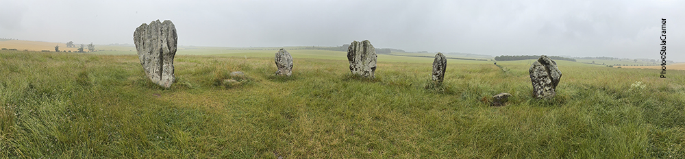
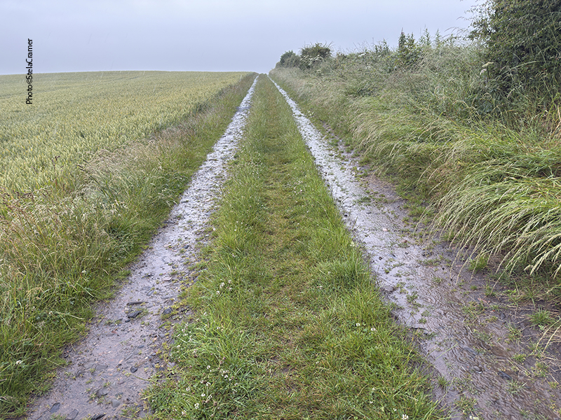
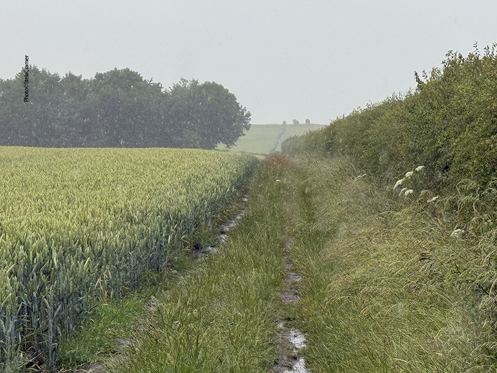
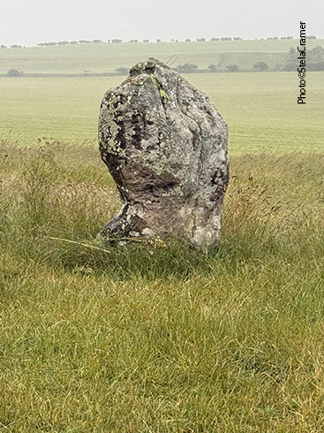
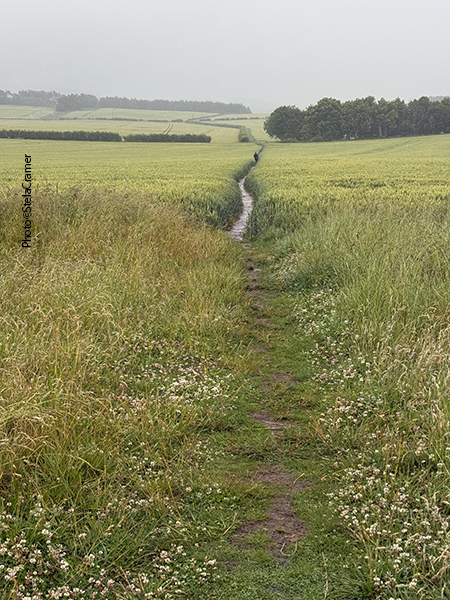
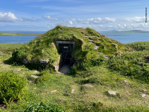
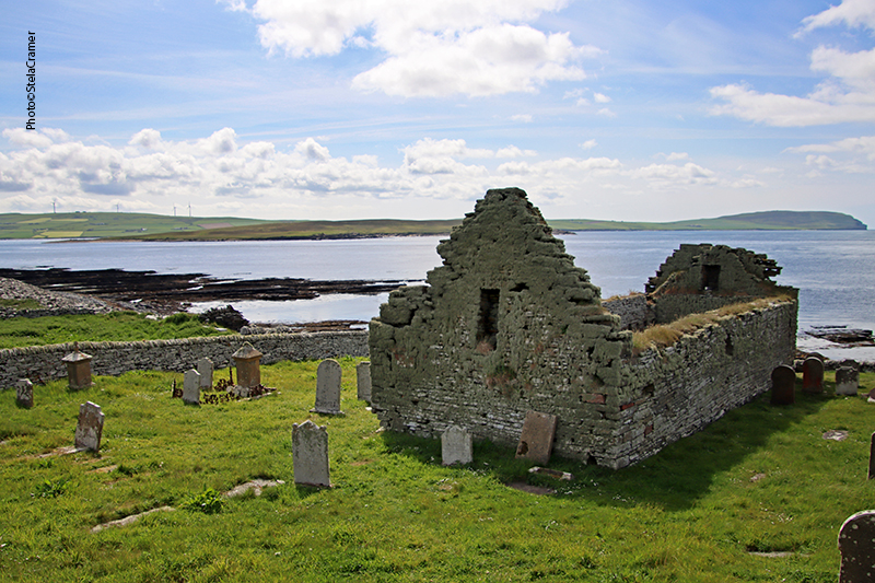
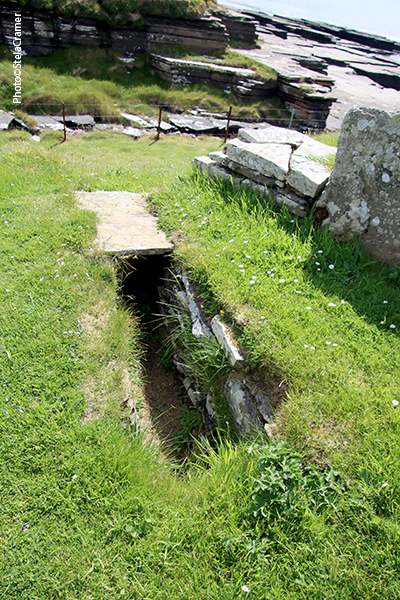
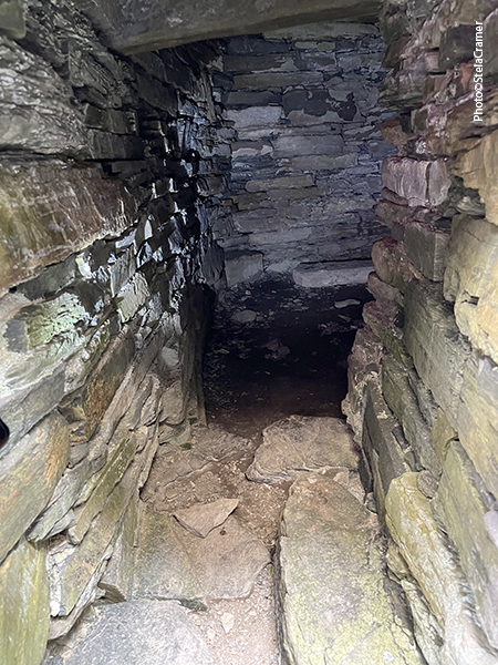
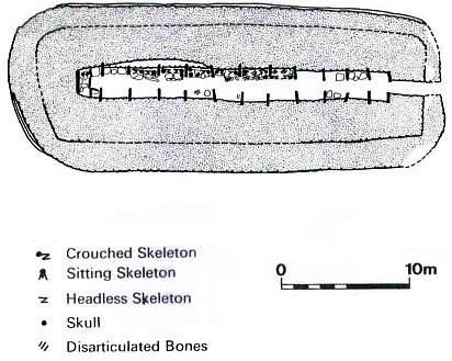
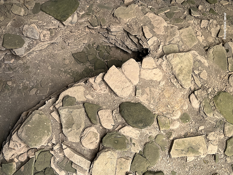
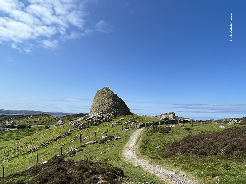
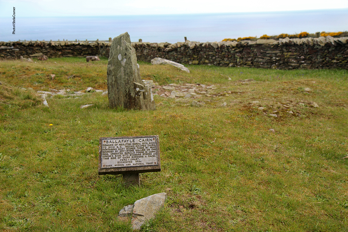
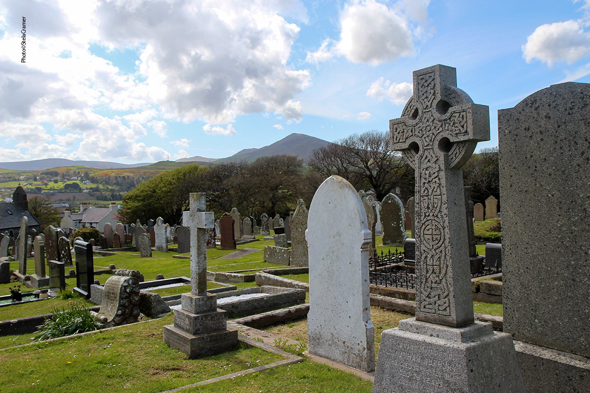
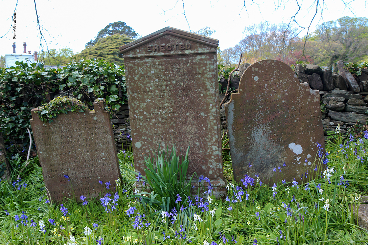
Depois de uns 20 min já estávamos ficando nervosas, achando que seríamos estupradas, assassinadas, esquartejadas e nossos corpos largados para apodrecer ali, no meio do nada, quando eis que surge uma bifurcação. Eles pararam e indicaram a direção onde minutos adiante encontraríamos as tais pedras. Acenaram e se foram, nós prosseguimos. A estradinha subia e, de fato, chegamos a um monolito, num círculo meio desabado, mas um verdadeiro túmulo neolítico, com placa do National Trust e tudo. Estacionamos bem em frente.
20 min after we,re starting to feel nervous, thinking that we could be raped, murdered, quartered and our remains left to rot there, in the middle of nowhere… when a fork in the road appeared. They stopped, pointed the way where the stones should be, a few minutes ahead, waved goodbye and left. We went up the road and eventually reached a single stone in a crumbled circle, a Neolithic tomb indeed, with a National Trust sign. We parked in front of it.
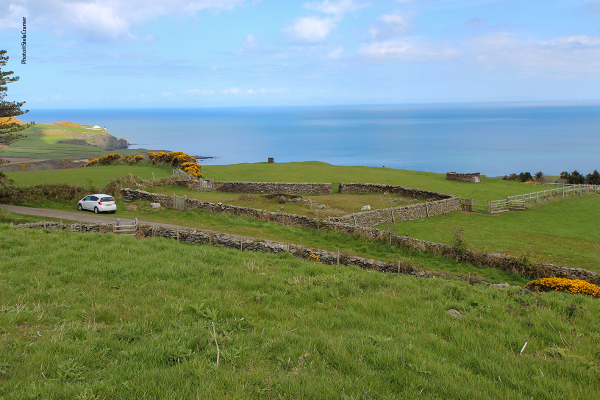
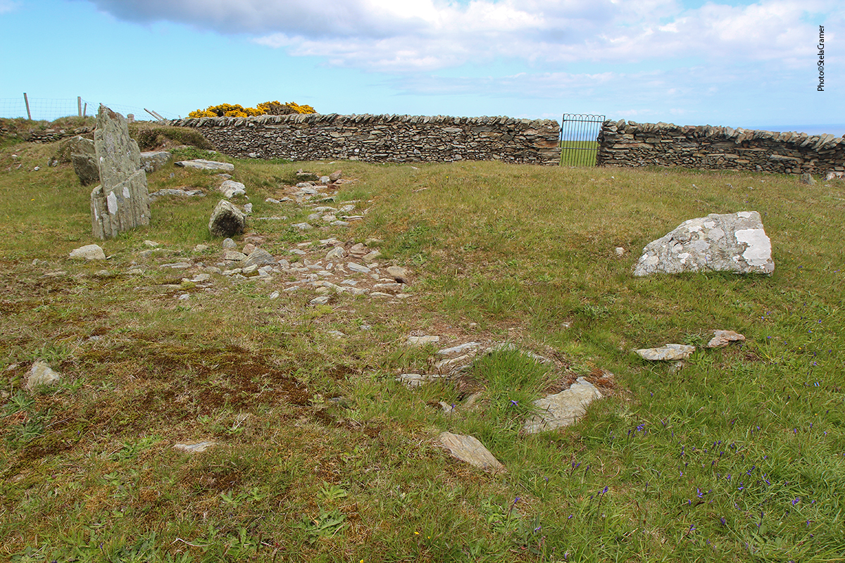
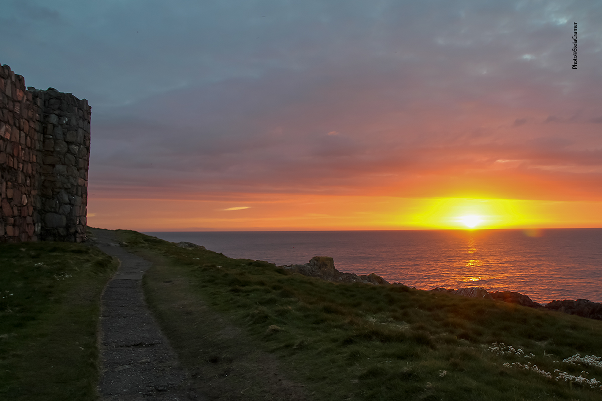
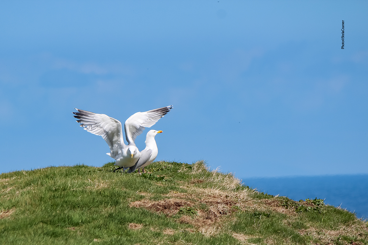
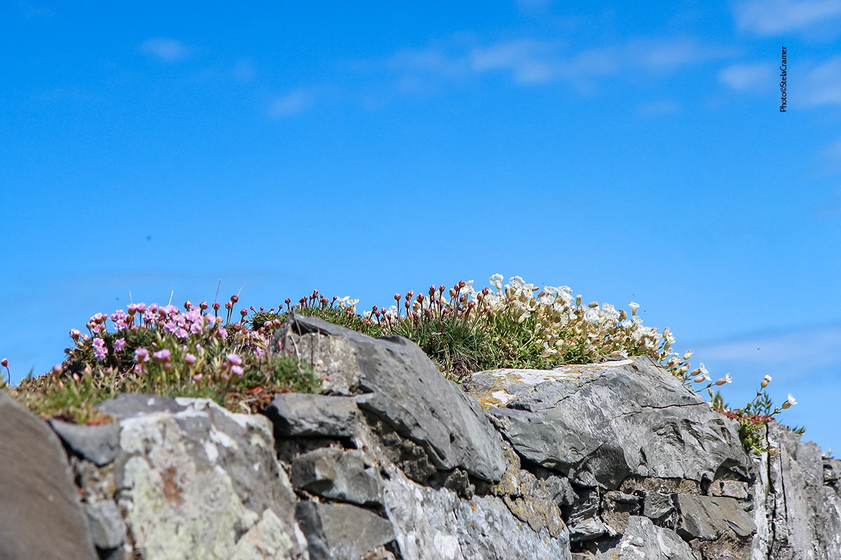
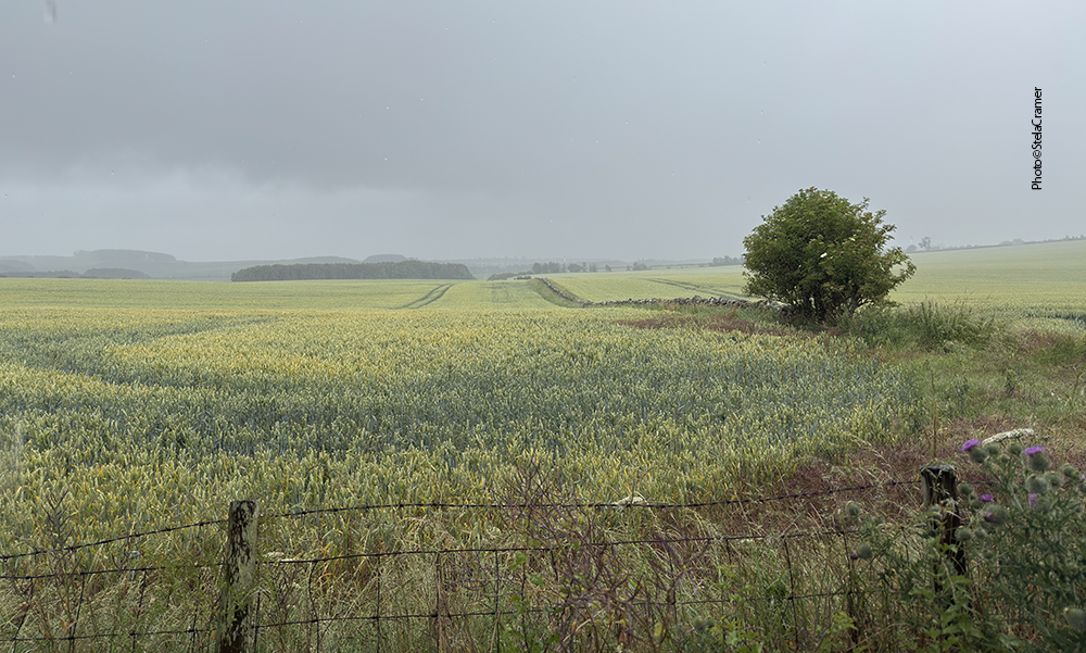
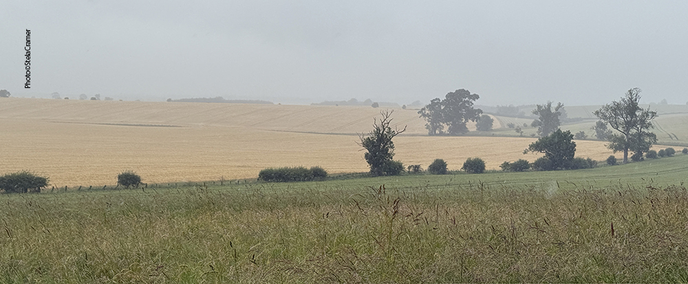
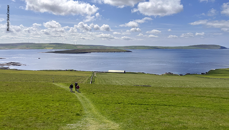
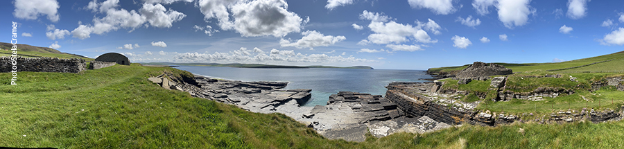
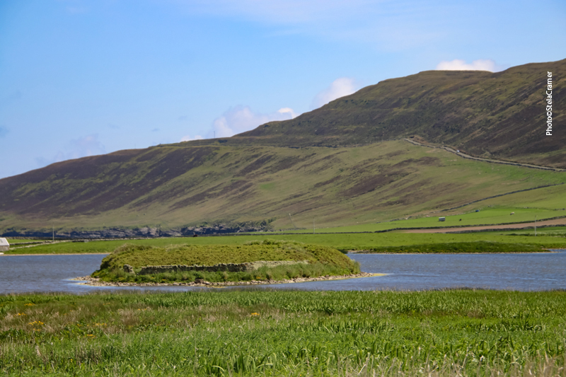
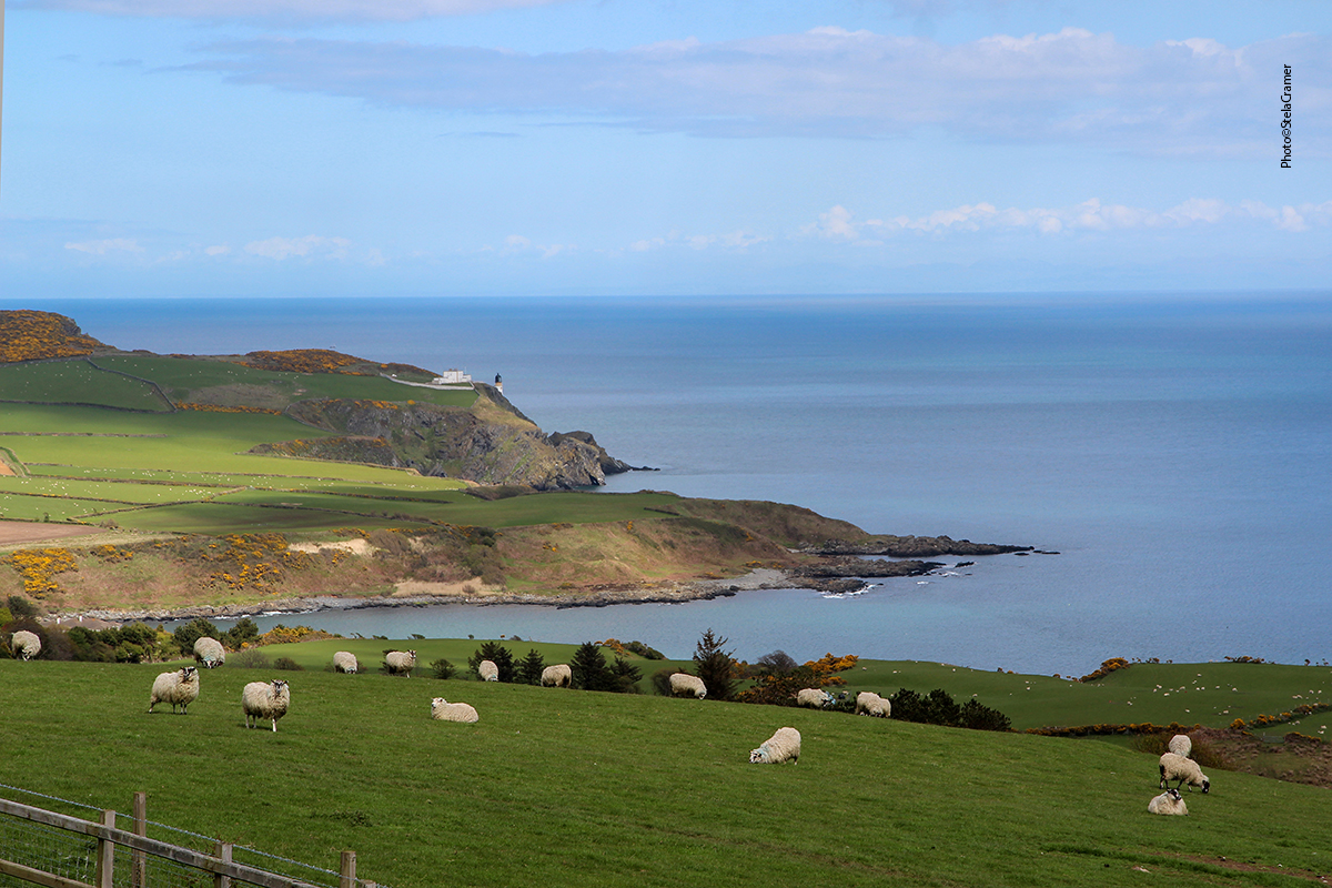
A vista era espetacular. De um lado, terra cultivada; do outro, pasto cheio de ovelhas, e o imenso mar azul ao fundo.
The view was awesome. Farm land to one side, sheeps grazing to the other, and the big blue sea beyond.
Acreditamos que este túmulo seja do proprietário original das terras / We believe this is the original land owner’s grave
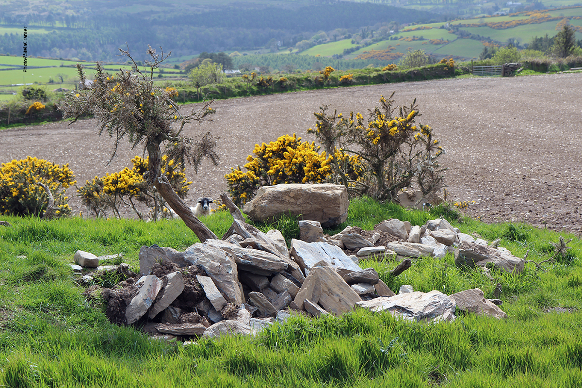
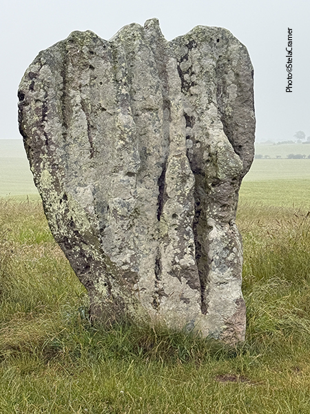
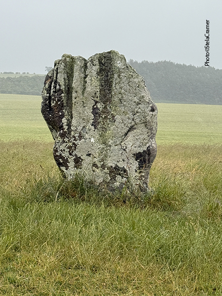
Este lugar, apesar de ter sido escavado em 1826 e estar bem cuidado, não deve ser muito visitado, pois nem existe na Wikipedia. Para nós foi um bônus extra! Seguindo adiante na estrada ,chegamos a Maughold.
This place, despite having been excavated in 1826, and apparently being well cared for, isn’t mentioned in Wikipedia. Probably not many visitors come here. For us it was an extra bonus! Following the road ahead, we eventually arrived at Maughold.
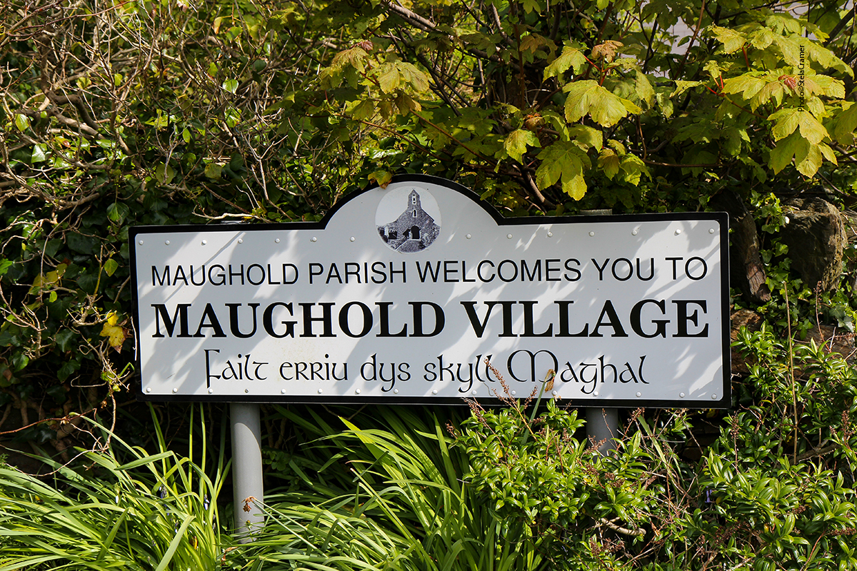
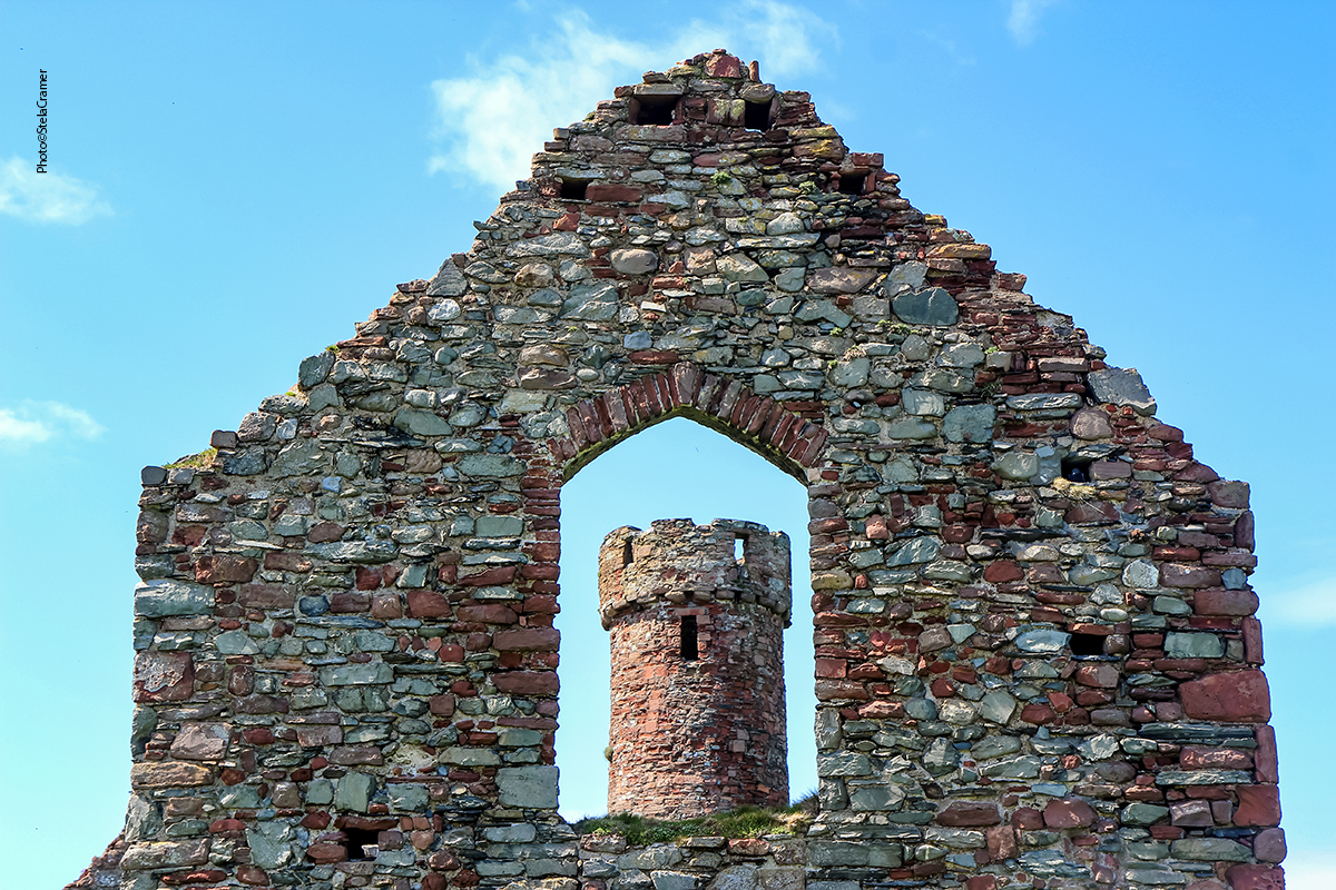
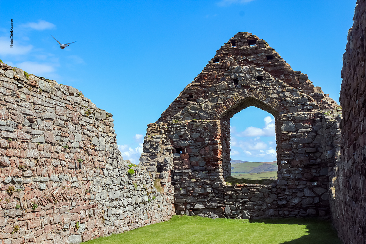
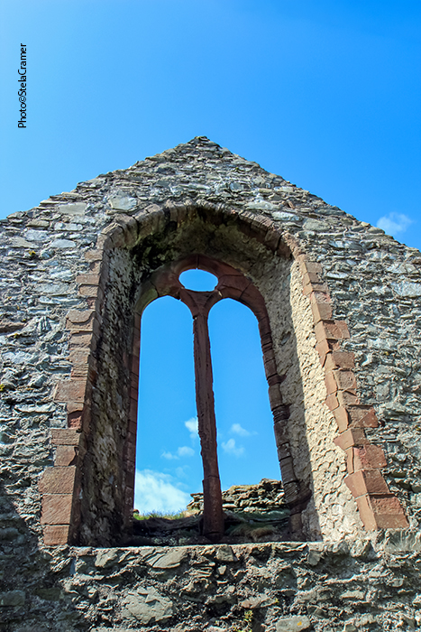
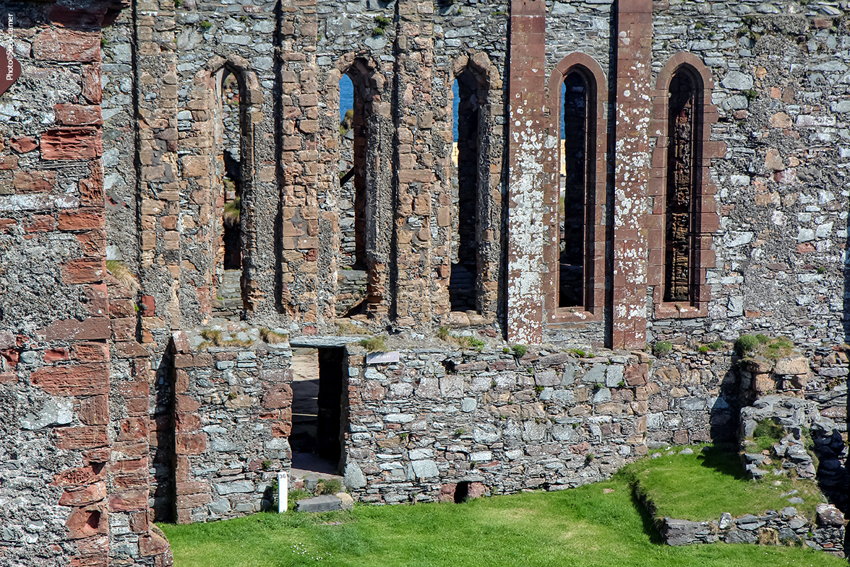
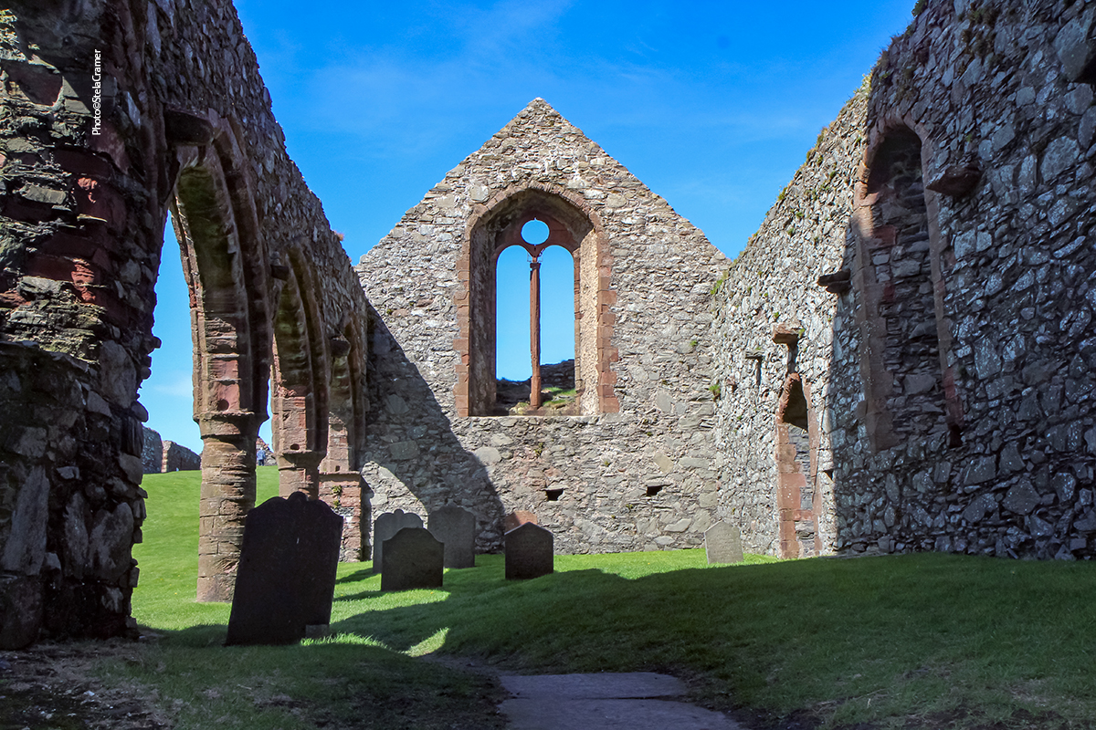
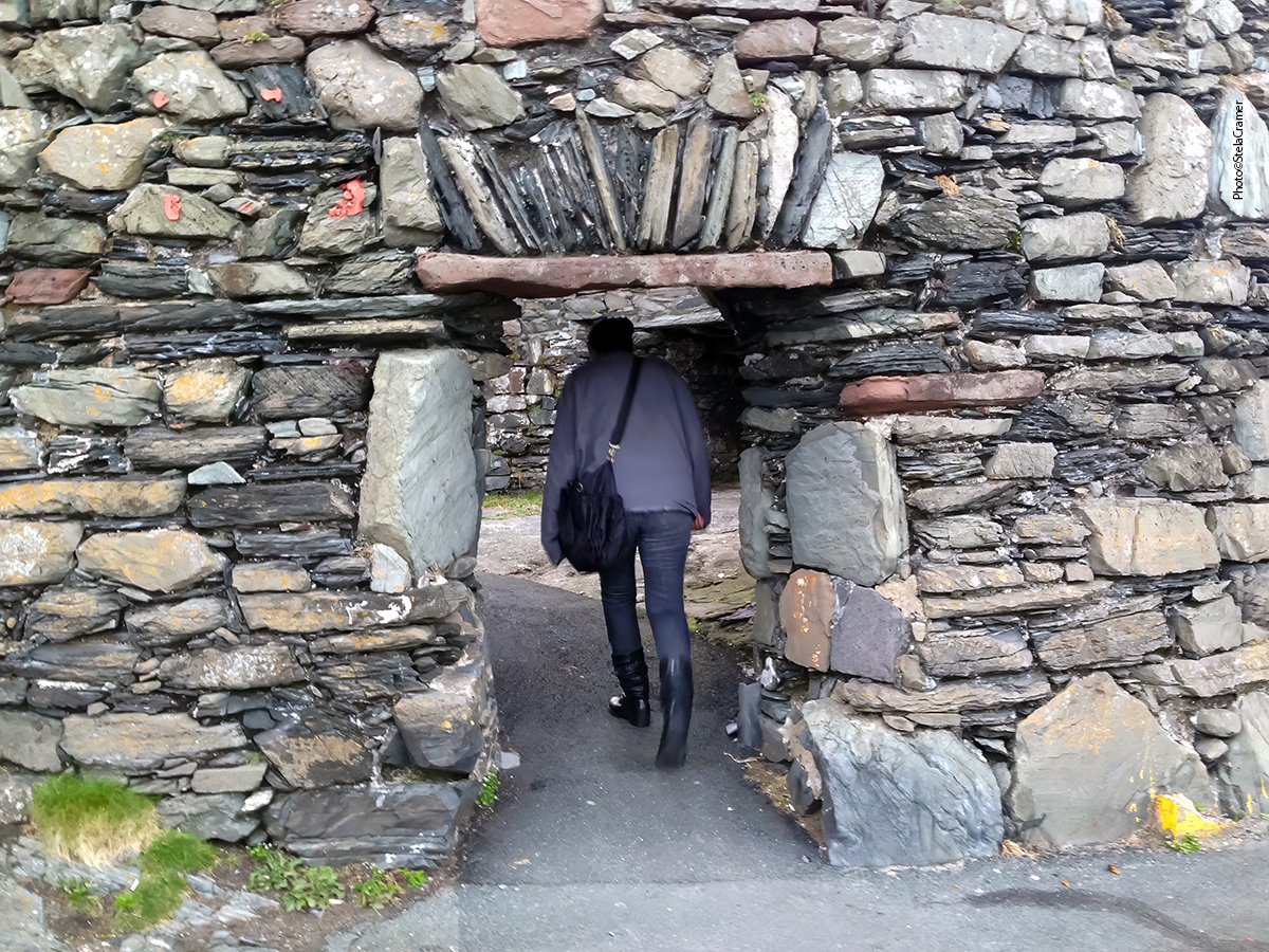
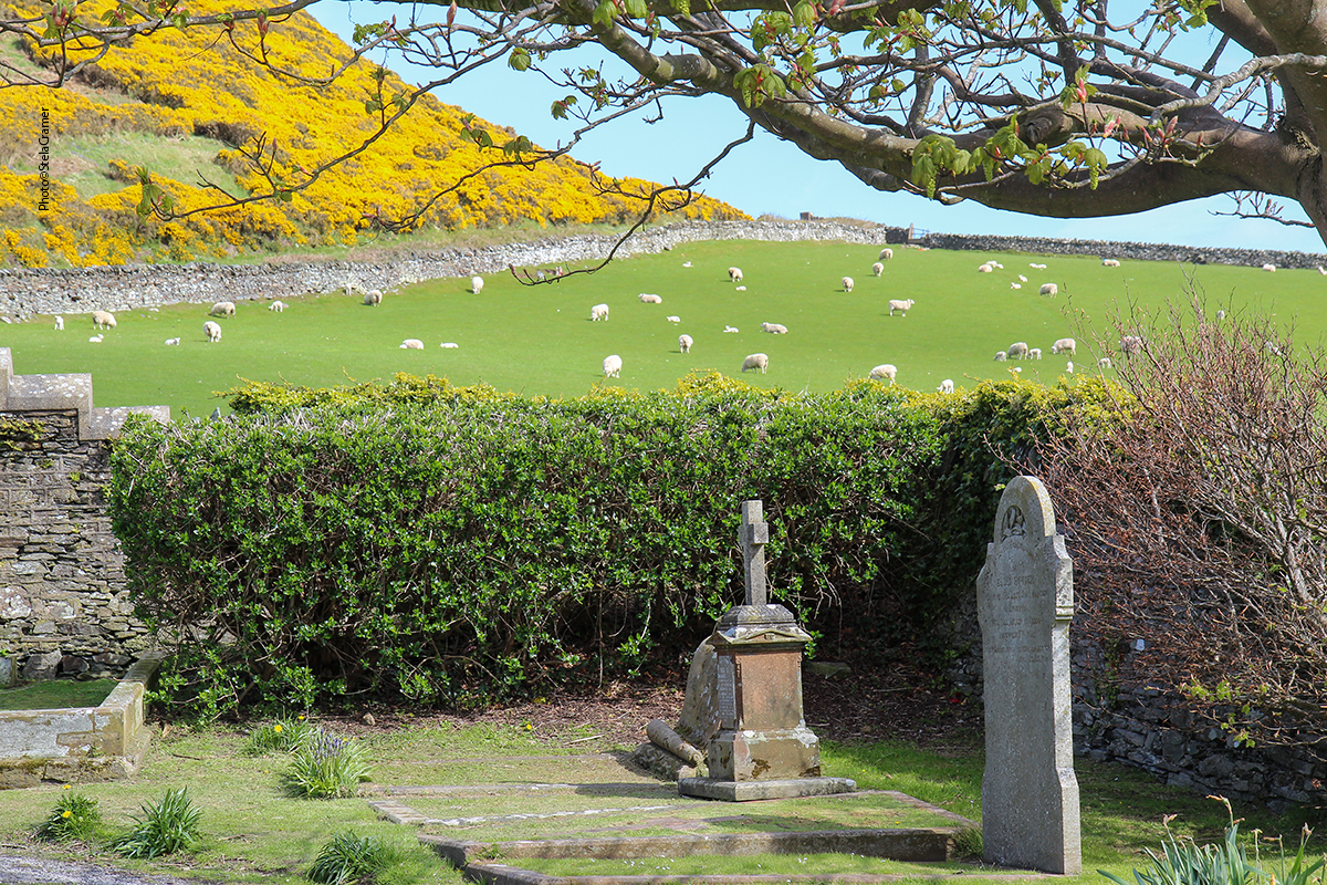
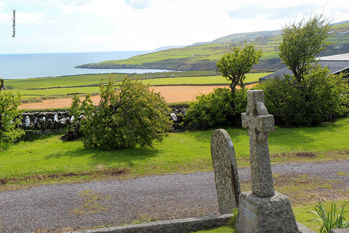
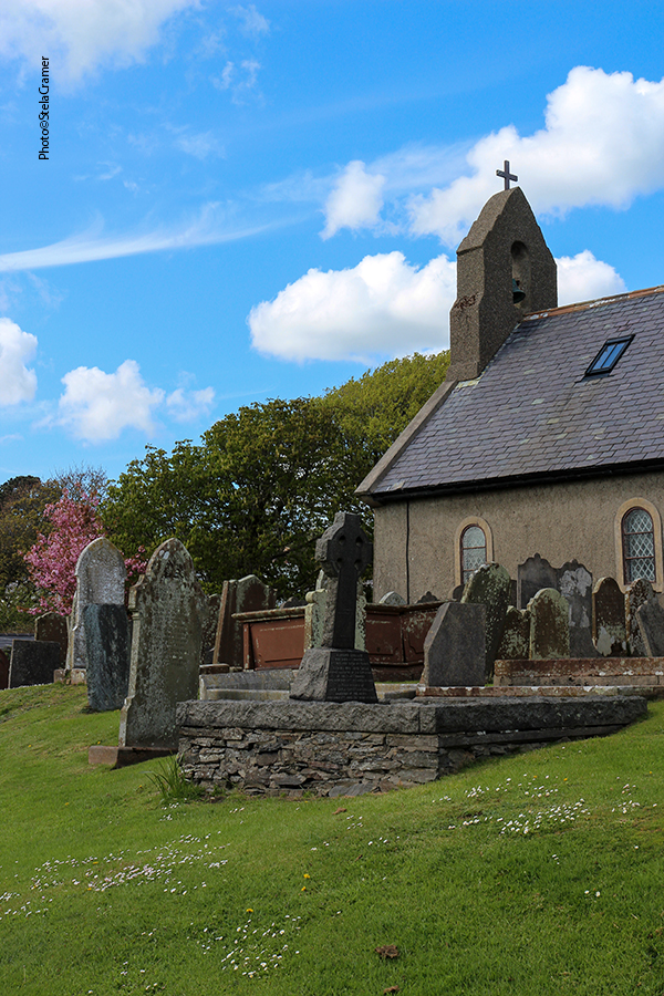
Maughold é um vilarejo centralizado na Igreja, com algumas residências em volta. O nome é derivado de St. Maughold, que lá chegou no século 5. Tendo sido o mais antigo assentamento monástico da Ilha de Man, o lugar teve sua importância e atraía muitos peregrinos mas, atualmente, é “insignificante”, segundo a Wikipedia.
Maughold is a settlement is centred around Kirk Maughold Parish Church and churchyard, with a handful of dwellings on either side. Its name comes from St Maughold, who arrived there in the 5th century. Once a place of considerable importance – Man’s oldest monastic settlement, much frequented by pilgrims – nowadays the village is “quite insignificant”, according to Wikipedia.
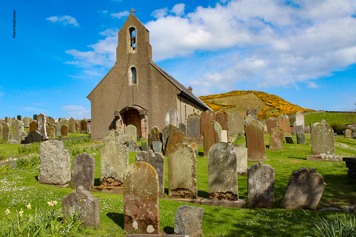
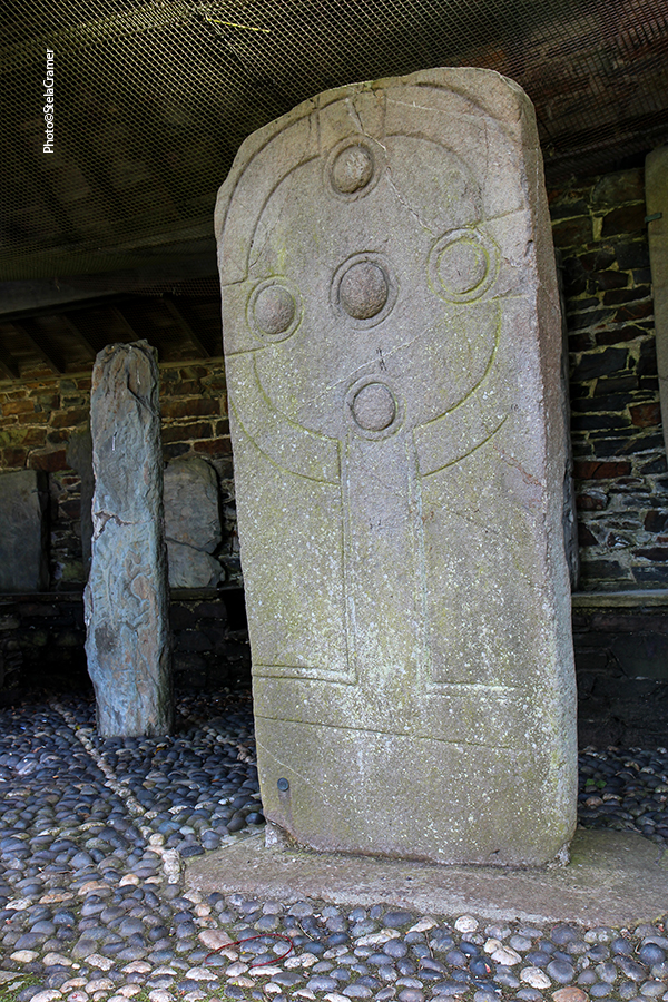
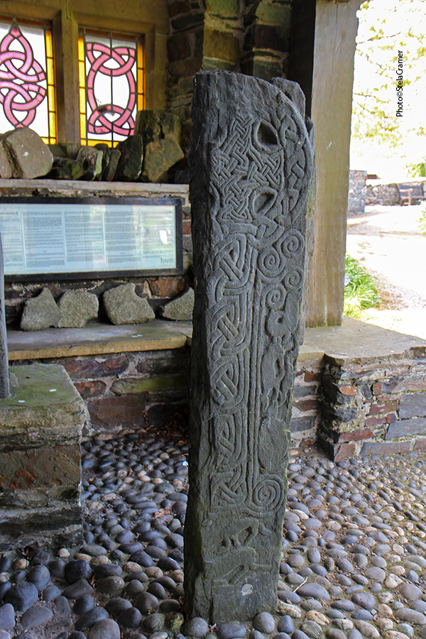
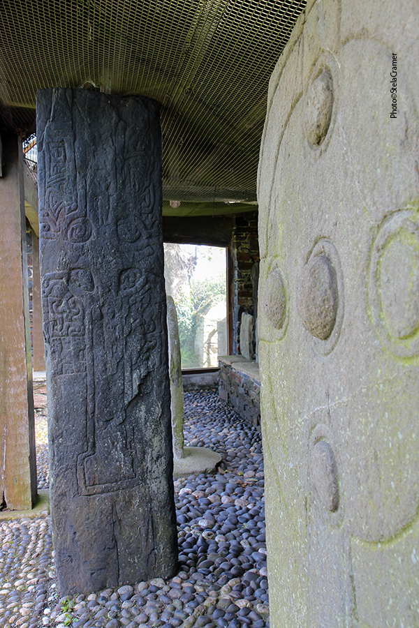
The Church was built in the 11th or 12th century, on top of the original Celtic monastery.
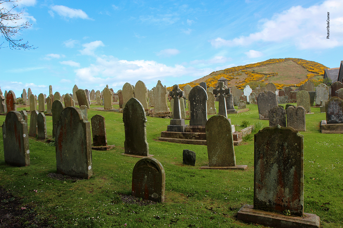
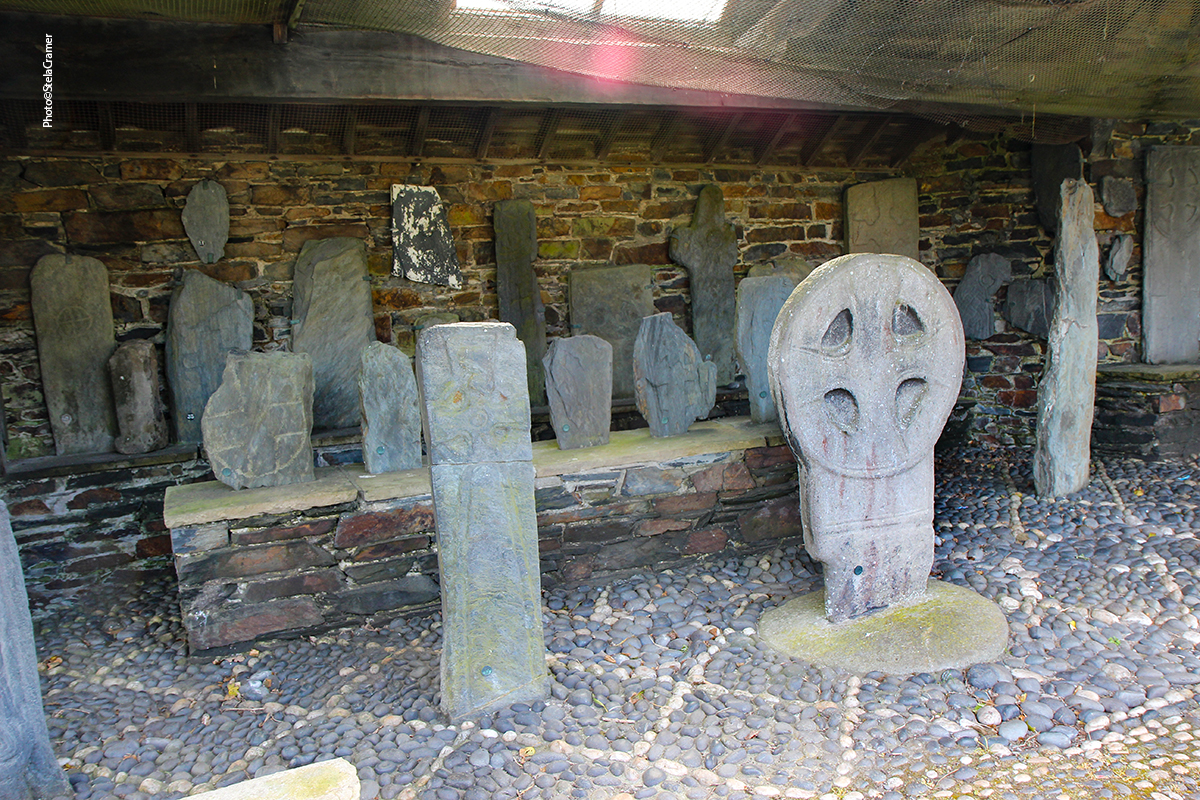
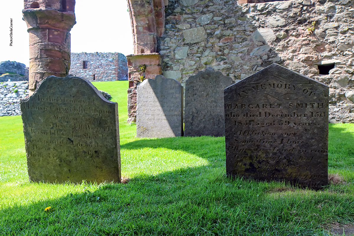
Maughold Cross House within the churchyard contains a large collection of early Christian
and Viking carved stone crosses.
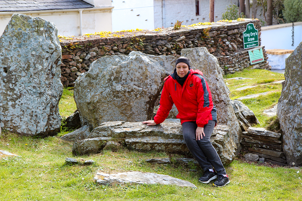
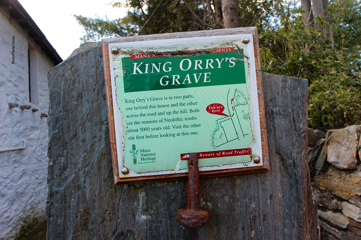
Após visitar o cemitério e a exposição de Cruzes, decidimos voltar para Peel enquanto era dia, pois nosso hotel era praticamente do outro lado da Ilha. Não queríamos arriscar nos perder de novo, no escuro. E de fato acabamos nos perdendo… e achamos o túmulo do Rei Orry!
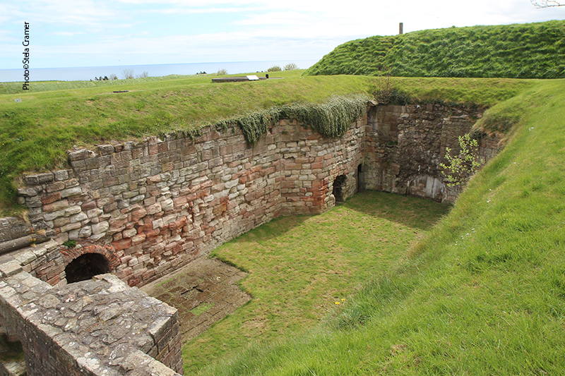
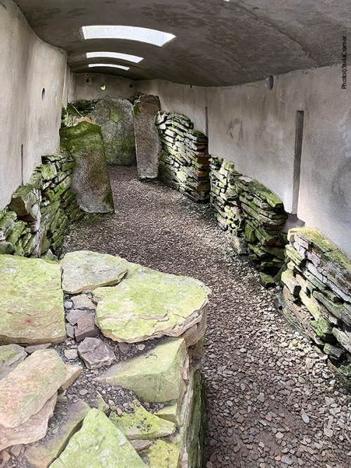
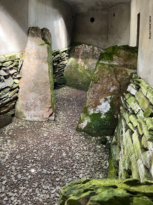
After visiting the graveyard and the Crosshouse, we decided to return to Peel while it was daylight, because our hotel was nearly the other side of the Island; we didn’t want to risk getting lost again, in the dark. And get lost again we did… just to find King Orry’s Grave!
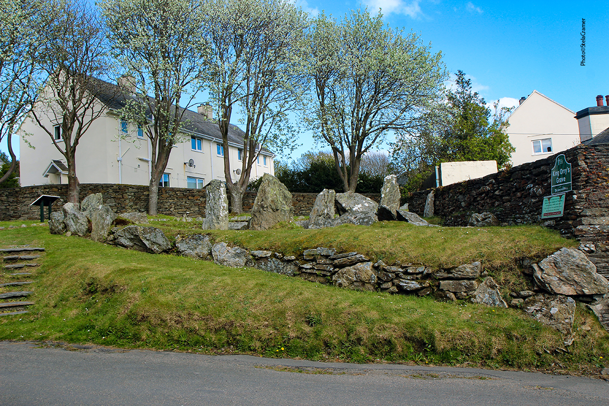
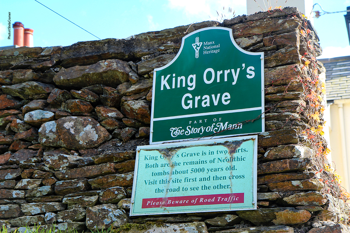
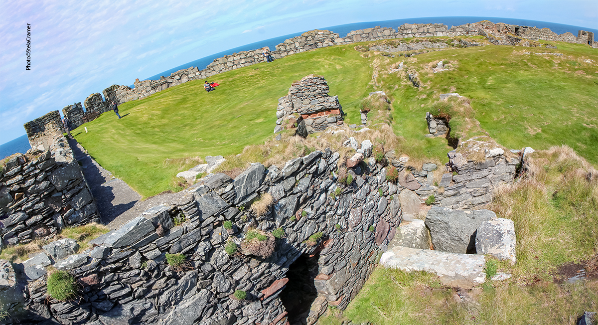
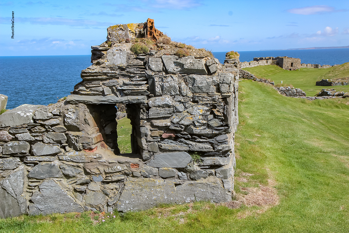
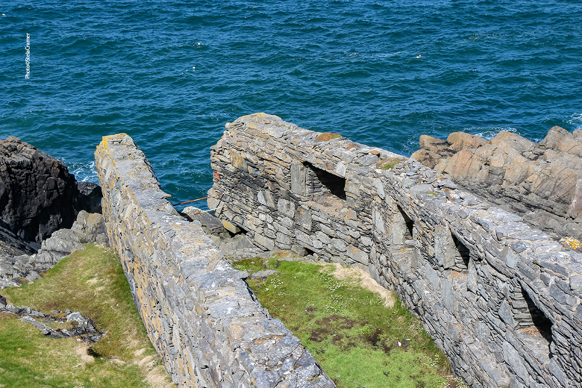
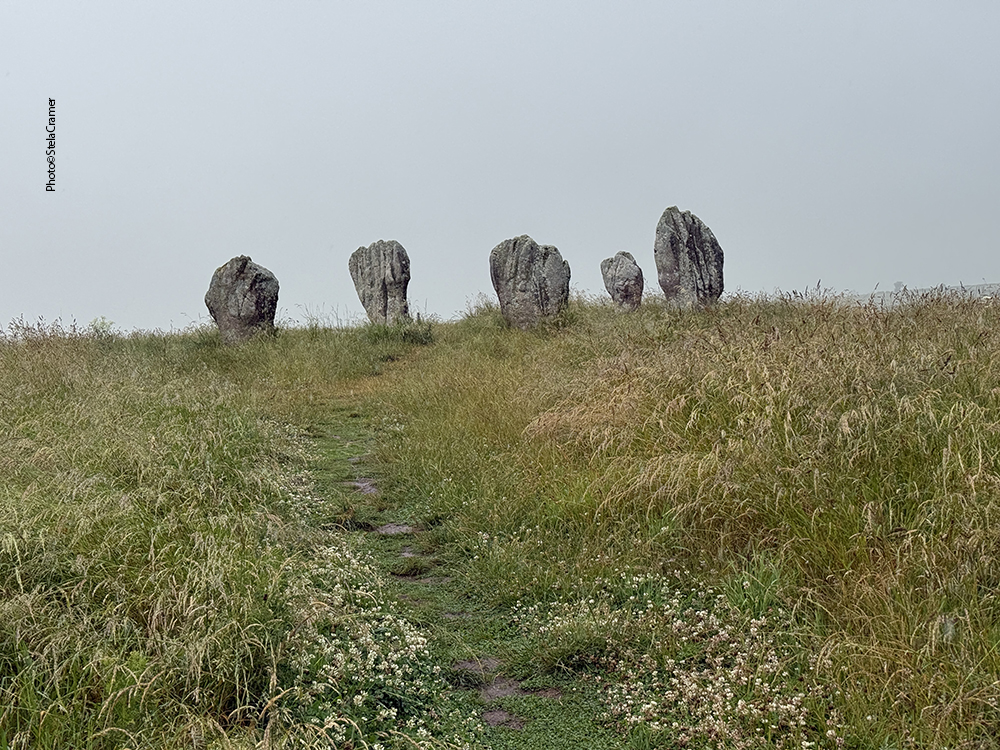
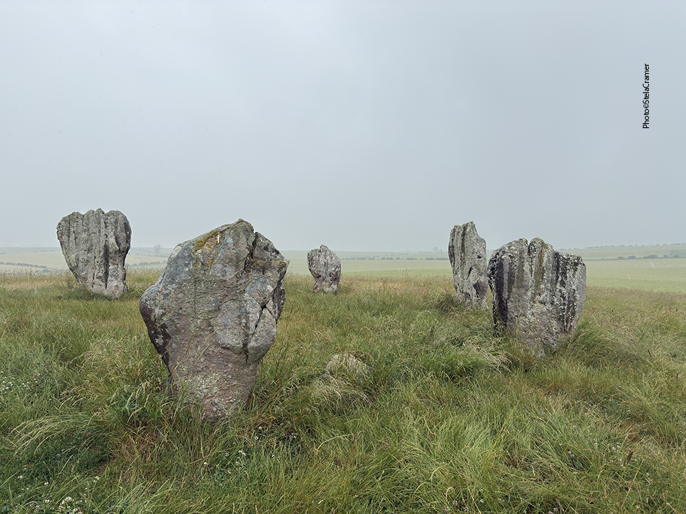
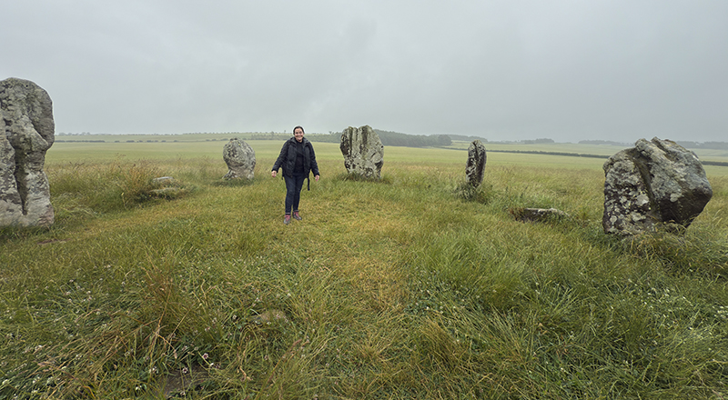
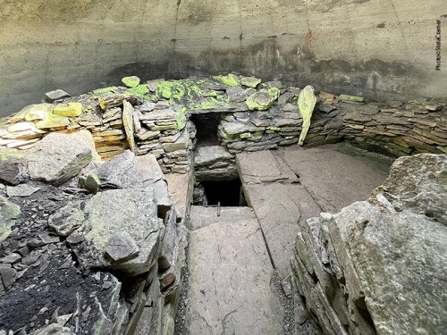
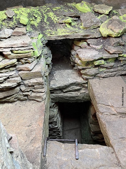
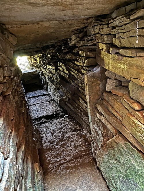
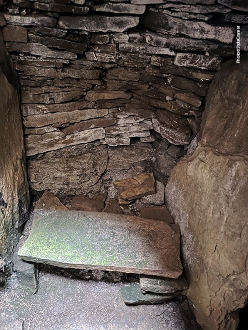
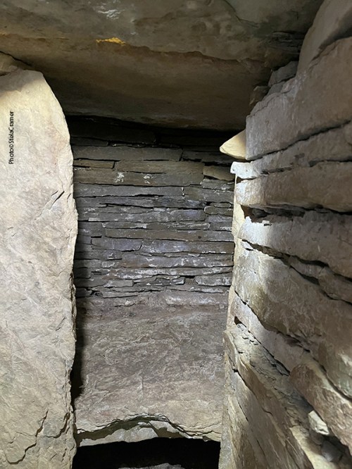
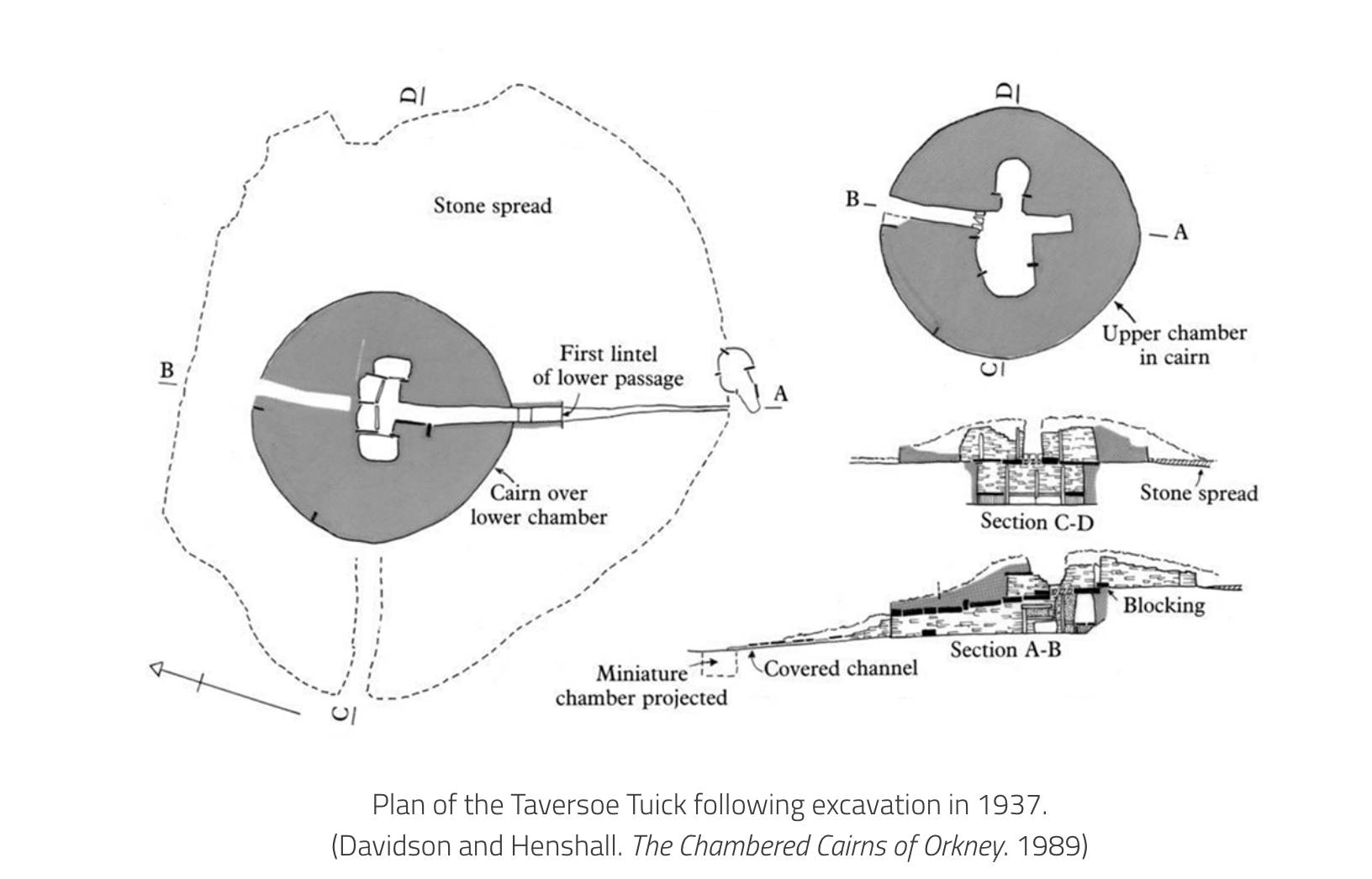
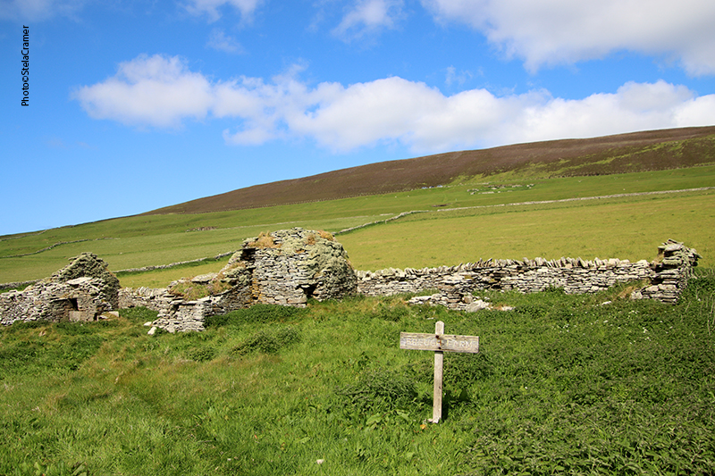
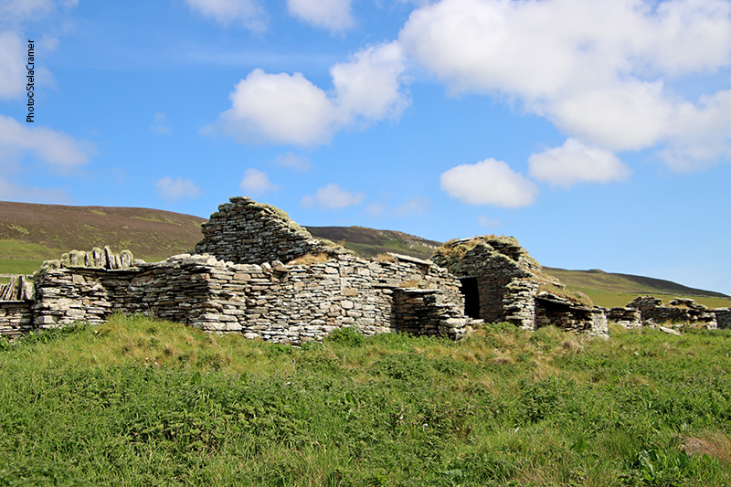
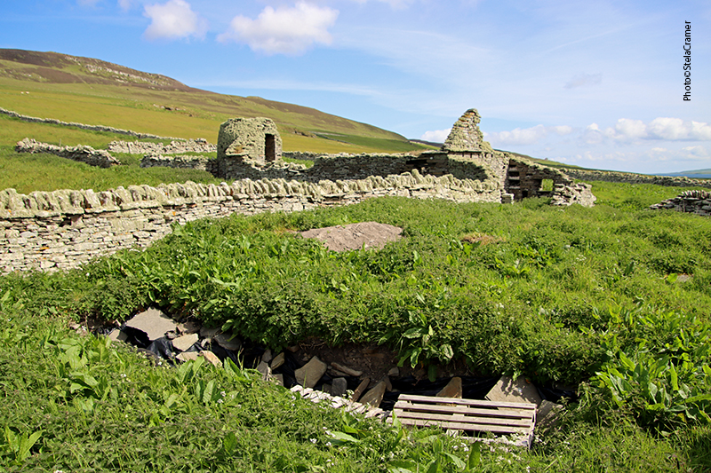
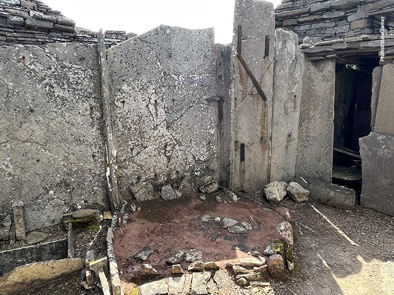
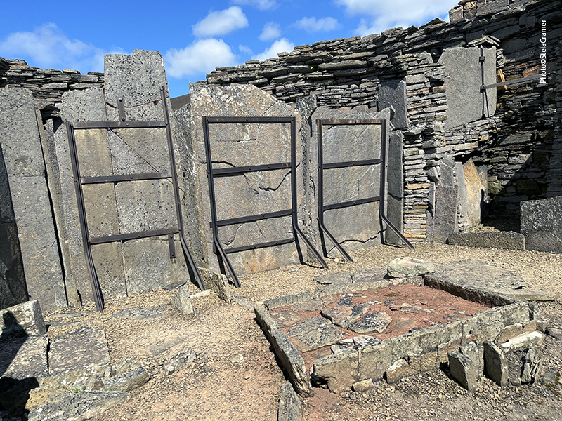
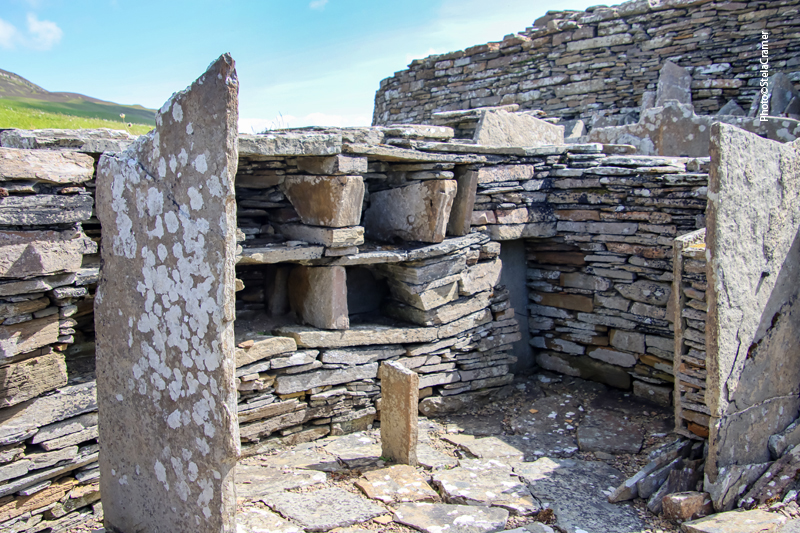
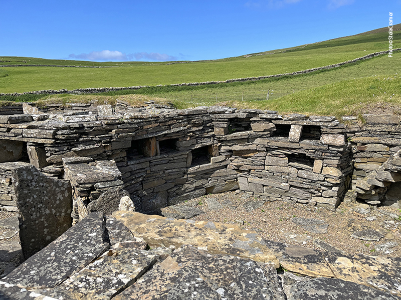
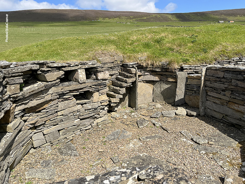
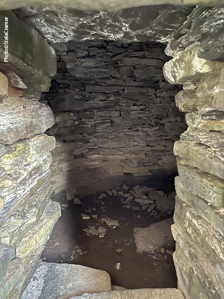
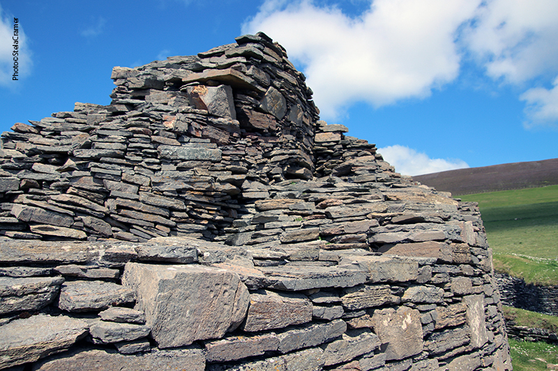
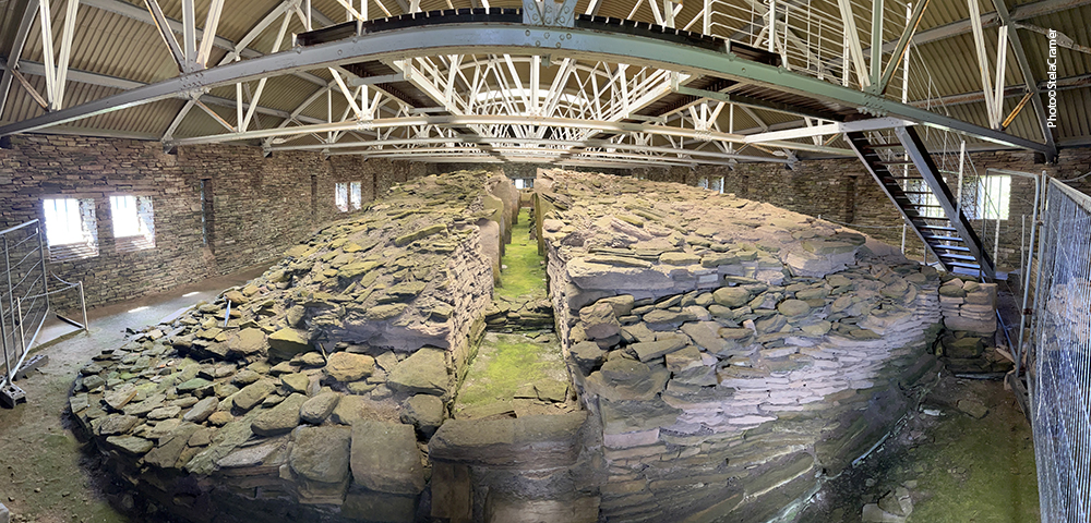
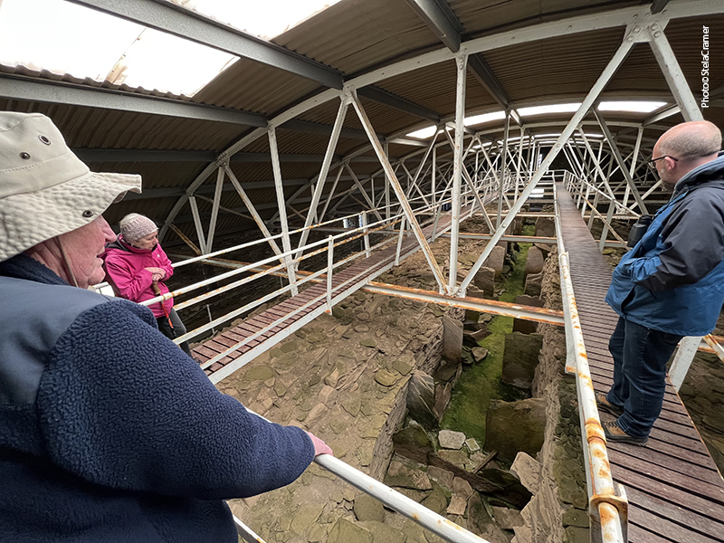
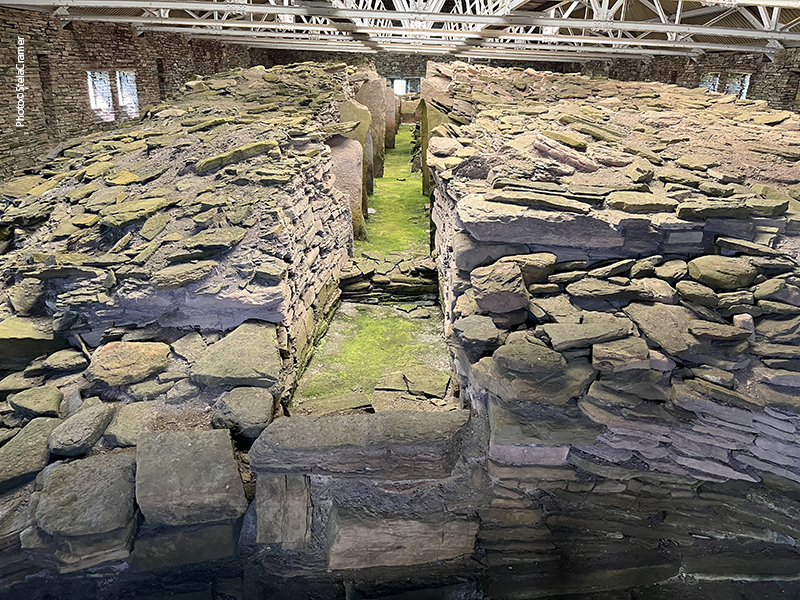
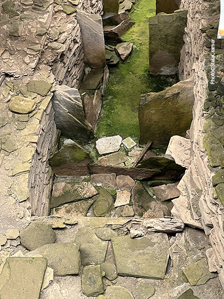
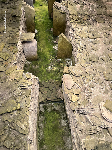
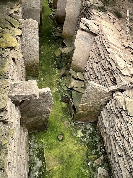
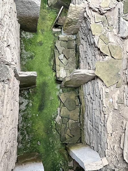
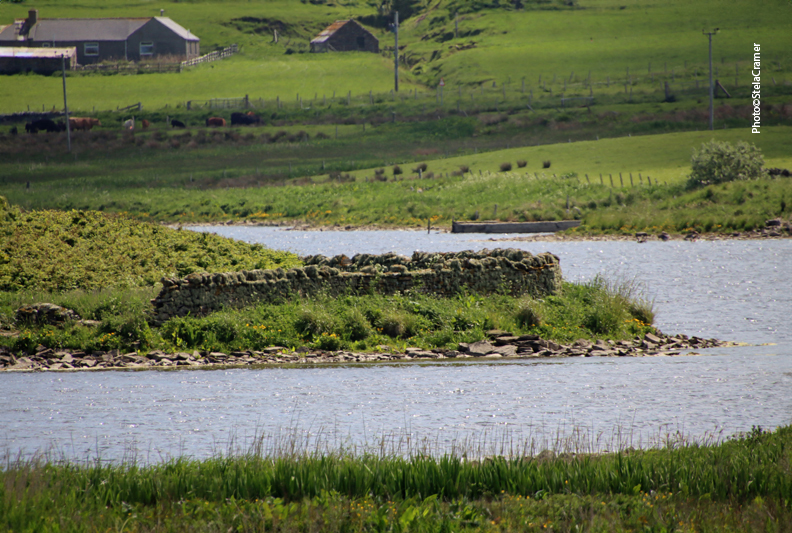
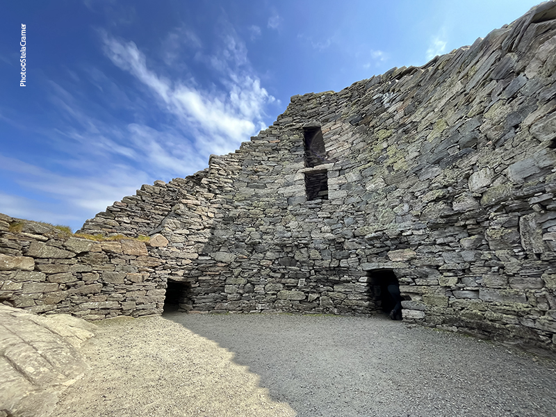
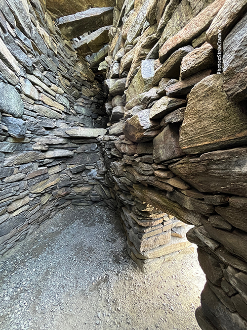
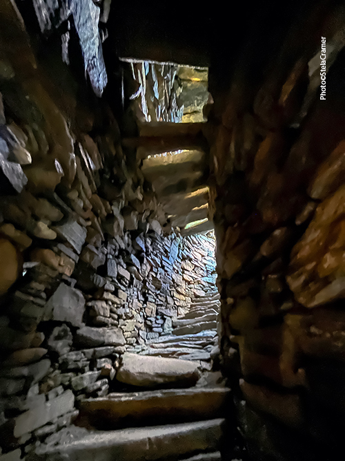
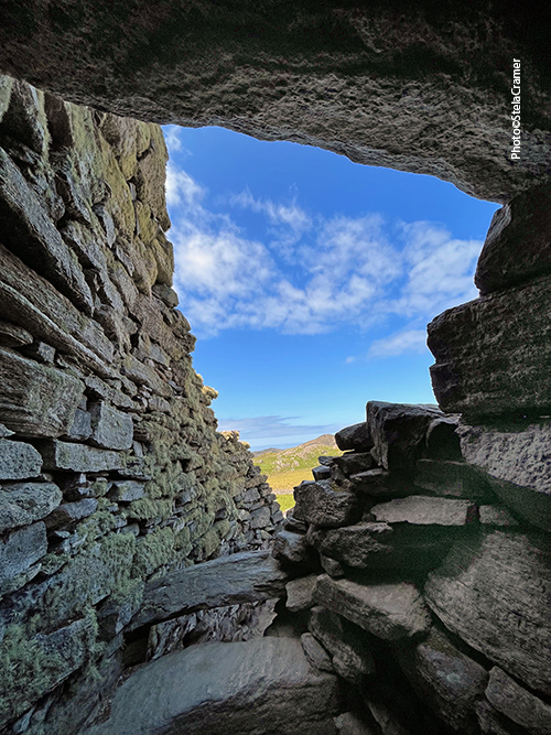
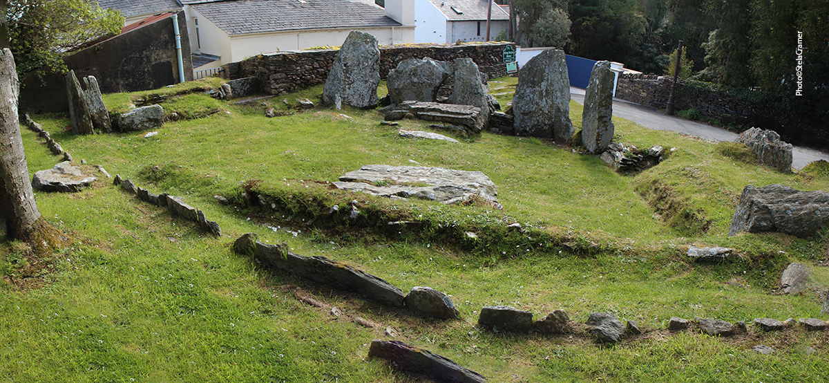
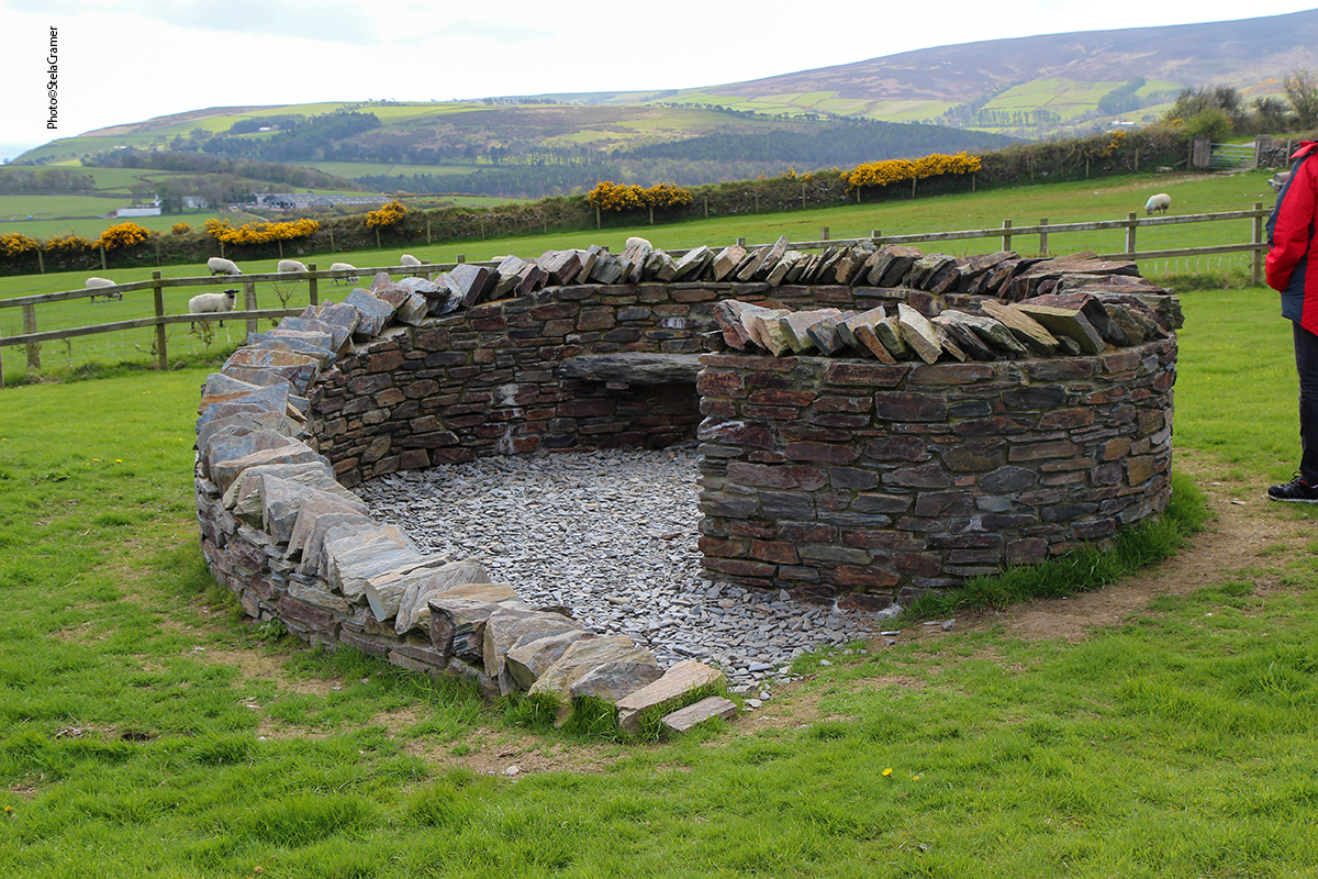
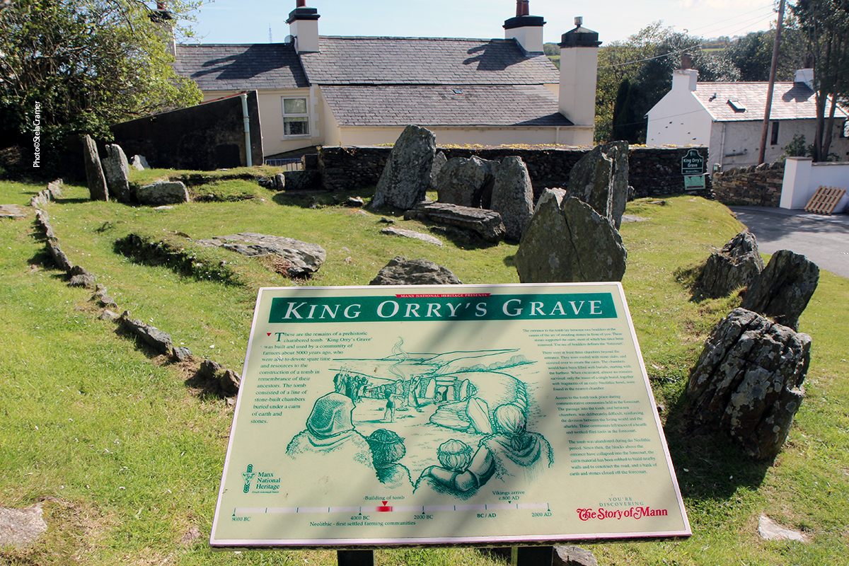
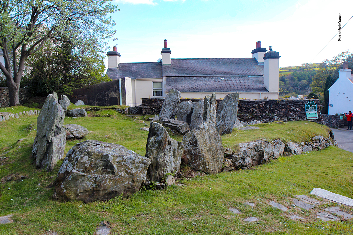
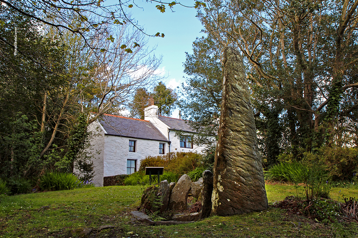
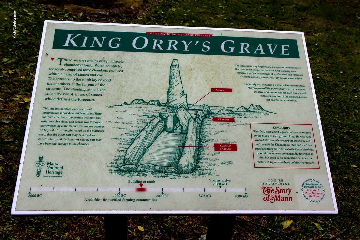
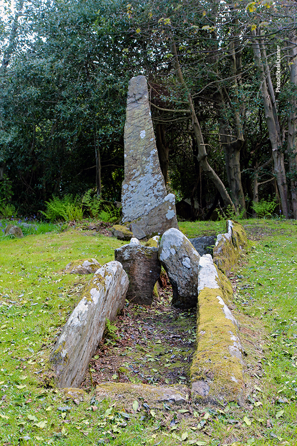
Trata-se do maior túmulo Neolítico conhecido na Ilha de Man, datado de cerca de 5000 anos, na estrada passando pelo povoado de Laxey, e parte fica no jardim de uma residência.
This site is the largest known Megalithic tomb on the Isle of Man, about 5000 years old, on the road through the village of Laxey, partly in a private cottage garden.
O Rei Orry é um personagem lendário, reverenciado como fundador de Mann e seu maior Rei, baseado no Rei Godred Crovan, um guerreiro Viking que criou o Reino de Mann e das Ilhas quando ali chegou em 1079. A ele se deve a introdução do sistema legal da Ilha e a fundação da dinastia Crovan, cujos descendentes governaram Mann e as Ilhas por quase dois séculos.
King Orry is an legendary character revered by the Manx as their greatest king and founder of Mann. This mythical figure is based on King Godred Crovan, a Viking warrior who created the Kingdom of Mann and the Isles upon his arrival on the Island in 1079. He was credited for the introduction of the island’s legal system and responsible for founding the Crovan dynasty, his descendants who ruled in Mann and the Isles for almost two centuries.
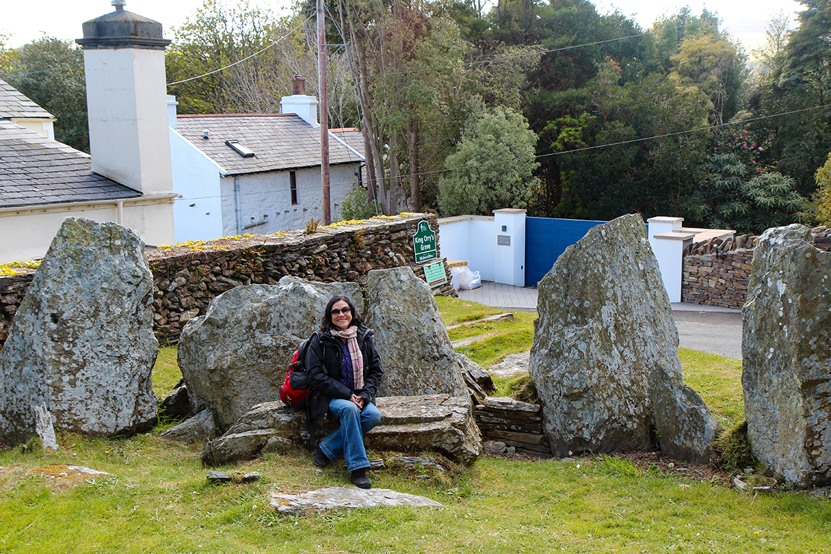
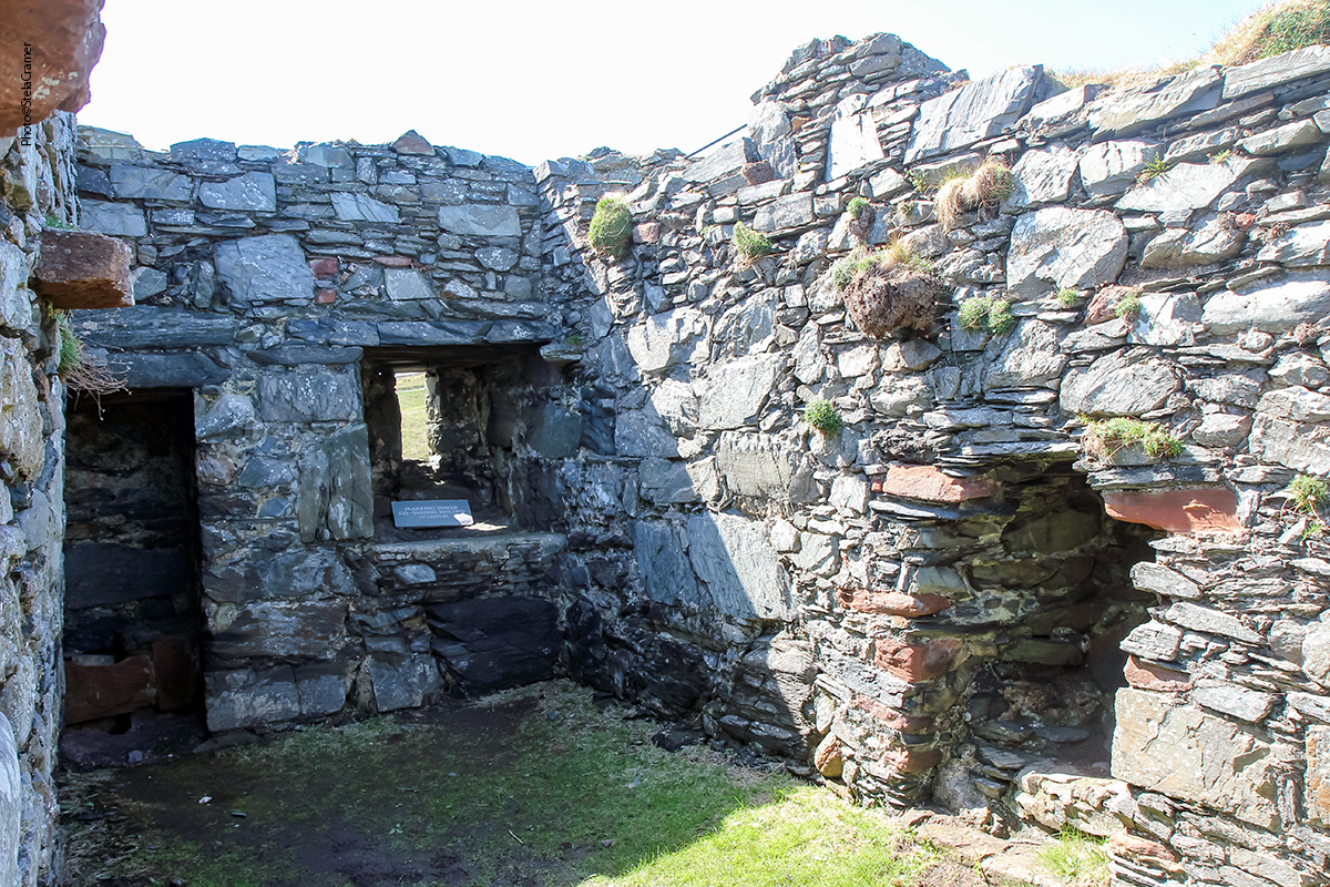
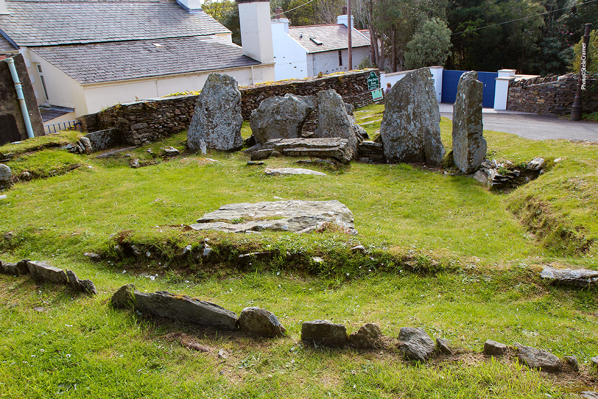
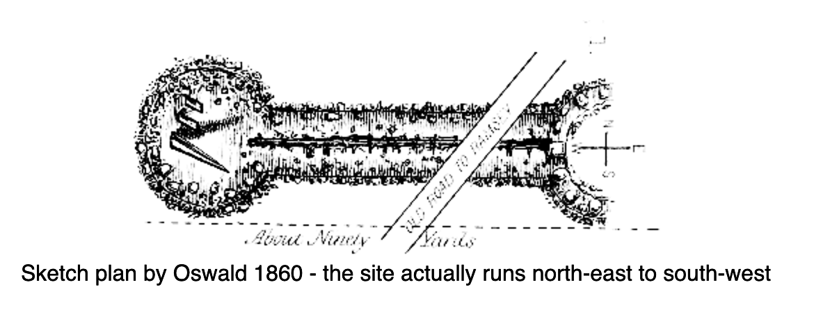
Há na verdade dois túmulos, um de cada lado da estrada, sendo um atrás de uma casa. Acredita-se que eram conectados, formando três câmaras contidas em uma mesma estrutura, mas a retirada de pedras e a construção da estrada e casas em volta, no sec. 19, destruiu as possíveis provas.
Across the road is the other tomb, behind a house. It is suggested that the two parts of the graves were connected to form three chambers enclosed by the cairn, but clear evidence for this has been muddied by the construction of the road and removal of stone for re-use and the building of cottages in the 19th century.
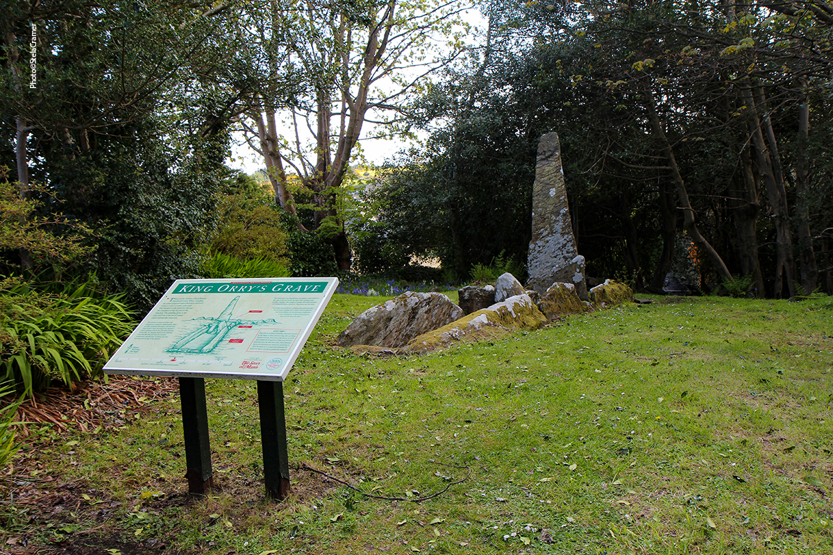
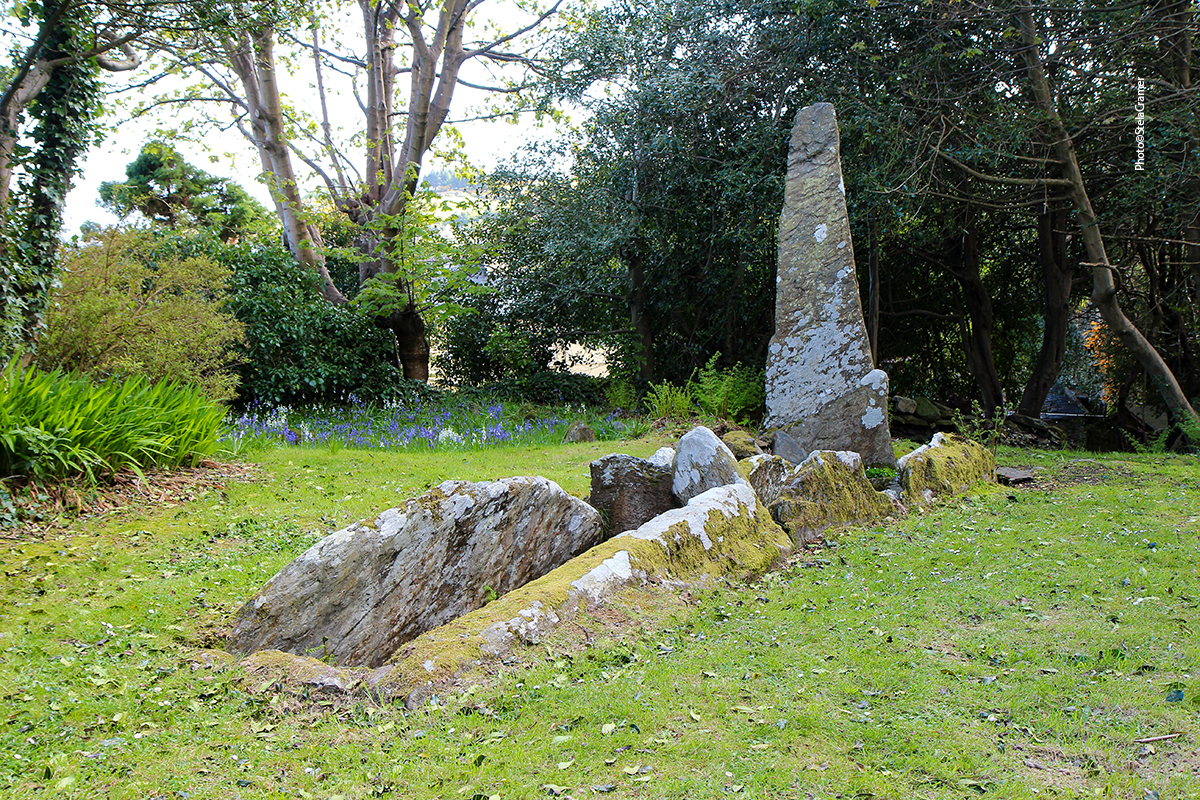
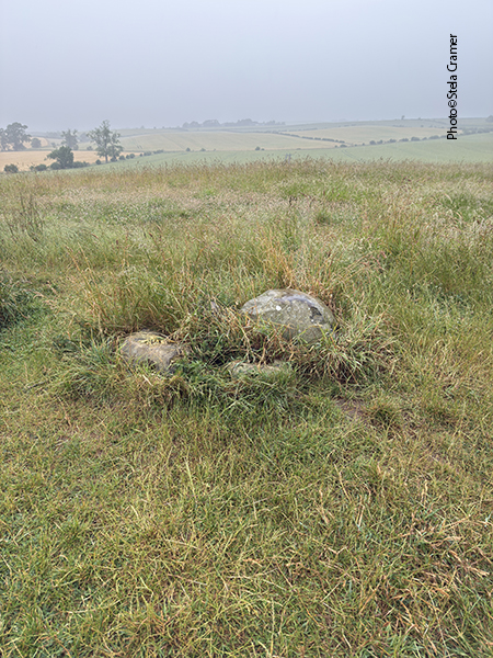
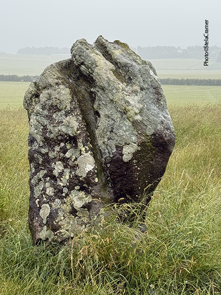
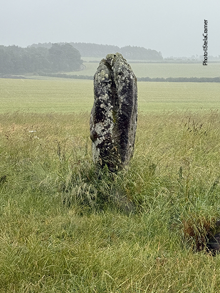
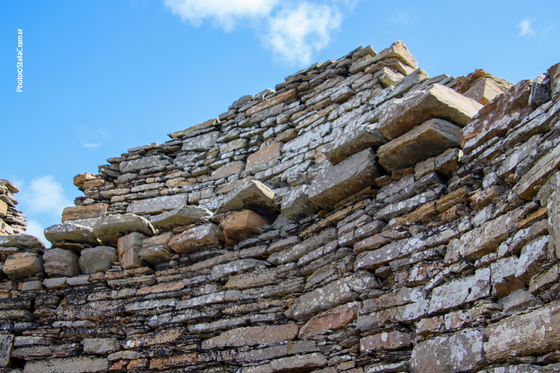
As enormes pedras que formam o monumento são todas locais, mas restam apenas cotocos das originais, à exceção deste menir.
The massive stone slabs that make up the chambers were of local stone. Only stumps of the original standing stones survive, except for this one remaining menhir.
Infelizmente, não chegamos a Cashtal yn Ard – o círculo de pedras que pretendíamos inicialmente visitar.
Ficou para uma próxima viagem. Mas as surpresas valeram o dia.
Unfortunately, we never reached Cashtal yn Ard – the stone circle we intended to visit. That will happen in a next trip. But the surprises were worth the day.
Engraçado foi que, estes dias, pesquisando, encontrei um texto “ A Localização de Avalon”,por Kelly D. Whittaker, onde a autora afirma que “O Rei Orry era o pai de Guinevere. A localização (Ilha de Mann) explica a estranha pronúncia de “Guinevere”: era um nome picto. Os pictos governavam a Ilha de Mann no tempo de Arthur.”
Pretendo aprofundar esta pesquisa. Por ora, abaixo fica o link para o artigo.
Funny thing is, while doing some research these days, I found a text – “Avalon’s Location” – by Kelly D. Whittaker,
where the author states that “King Orry was Guinevere’s father. This location (Isle of Mann) would explain the strange spelling of Guinevere. Her name was pictish. The Picts were ruling the Isle of Man at the time of Arthur.”
I intend to look deeper into this. For now, here’s the link to the article: