Feeds:
Posts
Comentários

Archive for outubro \21\America/Sao_Paulo 2023


Pierowall, a cidade mais importante de Westray / Pierowall, Westray’s main village
O hotel onde fiquei, no centro de Pierowall. Ao fundo, à esquerda, o Centro Histórico. / My hotel in downtown Pierowall. Heritage Center in the background, left.

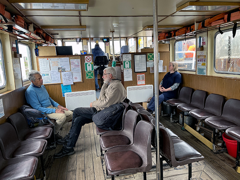
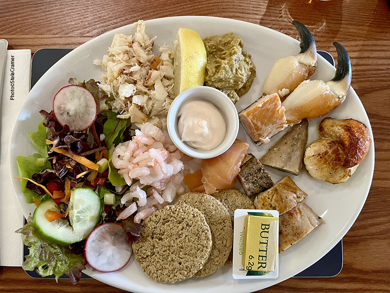
O Hotel Pierowall pertence a uma senhora que o gerencia com as filhas, todas muito simpáticas. Há outras opções de hospedagem, mas basicamente casas para alugar, mais distantes do centro. Viajando sozinha, fazia mais sentido ficar perto de transporte, com café da manhã e restaurante para jantar. Aliás, a comida era excelente! O restaurante estava sempre movimentado, com turistas e locais. Encontrei o hotel, assim como contato dos guias, no site Orkney.com .

Pierowall Hotel is a family business; the lady who runs it and her daughters are just lovely. There are other lodging options, but mostly self-catering and houses for rent, further away. As a solo traveller, it was convenient to stay near all transport, with breakfast included, and restaurant on site for dinner. By the way, excellent food. Place was busy on daily basis with visitors and locals. I found the hotel and guide’s contact in the Orkney.com website.

O delicioso prato de frutos do mar consiste em camarão, caranguejo, lagosta,salmão, haddock e vieiras, tudo fresquinho, pescado no local. / Yummy Seafood plate with fresh local shrimp, crab, lobster, salmon, haddock and scallops.
Centro histórico / Heritage Center
“Westray Wife”, em exibição no Centro histórico / on display at the Heritage Centre

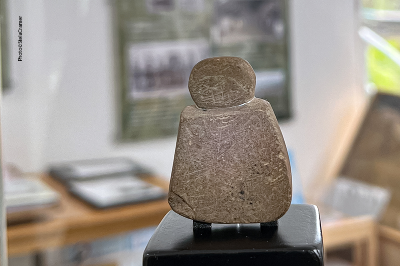
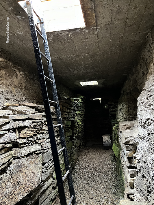
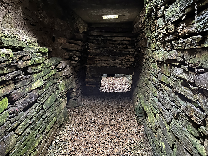
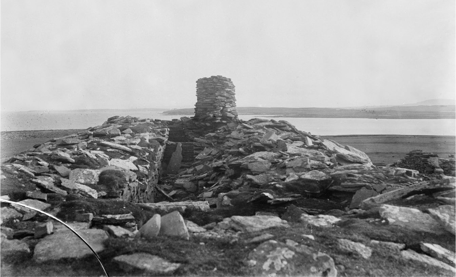
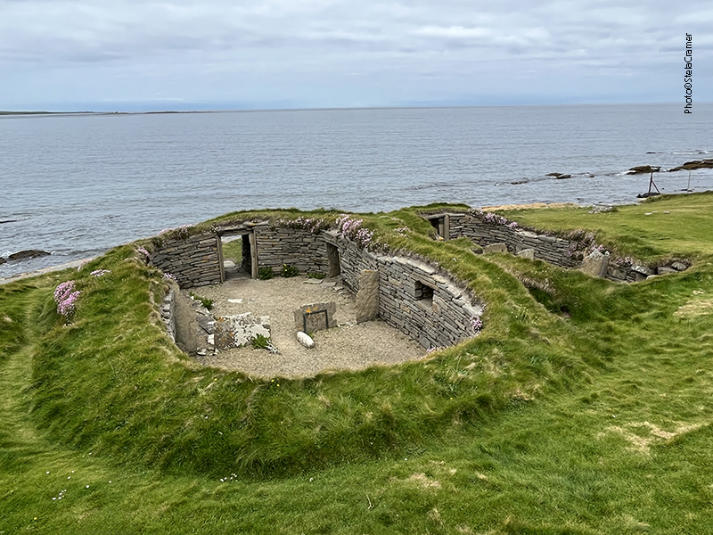
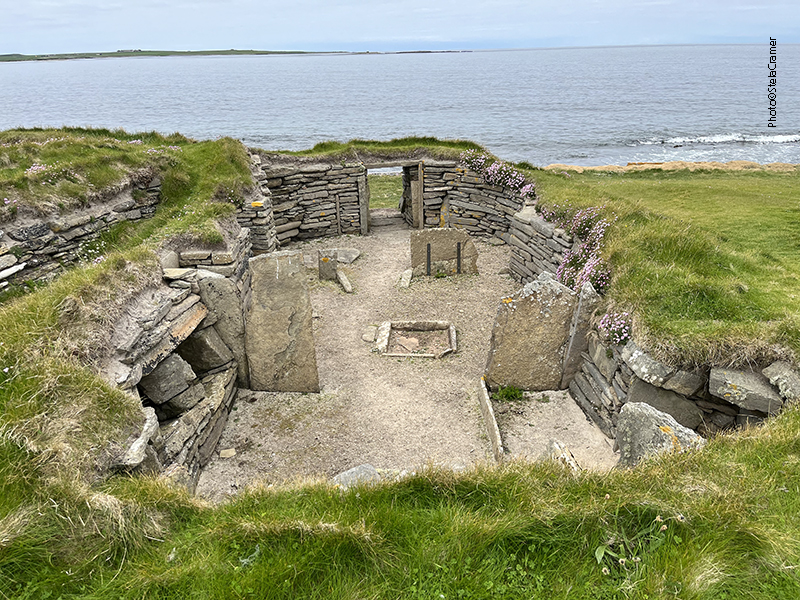
Uma pequena estatueta entalhada em arenito foi encontrada numa escavação em Westray (Links of Noltland) em 2009 e logo batizada “Vênus de Orkney”, ou “Mulher de Orkney”. É a mais antiga representação da figura humana encontrada na Escócia. A escavação abre durante a temporada, fiquei triste por ainda estar fechada, mas nessas situações penso sempre que é um bom motivo para voltar lá um dia. Retornar é sempre mais fácil do que ir pela primeira vez. Enquanto isso, aqui fica um link para visualização em 3D.

A tiny carved sandstone figurine was found at the Links of Noltand excavation in 2009 and immediately named ‘the Orkney Venus’ (known locally as ‘the Westray Wife’). It’s the earliest representation of a human found in Scotland. The Links of Noltand excavation is open seasonally; I was frustrated because it wasn’t open yet. But that’s a good reason to go back there one day. Returning is always easier than going for the first time. Meanwhile, the link above provides a 3D view of the site.

Também em exibição no Centro histórico está a “Pedra de Westray” – uma pedra entalhada encontrada numa câmara mortuária Neolítica cujo motivo é semelhante ao tipo encontrado no Vale Boyne, na Irlanda, que visitaremos mais adiante/ The Heritage Centre also exhibits The ‘Westray Stone’ – a neolithic carved stone from a chambered tomb which closely resembles the art style of the Boyne Valley in Ireland, which we’ll visit soon.
Acervo de objetos marítimos no Centro Histórico / Maritime collection in display at the Heritage Center
Lindo quilt em exibição / A gorgeous quilt in exhibit
Ossada de baleia no jardim do museu / Whale skeleton in the Center’s garden
Tangle dykes

“Tangle dykes” eram estruturas de pedra onde eram armazenadas longas algas (tangle), parecidas com corda, que eram coletadas na praia e ficavam ali secando durante o inverno, e no verão despachadas por navio para processamento. Faziam espessantes e estabilizantes utilizados na fabricação das coisas mais variadas, desde sorvete até massa para modelagem de dentes. A atividade se encerrou em 1998; nesta época as pessoas que coletavam as algas recebiam 176 libras por tonelada de alga seca, equivalente a 4 toneladas da alga original.

Tangle dykes were stone structures where locals used to gather long rope-like seaweed over the winter and dried them on the dykes before being shipped away for processing into thickeners and stabilizers in items as diverse as ice cream and modelling material for teeth impressions. By the time the tangle industry ceased in 1998,the tangle gatherers were paid 176 pounds per dry tonne, equivalent to 4 tonnes of wet tangle.

“Boat Noust”, also in the Center’s garden / também no jardim do Centro Histórico

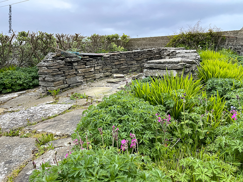
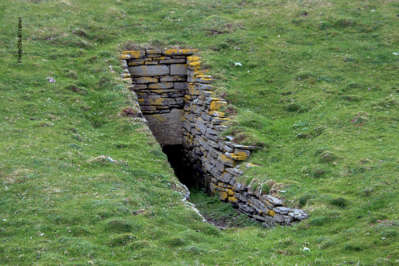
Boat Noust é um abrigo para barcos, a fim de protegê-los da maré alta e das tempestades, construídos de pedra num corte em forma de ferradura. A quantidade de nousts em Westray mostra que em 1870 haviam 254 barcos na ilha. Noust é uma palavra de origem nórdica, como muitas outras, assim como nomes de pessoas e lugares. As Ilhas Orkney pertenciam à Noruega. Em 1468, as ilhas foram cedidas ao rei James III da Escócia, como garantia de pagamento do dote da sua noiva, Margaret da Dinamarca, filha do rei Christian I da Noruega. Passou o tempo e o dote nunca foi pago, assim o arquipélago foi definitivamente absorvido pelo Reino da Escócia em 1472. Atualmente – disse-me um dos guias com quem conversei – existe uma facção popular (mais forte nas Ilhas Shetland) pedindo sua reintegração à Noruega.

Boat Noust is a hull shaped opening cut into the bank, to shelter a boat and keep it safe from storms and high tides. The number of nousts in Westray indicates that in 1870 there were 254 boats on the island. Noust is a nordic word, as many others, including names of people and places. The Orkney Islands were once part of Norway. In 1468, the islands were pledged by Christian I, King of Norway, as security against the payment of the dowry of his daughter Margaret of Denmark, betrothed to James III of Scotland. Time went by and the dowry was never paid, so Orkney was absorbed by the Kingdom of Scotland in 1472. Nowadays, according to one of the tour guides I’ve met, there is a group (stronger in the Shetlands) claiming reinstatement to Norway.

Gill Pier, Pierowall, Westray
Armadilha para caranguejo / Crab trap
Vistas da B9066, rua principal, na orla de Pierowall / Pictures taken along B9066, Pierowall’s shoreline main street.
Lady Kirk Pierowall’s Church and Cemetery

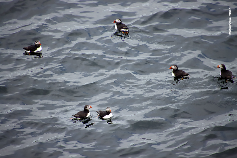
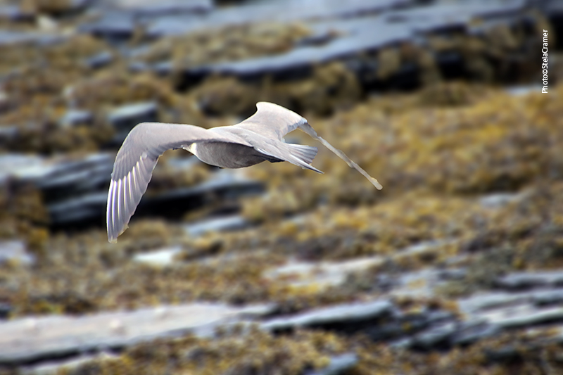
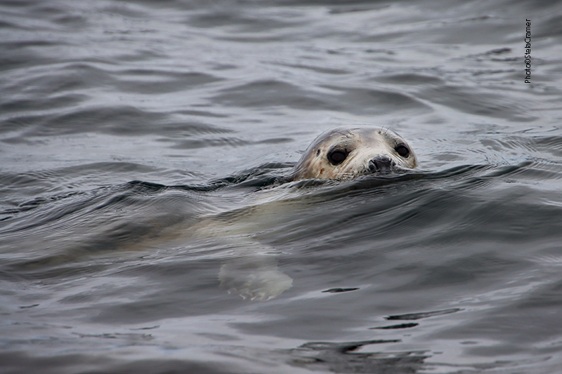
Westray possui cerca de 600 habitantes, e milhares de aves marinhas. Há muito mais aves do que gente. Aqui o santuário dos puffins, que consegui por fim avistar e fotografar.

Westray’s resident population is around 600 people, and thousands of seabirds. There are way more birds than people. Here is the puffins’ sanctuary, where I was able to, at last, watch and depict them.

Castle O’Burrian
Puffins!!!
” Hello, Stela!!!”

Read Full Post »


Pegamos o barco para Holm of Papa Westray (também chamada de Papay Holm), uma ilhota na costa leste, atravessando a baía de South Wick, conhecida por ter três câmaras mortuárias Neolíticas, das quais a maior (ao Sul) é impressionante, com uma longa passagem de entrada e diversas pequenas câmaras acessíveis pela área central.

Jonathan preparando o barco para a travessia. Longe ao fundo, a Câmara ao Norte / Jonathan preparing the boat for the crossing; the North Cairn far in the background

A short boat trip across South Wick took us to the Holm of Papa Westray, an islet off the eastern shore notable for its three Neolithic Chambered Cairns, the largest of which (South Cairn) is the most impressive, with a very long entrance passage and numerous burial chambers off a central area.

North Cairn
Contornamos a ilha para ver os penhascos do outro lado, formações impressionantes, ricas em vida selvagem / We went around the islet to see the impressive geos, abundant with wildlife
Segundo Jonathan, aqui aportavam os barcos Vikings/ Viking boats moored here, according to Jonathan

Cerca de 150 espécies de pássaros podem ser avistados na ilha, que é Área de Interesse Científico Específico, além de Área de Proteção Especial, para a reprodução de aves como a Arctic Skua (nas fotos).

Around 150 species of bird have been seen around the island, which is a Site of Special Scientific Interest, and a Special Protection Area as an important breeding site for birds as the Arctic Skua (in the photos).

Simpáticas focas e outros bichos vieram nos receber / Lovely seals and other assorted creatures showed up to welcome us

Após cinco minutos de caminhada chegamos à Câmara Mortuária ao Sul, um monumento de 5.000 anos. Consiste numa câmara principal retangular, com subdivisões, da qual saem outras doze pequenas câmaras. Foi escavado em 1849, mas depois disso ficou exposto aos elementos e estava se deteriorando, até que em 1930 passou a ser protegido pelo Estado. Construíram uma cobertura de concreto com turfa por cima para preservar a estrutura.

A five-minutes walk took us to The Holm of Papa Westray South Chambered Cairn, a 5.000 years old monument comprising a large subdivided rectangular chamber, from which twelve small cells open out. It’ been excavated in 1849, but after that, left open to elements, the site deteriorated badly until it was taken into State Guardianship in 1930, roofed in concrete and turfed over to preserve it.

Atualmente o visitante desce por uma das escotilhas na cobertura, que tem uma escada, mas a entrada original construída no Neolítico era por uma longa e estreita passagem. Este acesso agora está bloqueado por uma grade.

Today, visitors descend into the chamber through a hatch in the cairn’s reconstructed roof and down a vertical ladder, but in Neolithic times entry was through a long, low and narrow passage, now blocked by a grill.

Entrada original do monumento / Original entrance
Câmara central, ao fundo a parede transversal noroeste /
Main chamber, north-west transverse wall in the background

A câmara principal se divide em três, sendo a parte central com 13.5m de comprimento. De cada lado, uma estreita passagem aberta numa parede transversal dá acesso a uma câmara menor. O compartimento a noroeste (foto acima) mede 2,2m, enquanto a sudoeste (foto abaixo) temos um espaço maior, com 3,4m.

Câmara central, ao fundo a parede transversal sudoeste /
Main chamber, south-west transverse wall in the background

The main chamber is divided into three parts, with the largest, central part measuring 13.5m in length. At either end are smaller spaces entered by small openings in the transverse walls. At the north-east end this compartment is 2.2m long, at the south-west end (photo above) it is 3.4m.

Os desenhos encontrados neste monumento são da maior importância. Na câmara menor a sudoeste, temos um lintel decorado com o motivo que pesquisadores chamam de “sobrancelhas” (um par de círculos sob dois arcos).

The artwork found in this cairn are extremely important. In the south-west end cell, a decorated lintel bears two pecked ‘eyebrow’ motifs (a pair of cup-marks under double arcs).

Motivos entalhados em zigzag / Zigzag incised motifs

É muito raro encontrar tais exemplos de arte em seu lugar original. Os desenhos aqui são variados e encontram paralelo em artefatos de outros sítios, como Skara Brae, Links of Noltland e Ness of Brodgar. Entretanto, Papay Holm ao Sul é o único monumento funerário Neolítico em Orkney onde ambos os motivos (furados e entalhados) foram encontrados juntos.

It is very rare for such artwork to survive in its original setting. The designs here are varied and can be paralleled at artifacts from other sites such as Skara Brae, Links of Noltland and the Ness of Brodgar. However, Papay Holm South is the only Orcadian Neolithic funerary site in which both pecked and incised decoration have been identified.

Passagem na parede transversal noroeste / Passage in north-west transverse wall

Não há provas quanto à finalidade do monumento; entretanto, comparando com outros sítios semelhantes em Orkney, se acredita que foi construído para abrigar os restos mortais de uma comunidade.

No evidence for the uses of the cairn survives, however it is assumed, on comparison with other similar sites in Orkney, that it was constructed with the intention of holding the mortal remains of a community.

Câmara menor a noroeste / North-west smaller chamber

A Câmara Mortuária de Papay Holm ao Sul é um exemplo bem preservado da chamada “Câmara tipo Maeshowe”: uma câmara retangular com entrada por uma longa passagem pela lateral, com acesso a cubículos menores, decoração em muitas pedras e uso de blocos muito grandes na construção, posicionados cuidadosamente em determinados pontos, usando inclusive pedrinhas de fixação para ajustar com precisão o alinhamento e orientação. Tais monumentos mostram a habilidade dos construtores Neolíticos, tanto no planejamento como na construção em si. Veremos Maeshowe na sequência.

Detalhe de pedra bem maior, precisamente utilizada na construção / Detail: a much larger stone skillfully placed in the building

Holm of Papa Westray South chambered cairn is a well-preserved example of a “Maeshowe-type of Cairn”: a rectangular chamber entered at the side via a long passage, with cells leading off the chamber, several decorated stones and many very large blocks of stone used in the construction, carefully placed in certain locations, often using small pinning stones to precisely adjust their alignment and orientation. These monuments displays the skill of the Neolithic builders in both planning and construction. We’ll visit Maeshowe next.

O nível do mar elevou-se desde que Papay Holm foi construído, formando a quantidade de pequenas ilhas que hoje formam o arquipélago Orkney. Durante o período Neolítico, entretanto, seria composto de menos e maiores extensões de terra. É provável que Papay Holm, Papa Westray e Westray fossem uma coisa só.

Sea levels have risen since the cairn was constructed, giving rise to the large number of small islands which today form the Orkney archipelago. During the Neolithic period, however, Orkney would have comprised of fewer, larger landmasses. It is likely that the Holm of Papa Westray formed part of a larger landmass which also took in what today are the islands of Papa Westray and Westray.

Foto tirada em 1930, aproximadamente, antes da construção do teto de proteção em concreto / Photo taken around 1930, before building the protective concrete roof

As focas vieram se despedir quando embarcamos para retornar a Papa Westray. Uma delas nos acompanhou por um bom tempo!

The seals came to say goodbye when we boarded the boat back to Papa Westray. One kept us company for a long time!

Read Full Post »


Holm of Papa Westray, ou apenas Papay Holm, construído e habitado um milênio antes das pirâmides / Papay Holm, built and occupied a millennium before the pyramids

Mais ao norte, em Papa Westray, outra ilhota do arquipélago Orkney, existe outro sítio, tipo uma miniatura de Skara Brae, porém ainda mais antigo: Knap of Howar. Chegar lá, entretanto, exige um pouco mais de esforço. Como eu estava em Glasgow, optei por voar para Westray (pois em Papa Westray não havia acomodação), fazendo conexão em Kirkwall. A companhia aérea escocesa LoganAir tem voos entre diversas ilhas do Norte da Escócia, assim como entre as principais cidades e as ilhas. A princípio estava preocupada pois o tempo de conexão entre os dois voos era de apenas 20 minutos, mas a atendente da Logan Air no aeroporto me garantiu que não haveria problema. De fato, o aeroporto de Kirkwall cabe todo na Praça de Alimentação do Galeão. Passageiros embarcam, desembarcam e recolhem bagagem no mesmo lugar. A atendente que faz o check-in também leva as malas para a aeronave, empurrando um carrinho. Existem mesas, mas a lanchonete estava fechada, talvez em reforma. Duas máquinas de bebidas e snacks eram a salvação dos famintos. O aeroporto foi construído em 1940, originalmente para atender à base naval em Scapa Flow.

Kirkwall Airport

Further North, in Papa Westray, another islet of Orkney archipelago, there is another site such as a miniature Skara Brae, still older: Knap of Howar. Access to it demands a bit additional effort. As I was in Glasgow, my choice was take a flight to Westray (there is no lodging at Papay itself), connecting in Kirkwall. The Scottish airline Logan Air flies between most islands, as well as the main Scottish cities. I was worried because there was only 20 minutes for the connection, but LoganAir’s clerk reassured me that it wouldn’t be a problem. Indeed, Kirkwall Airport is a small one. Passengers arrive, depart and reclaim baggage in the same room. The lady who checks you in also pushes the luggage cart to the aircraft. There are tables but no snack bar, it’s perhaps in renovation. A couple of vending machines are the only option for starving passengers. Built in 1940, the airport was originally used for the defence of the Scapa Flow naval base. 

Voo Westray-Papay

O voo de Kirkwall para Westray fazia escala em Papa Westray. Foi muito interessante porque o trecho Westray-Papay é o voo mais curto do planeta: leva dois minutos. A aeronave comporta oito passageiros, amontoados entre o piloto e as bagagens; o ruído do motor é a trilha sonora. Uma verdadeira aventura! Ao meu lado ia sentado o diretor da escola primária de Westray, um rapaz muito simpático a quem perguntei se havia condução, ou se era possível ir andando do aeroporto até meu hotel, pois no mapa parecia muito perto. Ele riu e me disse que haveria um táxi esperando por ele, que poderia me levar também, pois morava ao lado do meu hotel. A carona foi fortuita pois começou a chover.

Aeroporto de Westray . A van azul marinho é o taxi / Westray Airport. The blue van is the taxi

The flight from Kirkwall to Westray stops at Papa Westray. That was interesting because the stretch Westray-Papay is the world’s shortest commercial route: a distance of 1.7 miles, takes 2 minutes. The plane carries up to 8 passengers, crammed between the pilot and the luggage; the engine noise is the soundtrack. A real adventure! Sitting by my side was Westray’s School Principal, a nice guy to whom I asked if there was transport from the airport to my hotel, or if it was possible to walk, because in the map it looked very close. He laughed, and said that there would be a taxi waiting for him, and I could take it too, because he lived next to the hotel. That was fortunate, because it started to rain as soon as we landed.

Ferryboat que liga Westray a Papay / Ferryboat linking Westray to Papay

O Pierowall é o único hotel da cidade, chamada Pierowall, talvez a única cidade na ilha de Westray, que possui 600 habitantes. Todo mundo na verdade é vizinho. A economia local é baseada na pesca, fazendas de peixe e gado, assim como turismo. Jonathan, o “Papay Ranger”, é o guia que leva visitantes a Papay (apelido de Papa Westray, a ilhota que possui cerca de 90 habitantes). Eu tinha reservado o passeio dois meses antes. Assim, dia 6 de junho, conforme combinado, o encontrei na rampa do ferryboat que também liga as duas ilhas. A travessia leva 25 minutos, mais uns 15 de van, até Knap of Howar.

Este ferry leva apenas passageiros/ This vessel takes footpassengers only

The Pierowall is the only hotel in the city called Pierowall as well, maybe it is the only city in the island. Westray has 600 residents. So, everyone are kind of neighbors. The island’s main industries are fishing, fish and cattle farming and tourism. Jonathan, known as “Papay Ranger”, is the tour guide who takes people to Papay (nickname of Papa Westray, islet with around 90 residents). I had booked this tour two months in advance. So, the 6th June, I met him at the pier, to take the ferryboat between the islands. The crossing takes 25 minutes, plus 15 minutes drive in his van until the Knap of Howar.

Fazenda de pescado entre as ilhas / Fish farm between the islands

Assim como Skara Brae, atualmente Knap of Howar se situa no litoral, mas durante sua ocupação estaria bem mais afastado, atrás de dunas de areia, numa vasta pradaria. Esta teoria foi confirmada por arqueólogos e geólogos com base nas evidências encontradas no local e em estudos dos padrões de erosão na ilha. Naquele tempo, provavelmente as ilhas de Westray e Papay eram ainda unidas por uma planície.

Just like Skara Brae, today the Knap of Howar sits by the coast but, in its days of occupation, it would have been inland from the sea in what was probably a wide meadow behind a wall of sand dunes. Archaeologists and geologists have confirmed this theory based upon evidence at the site and geological studies of erosion patterns on the island. At that time, the isles of Papay and Westray were probably still joined together by a bridge of low-lying land.

A casa principal é a estrutura maior e mais antiga/ The mainhouse, a larger and older structure
Acredita-se que a construção adjacente era uma oficina ou outra casa. /The neighbor building has been interpreted as a workshop or a second house.
Entrada das casas, agora de frente para o mar / Entrances of both houses now face the sea
Detalhe da pedra que deveria ser para moer grãos e da engenhosa alvenaria em pedras para formar o canto do aposento. Abaixo, “estante” e divisórias, tudo construído sem o uso de qualquer tipo de cimento / Detail of the stone quern, probably to grind grain, and of the skillful masonry to create the room’s corner. Below, “cupboard” and partition screens, all built without any kind of cement.
Esta fazenda Neolítica pode ser a mais antiga casa de pedra preservada do Norte da Europa. Datação por radiocarbono mostra que foi ocupada de 3700 a 2800 AC, isto é, antes das casas semelhantes em Skara Brae. / This Neolithic farmstead which may be the oldest preserved stone house in northern Europe.Radiocarbon dating shows that it was occupied from 3700 BC to 2800 BC, earlier than the similar houses in the settlement at Skara Brae.

Lareiras, divisórias, camas e estantes estão praticamente intactas, e foram encontrados postes indicando a estrutura do telhado, que era provavelmente feito de madeira, palha ou turfa, por isso desintegrou com o tempo.

Fireplaces, partition screens, beds and storage shelves are almost intact, and post holes were found indicating the roof structure. The roof is missing, but it was likely made of wood and thatched or turfed, because it eventually disintegrated.

Assim como Skara Brae, o Knap of Howar esteve séculos encapsulado pela areia. Os escavadores precisaram retirar uma camada de 2,4 metros que preenchia totalmente as estruturas. Revelou-se a existência de uma passagem conectando as duas casas, que em algum momento foi desativada e teve as entradas bloqueadas com pedras. Nas fotos abaixo você pode ver as entradas, perto das portas da frente nas paredes adjacentes.
As escavações revelaram também que estas casas podem ter sido construídas sobre os vestígios de outra estrutura ainda mais antiga.

Like Skara Brae, the Knap of Howar had been for centuries cocooned by sand. The excavation team had to clear a 2.4-metre-deep layer that completely filled both buildings. It came to light that the structures were linked by a passage through the joined walls, that was eventually deactivated and both entrances blocked with stones. In the photos below, in both rooms you can see the doors, near the front ones, on the adjacent walls.
The excavations also revealed that the current houses were not the first on the site, but may actually have been built upon the midden remains of an earlier, even older, structure.

A visita a Papa Westray estava apenas começando. A ilhota é rica em arqueologia assim como em aves e animais marinhos. Vamos encontrá-los no próximo post.

The Papay tour was just begginning. The islet is as plentiful of archaeology as it teems with wildlife. We’ll meet them in the next post.

Mapa de rotas, destacando meu trajeto de Kirkwall, Mainland para Westray, com a escala em Papay. As linhas tracejadas em cinza são trajetos de ferryboat. / Route map highlighting my flight from Kirkwall, Mainland, to Westray, with stop at Papay. Gray dotted lines indicate ferry routes.

Read Full Post »