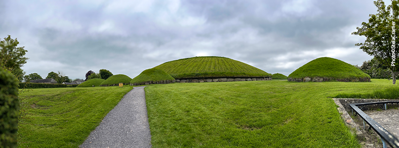
Knowth é como Newgrange com mais montinhos / Knowth Megalithic Passage Tomblooks like Newgrange with more mounds
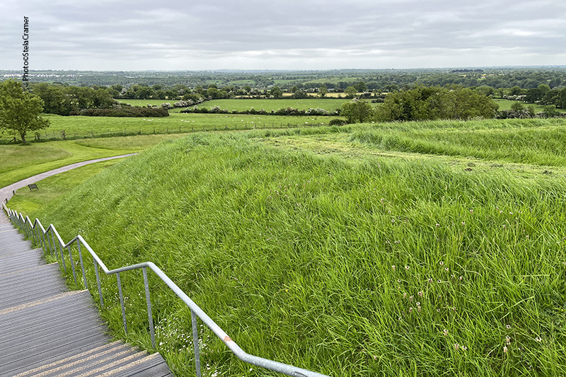
Porém aqui se pode subir no monte principal, com cerca de 12m de altura e 67m de diâmetro. But here you can walk up the main mound, about 40 ft high and 220 ft in diameter.
Tem uma escadaria / There’s a stairway
Um caminho permite que se faça toda a volta no alto do monte. There’s a path to walk all around the top of the mound
Pausa no serviço de manutenção Taking a break in mainteinance service
Painéis mostram a localização de outros marcos na paisagem Signs locate surrounding landmarks
Hill of Slane, indicado à direita, fica a 15 minutos de caminhada do hotel onde me hospedei Hill of Slane, at the right end, was a short walk uphill from my hotel
Newgrange, embora muito próximo, está oculto pelas árvores The trees hide nearby Newgrange
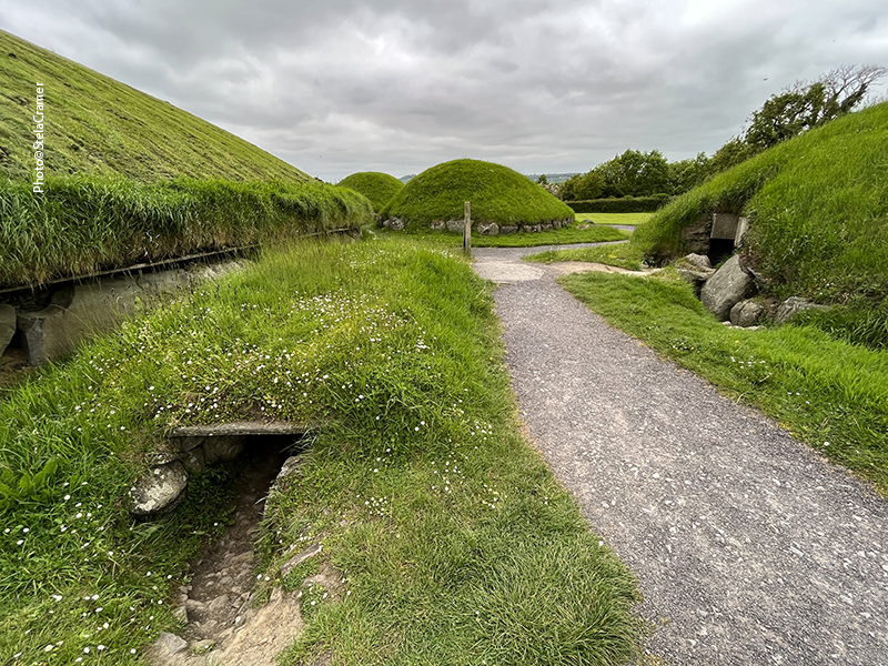
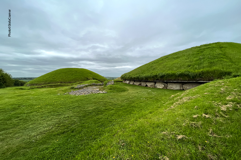
Em volta do monte principal há outros 18 montinhos “satélites” There are 18 smaller satellite mounds around the largest one in Knowth
Não se pode entrar em nenhum, apenas andar em volta You can’t enter the mounds, just stroll around them
Vestígios de outras estruturas / Other structures’ traces
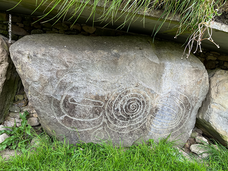
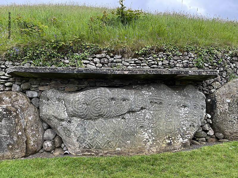
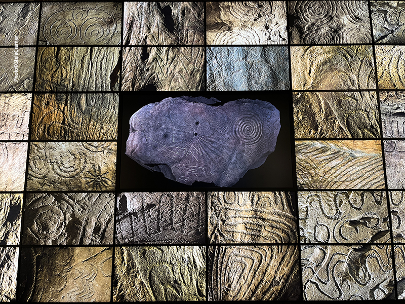
Knowth contém o maior conjunto de Arte Megalítica da Europa. Assim como em Newgrange, as pedras com inscrições foram arrumadas em volta dos montes Knowth contains the largest assemblage of Megalithic Art in Europe. As in Newgrange, the inscribed stones have been placed around the mounds
Mais de 200 pedras com inscrições foram encontradas durante as escavações Over 200 decorated stones were found during excavations
As enormes pedras, chamadas de “kerbstones”, pesam em torno de 5 toneladas cada The boulders, called kerbstones, weigh around 5 tons each
Arqueólogos concluíram que as inscrições representam a lua e ciclos lunares, as mais antigas ilustrações da lua conhecidas em toda a História Archaeologists concluded that the inscriptions refer to the moon and its cicles; these are the oldest known illustration of the moon in history.
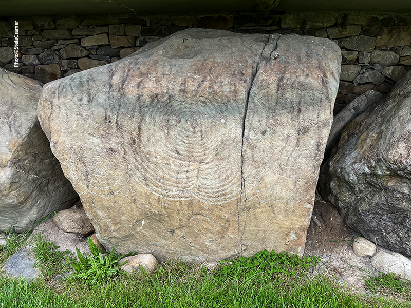
A pedra do Relógio de Sol (Kerbstone K15), que aparece no estudo abaixo feito durante a escavação Kerbstone K15, the Sundial Stone, depicted below during the excavation
Muitas pedras tinham os desenhos ocultos, isto é, gravados na parte de baixo ou de trás das pedras. A lot of the art was hidden, i.e. carved onto the reverse or underside of the stones.
O visitante tem mais tempo para observar as pedras em Knowth do que em Newgrange The visitors have more time to see the stones in Knowth than in Newgrange
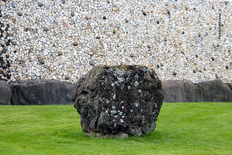
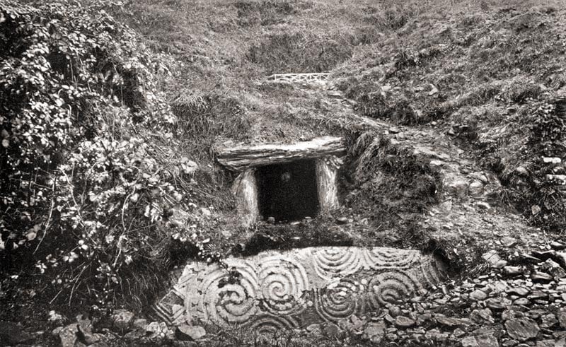
Uma camada de quartzo branco foi encontrada na entrada do monte principal. O mesmo se encontrava na entrada de Newgrange, e arqueólogos concluíram que devia ser um revestimento de fachada que havia caído. Em Newgrange, foi feita uma “reconstrução”. Em Knowth, deixaram como estava. A layer of white quartz stones was found at the entrances to the great mound. The same was found at the entrance to Newgrange, and the archaeologists concluded that it had been a white façade or revetment on the front of the monument that had fallen. This white quartz front was reconstructed at Newgrange; here it was left where it was.
A orientação leste-oeste das passagens em Knowth sugerem alinhamento com os equinócios. Porém as passagens foram alteradas e destruídas ao longo do tempo, e a construção de uma parede de concreto resultante das escavações (feitas a partir de 1962) impossibilita a investigação de possíveis alinhamentos. The east-west orientation of the passages at Knowth suggests astronomical alignment with the equinoxes. But the passages have been distorted or destroyed by latter settlers, and the erection of a concrete slab wall inside the mound’s west entrance, after excavations (1962 onwards) prevent any investigation into the possible alignments.
Muitas pedras ficam guardadas debaixo dos próprios montes Many stones are kept in “storages” under the mounds
Pedras armazenadas / Stones in storage
Estes troncos assinalam o local de outro monte / These trunks mark another mound’s location
Abaixo link para filmagem por drone, bem bacana / Below, link to a cool drone footage
Uma pena não se poder entrar! Parece tão interessante quanto Newgrange, ou até mais. What a shame, they let nobody in. Looks as interesting as Newgrange, or more. (Photo: Kent Wang, downloaded from Wikipedia.)
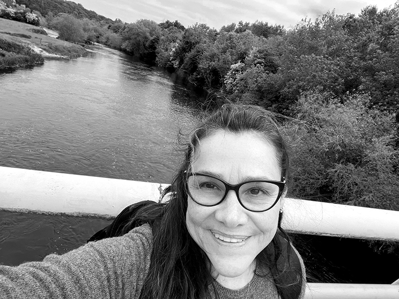
Boyne River
Compartilhe meu blog se você gostou.Share my blog if you liked it!
Newgrange é o principal monumento do complexo Brú na Boinne, declarado pela UNESCO Patrimônio Mundial. Construído durante o Neolítico, por volta de 3200 A.C. – mais antigo que Stonehenge e as Pirâmides do Egito – está alinhado ao nascer do sol no Solstício de Inverno. / Newgrange is the main monument in the Brú na Bóinne complex, a UNESCO World Heritage Site. Built during the Neolithic Period, around 3200 BC- older than Stonehenge and the Egyptian pyramids – it is aligned on the winter solstice sunrise.
Eu sempre quis visitar Newgrange, por ser um complemento de Stonehenge. Enquanto Stonehenge marca o Solstício de verão, Newgrange assinala o de Inverno, dia 21 de dezembro. O número de visitantes para essa celebração é limitado e as pessoas escolhidas por sorteio. Preenchi o cupom e deixei meu nome na urna, mas não tive a felicidade de ser contemplada…
Newgrange has always been in my travel wishlist, because it’s an adjunct to Stonehenge. While Stonehenge marks the Summer Solstice, in Newgrange the Winter Solstice, 21th December, is the highlight. There are limited spots to attend to the celebration, and people are chosen by lottery. I have filled the form and put my name in the ballot, but unfortunately haven’t been chosen.
Entrada do Centro de Visitantes / Visitor Center entrance
Desembarquei em Dublin, dia 19 de Maio de 2023, muito animada para passar dois dias nesta cidade e depois seguir para o Vale do Rio Boyne, onde fica Newgrange, assim como outros monumentos. Tinha reservado duas noites em Slane, uma pequena cidade que me parecia bem central na região. Minha intenção era alugar um carro, mas depois de dois dias pegando excursões desanimei: o trânsito parecia bem confuso nos arredores de Dublin, e seria uma longa viagem na auto estrada, especialmente dirigindo na mão inglesa. Então peguei o trem para Drogheda, a estação mais próxima. Depois me arrependi por não ter tentado alugar um carro lá. Só o taxi para Slane já custou caro – 20 libras.
Mapa do local. Dowth é outra Tumba de Passagem próxima, de visitação livre, com acesso pela estrada N51/ Area map. Dowth Passage Tomb nearby has free access from the N51 road.
I was very excited when I got off the plane in Dublin in 19th May 2023, ready to spend a couple days there before departing to Boyne Valley, where Newgrange and many other monuments stand. I had booked a couple nights in Slane, a village that seemed central to the area. I intended to rent a car, but two days of tours made me change my mind: traffic could a bit complicated on Dublin’s outskirts and it was a long drive in the highway… right-hand driving. So I took a train to Drogheda, the closest station. There I should have tried renting a car! The taxi to Sloane itself was very expensive, 20 pounds.
Rio Boyne / Boyne River
Meu hotel ficava ao lado do Centro de Informações de Turismo, assim bati lá para me informar sobre transporte para o Centro de Visitantes de Brú na Bóinne, de onde sai a visita a Newgrange e Knowth. Parecia complicado. A atendente já estava há dez minutos pesquisando horários de ônibus quando a resposta à minha questão adentrou o recinto. Um homem, conhecido do pessoal ali, estava levando seus cartões de visita recém impressos para deixar no balcão. Ele tinha se aposentado e estava começando a trabalhar com táxi. Ficou bem surpreso quando virei para ele e declarei que seria sua primeira cliente. Combinamos então que na manhã seguinte ele me levaria a Monasterboice, Mellifont Abbey (um cemitério e uma abadia em ruínas), e por fim me deixaria no Centro de Visitantes de Brú na Boinne, onde minha visita estava marcada para 2 da tarde. Eu tinha comprado o ingresso online dois meses antes, pelo site cujo link deixo abaixo. O acesso aos monumentos é feito por micro ônibus, limitado a 16 pessoas de cada vez, saindo do Centro de Visitantes. Primeiro o grupo para em Knowth por cerca de meia hora, e só depois segue para Newgrange em si. É fundamental comprar com antecedência pois, lá na hora, você não consegue lugar.
Os grupos vão e voltam do Centro de Visitantes até os monumentos neste micro ônibus./ This shuttle takes the visitor groups from Visitor Centre to the monuments and back
My hotel was next door to Tourist Information Office, so I went there to ask about transport to Brú na Bóinne Visitor Centre, where the Newgrange/ Knowth tours start. Apparently it was not so easy, because after ten minutes perusing bus schedules the clerk hadn’t got an answer yet. Then my answer just walked in! A guy (who knew all the ladies there) came to leave his just printed contact cards. He had retired an was starting in the taxi business, being positively surprised when I looked at him and said: “ I’ll be your first client!” We arranged for next day a visit to some places of interest ( Monasterboice and Mellifont Abbey), ending at the Visitor’s Centre, where he would leave me. My visit was scheduled for 2 p.m.; I had bought the ticket online at the website (link above shuttle picture) two months before. You can’t go to Newgrange on your own. Visitors are brought via shuttle bus to these monuments and pre-booking tickets is essential. The shuttle takes groups of 16 people, first to Knowth (giving you around half an hour to visit it) and eventually to Newgrange itself.
É possível avistar Newgrange do alto do Centro de Visitantes / It’s possible to see Newgrange from the Visitor Centre’s higher floor
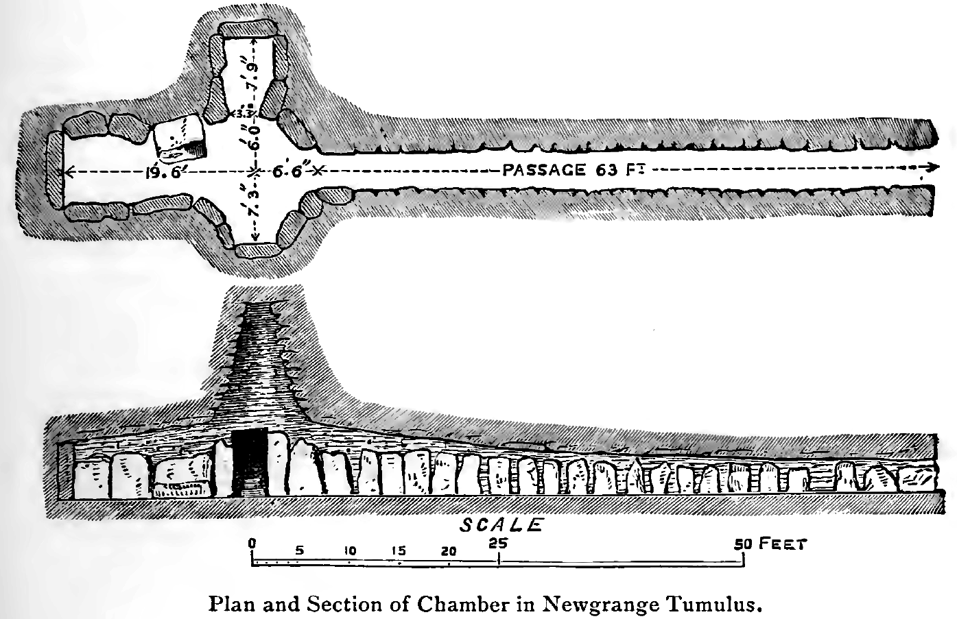
A imponente entrada com a pedra entalhada em “triskeles” – espirais triplas. Esta pedra mede cerca de 3 m de comprimento por 1,2m de altura, e pesa cerca de 5 toneladas. / The entrance passage and entrance stone’s triskele-like features, approximately three metres long and 1.2 metres high, and about five tons in weight.
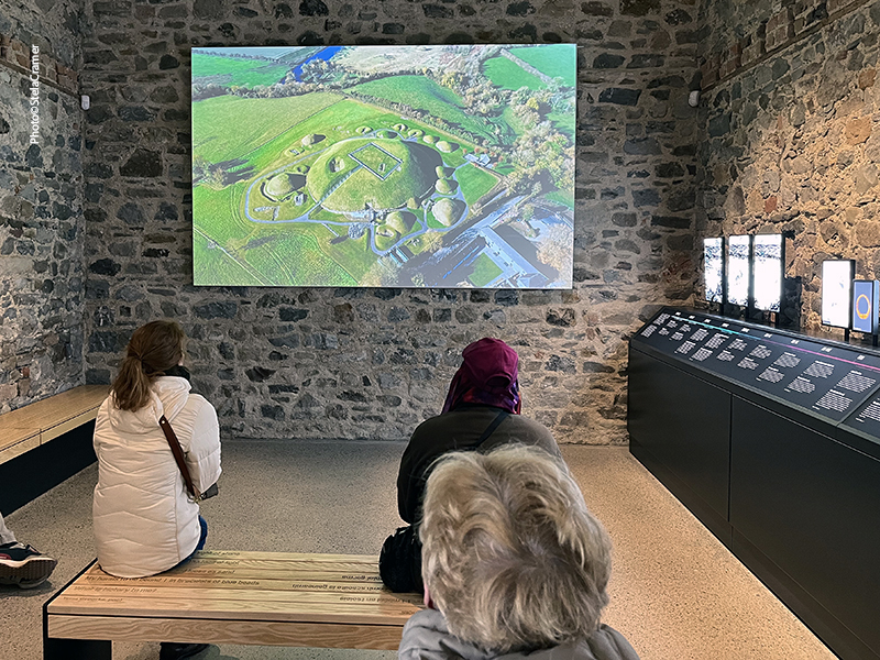
Vista aérea / Aerial view, photo by Heritage Ireland
Cheguei mais cedo para ter tempo de visitar o Centro, a loja de souvenirs e almoçar no restaurante. A opção sopa+sanduíche é sempre uma boa: barata, nutritiva, gostosa e não demora. Embora eu estivesse agendada para 2h, me puseram no ônibus que saía às 3h para os monumentos, no penúltimo grupo. O guia não era nada simpático e se esquivava de responder muitas perguntas, dizendo sempre que falaria sobre isso quando chegássemos lá… assim, jamais respondeu, até porque é outro guia que leva as pessoas para o interior da câmara. Ele parecia só estar esperando para nos conduzir de volta e ir embora.
I arrived early at the Visitor Centre, so there was plenty of time to stroll the facilities, souvenir shop and have lunch at the restaurant. The option soup+sandwich is always a good choice: cheap, tasteful, nourishing and quick. Although my schedule was for 2 p.m. they put me in the 3 p.m. group to the monuments, almost the last one. The guide wasn’t exactly friendly, and to most questions, he said that he would answer later, at the monument… what never happened. Actually, it was another guide who led people inside the chamber. He just stayed there waiting to drive people back and call it a day.
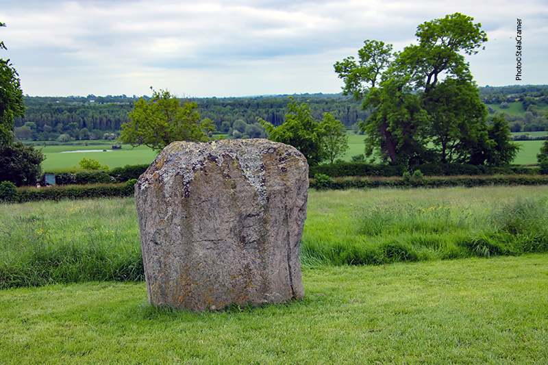
O monumento é cercado por um círculo de pedras. 12 pedras restam das supostas 35 originais. / The mound is also ringed by a stone circle. Twelve standing-stones survive out of a possible original thirty-five.
Algumas das pedras que formam um círculo em volta do monumento / Some of the Standing Stones that surround the monument
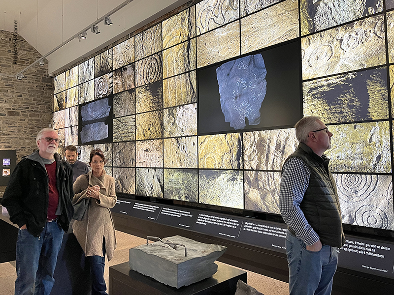
Exemplos de arte gráfica Neolítica entalhada nas pedras / Examples of graphic Neolithic rock art carved onto stone surfaces
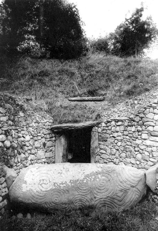
Entrada de Newgrange no final do séc XVIII / Entrance to Newgrange in the late 1800s
Bem em cima da entrada fica a “caixa do telhado”, através da qual o sol nascente no Solstício de Inverno brilha através da longa entrada, iluminando por cerca de 17 minutos a câmara central e os entalhes no interior, como a espiral tripla ( Triskele) na parede. / The “roofbox” , directly above the main entrance, through which the Winter Solstice rising sun shines directly along the long passage, illuminating the inner chamber (for approximately 17 minutes) and revealing the carvings inside, notably the triple spiral ( Triskele) on the front wall of the chamber.
Photos by Heritage Ireland
Em cada câmara há uma bacia de pedra achatada, onde ossos dos mortos eram depositados. Escavações revelaram ossos humanos , alguns queimados, indicando que corpos foram postos ali, alguns tendo sido cremados. A bacia na parede do fundo também é iluminada pelo sol no Solstício de Inverno. / Each chamber has a large flat basin stone where the bones of the dead may have been deposited during prehistoric times. Excavations have revealed deposits of human bone in the passage, indicating corpses had been placed within it, some of whom had been cremated. The Winter Solstice sunlight shines on the basin at the end wall too.
Foto tirada durante escavação em 1970 / Photo taken during excavations in 1970
Obras da polêmica “restauração” da fachada pelo arqueólogo Michael J. O’Kelly, que conduziu as escavações entre 1962 e 1975 / Archaeologist Michael J. O’Kelly led the most extensive excavations from 1962 to 1975 and was responsible for the controversial reconstruction of the front of the monument
É proibido fotografar no interior do monumento. Nem pude levar a câmera. As pessoas entram, o guia mostra as coisas mais importantes, fazem uma simulação da luz do sol surgindo no Solstício de Inverno, e pronto. O grupo tem que sair, pois já tem outro esperando para entrar. A visita leva uns quinze minutos no máximo. Irritou-me quase não ter tempo para caminhar pelo lugar, bater mais e melhores fotos, visitar com calma a exposição na saída. Segundo o guia, as pessoas tem que voltar no grupo que vieram; se você tentar permanecer e voltar na próxima van, o motorista pode não deixar você entrar, caso a lotação esteja completa – e geralmente está. Assim, recomendo agendar a visita cedo para depois ter tempo de curtir o lugar e, se preciso, caminhar de volta para o Centro de Visitantes. Não é longe: menos de 4 km.
Photography inside the chamber is forbidden. My camera gear wasn’t even allowed in. People stay inside for around 15 minutes. A guide shows you points of interest, there’s a simulation of the Solstice light, and off you go. Next group is already in line outside waiting for their turn. I was pissed off because there’s not much time to hang around and get more and better pictures or pay proper attention to the exhibition room on the way out. According to the guide, you’re not supposed to stay and take the next shuttle back. If it’s full – and it usually is – the driver can’t let you in. So, my advice is to book an early visit, take your time at the end and just walk back to the Visitor Center if need to, because it’s not so far, less than 2 miles.
Exposição interativa / Interactive exhibition
A exposição destaca a riqueza de arte gráfica Neolítica entalhada nas pedras / The exhibition highlights the richness of graphic Neolithic rock art carved onto stone surfaces
No fim de tudo, eu tinha que ver como voltar para o hotel em Slane. Pedi ajuda às moças na recepção, mas elas não tinham contatos de táxis. Lembrei-me de chamar um Uber. Meu celular estava quase descarregado e não havia uma tomada sequer para plugar o carregador. Com a conexão muito fraca, custei para conseguir solicitar a corrida, e a princípio nenhum motorista estava disponível. Uma recepcionista me sugeriu outro aplicativo, segundo ela melhor que o Uber, e a duras penas consegui baixá-lo mas travou na hora de pedir a corrida. Estava quase na hora do lugar fechar, os funcionários se preparando para ir embora; nessa hora me arrependi amargamente de não ter alugado um carro. As recepcionistas apenas lamentavam não poder ajudar. Me disseram que na saída do estacionamento havia um recuo com um ponto de ônibus, mas não sabiam se ainda passaria algum. O estacionamento já estava praticamente vazio, chance zero de conseguir uma carona. Assim, por fim me vi plantada no ponto, eu e mais três pessoas, esperando um ônibus que TALVEZ aparecesse em 25 minutos. 15 minutos depois, meu celular descarregou. Começava a escurecer. Então um carro entrou no recuo, parou em frente ao ponto e o motorista perguntou: “Você é a Stela?” Era o Uber. A corrida tinha sido solicitada e por fim um motorista respondeu.
Poderia ficar o dia todo fotografando os grafismos Neolíticos / I could stay the whole day taking photos of the Neolithic Graphics.
Back to the Visitor Centre, I had to find my way back to Slane. I went to the reception desk for help, but the girls there had no taxi contacts. I remembered to call an Uber. My mobile was almost dead, and there was not a single outlet where to charge it; it took time to get service but I placed the request. No driver was available. The girls suggested another app, a better one, according to them. I managed to download it but it got stuck in the process. It was about closing time, people cleaning their desks to leave, and I regretted more than ever not having rent a car. The staff was very “sorry” but not helpful at all. I was told there was a bus stop by the entrance, but nobody was sure if any would show up at that late hour. The parking lot was almost empty, no chance of getting a ride. So I found myself standing at the bus stop with three other people, waiting for a bus that could appear in 25 min. – if it did. After 15 min my phone died, night was falling… and a car entered the lane, stopping in front of us. “Are you Stela?” asked me the driver. It was the Uber. The request had been placed after all, and someone eventually answered to it.
Não pude fotografar o interior da câmara, mas estes links levarão você lá. O primeiro mostra o Solstício de Inverno, há dois dias atrás; os demais falam sobre Newgrange em si.
I couldn’t take pictures inside Newgrange chamber, but these links will take you to it. The first shows the Winter Solstice, two days ago; the others are about Newgrange itself.
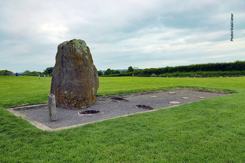
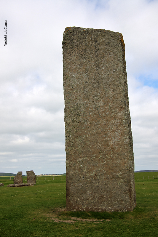
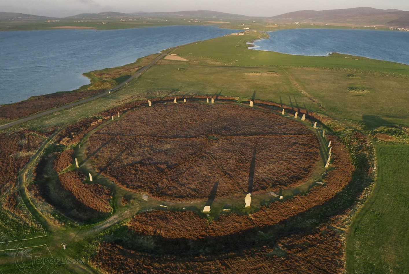
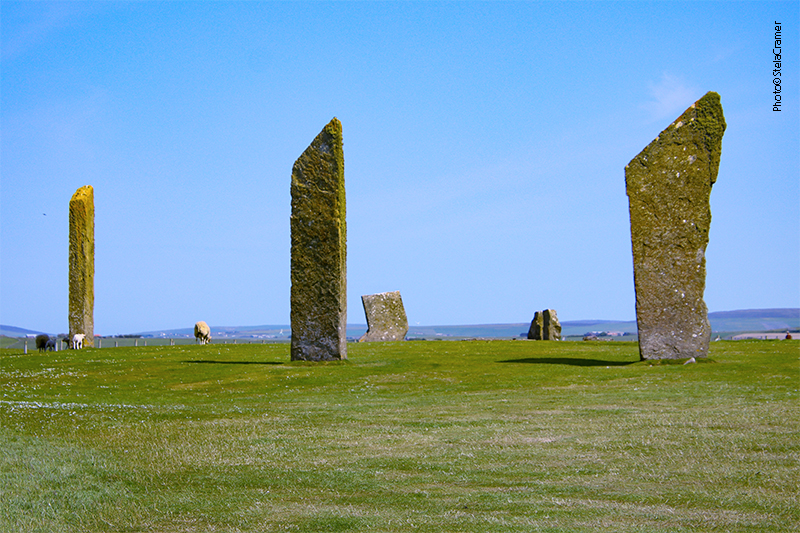
Standing Stones of Stenness: the oldest monument at the World Heritage Center./ O monumento mais antigo deste Patrimônio Mundial.
Escavações mostraram que este sítio era, originalmente, um círculo de pedras – possivelmente o mais antigo nas Ilhas Britânicas. Embora atualmente não exista mais o fosso ao redor das pedras – desgastado por séculos de lavoura – confirmaram que o mesmo tinha dois metros de profundidade, cercando uma área de 44m de diâmetro. Originalmente havia pelo menos 11 monolitos, dos quais restam apenas 4, e alguns cotocos.
Although the site today lacks the encircling ditch and bank, excavation has shown this site was a henge monument, possibly the oldest in the British Isles. In Neolithical times, the stone ring had been entirely surrounded by a ditch, two metres (6.5 ft) deep, surrounding an area 44 metres (144 ft) in diameter. Centuries of ploughing have almost entirely removed the henge which once enclosed the (at least 11) standing stones, of which only four survive today, and some stumps.
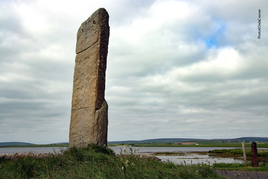
A Sentinela, às margens da lagoa (de água salgada) de Stenness. Do outro lado da estrada temos o lago de Harray, de água doce, o maior das Orkneys./ The Watchstone, by the shore of Loch of Stenness – a salt water (saline) lagoon. The freshwater Loch of Harray, on the other side of the road, is the largest loch of Mainland Orkney.
Em dezembro de 1814, um fazendeiro resolveu remover as pedras, pois lhe incomodava a quantidade de gente que invadia a propriedade para fazer rituais junto às pedras. Ele começou demolindo a Pedra de Odin, para ultraje geral. Quando, por fim, conseguiram fazê-lo parar, ele já tinha derrubado duas outras pedras.
A Pedra de Odin, à qual se atribuíam poderes mágicos, ficava ao norte do círculo. A pedra tinha um furo circular, através do qual casais tradicionalmente davam as mãos para assumir seu compromisso. Outras cerimônias eram realizadas ali, inclusive promessas e juramentos eram feitos pondo a mão na pedra – o chamado Voto de Odin.
Ilustração do sec.18 mostrando a Pedra de Odin e a Sentinela, no caminho para ao Anel de Brodgar./ A 18th-century illustration shows the lost Odin Stone and the Watchstone, by the road to the ring of Brodgar.
In December 1814 a tenant farmer in the vicinity of the stones, decided to remove them on the grounds that local people were trespassing and disturbing his land by using the stones in rituals. He started by smashing the Odin Stone. This caused outrage and he was eventually stopped, but two more stones had already been destroyed.
The Odin Stone, believed to have magical power, stood in the field to the north of the henge. It was pierced with a circular hole, and was used by local couples for plighting engagements by holding hands through the gap. Other ceremonies took place there, including the “Vow of Odin” – a tradition of making oaths or promises with one’s hand in the Odin Stone.
Na década de 70 a pedra que ficava sobre estas duas, como o tampo de uma mesa, foi retirada pois havia dúvida quanto à sua autenticidade. Os “pés” da mesa permanecem no lugar. / In the 1970s, a dolmen structure was toppled, since there were doubts as to its authenticity. The two upright stones remain in place.
Análise geológica dos monolitos revelou que cinco diferentes tipos de pedras foram utilizadas. Esta descoberta reforça a teoria de que, assim como em Brodgar, as pedras foram trazidas de diferentes lugares, provavelmente significativos, para a construção do monumento. A construção de um círculo de pedras envolvia considerável esforço da comunidade, envolvendo atividades “especializadas” como planejamento, extração das pedras, transporte, construção de fundações e a construção final. Os círculos mais antigos no Reino Unido – Stenness e Callanish (este na Ilha de Lewis) – foram construídos alinhados com a posição do Sol e da Lua. Mas não há consenso entre os arqueólogos quanto à sua função. Poderiam ter sido locais cerimoniais, rituais, sociais, mortuários, para reuniões comunitárias…ninguém sabe ao certo. Eu acrescentaria pontos de comércio a essa lista de possibilidades.
Geological examinations of the surviving stones revealed that five different types of stone were used – a discovery that reinforces the theory that the stones for the monument, just like Brodgar, were brought to the site from various different, perhaps significant, locations.
A stone circle construction often involved considerable communal effort, including specialist tasks such as planning, quarrying, transportation, laying the foundation trenches, and final construction. The two oldest stone circles in Britain – Stenness and Callanish (this on the Isle of Lewis) – were constructed to align with solar and lunar positions. But no consensus exists among archaeologists regarding their intended function: places of ceremony, worship, burial grounds, social gathering places… nobody knows for sure. I’d add trade spots to the list.
Lareira no centro do círculo, semelhante à da Estrutura 8 em Barnhouse Village, que veremos no próximo post / Hearth at the center, similar to the one found in Barnhouse Village’s Structure 8, topic of our next post.
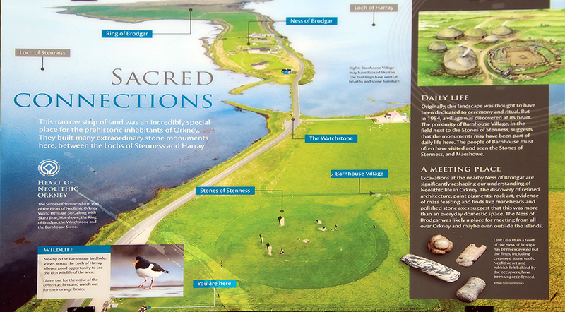
Placas informativas em Stenness. A de baixo mostra a conexão entre os monumentos, incluindo Barnhouse Village, que visitaremos a seguir. /Signs at the Stenness site. The one below shows how interconected the monuments were, including the Barnhouse Village, which we’ll visit next.
Eu fui! / I’ve been there!
Compartilhe meu blog se você gostou.Share my blog if you liked it!
Vista aérea do Círculo de Brodgar, no istmo entre os lagos de Stenness e Harray. / Aerial view of Ring of Brodgar, in a istmus between the Lochs of Stenness and Harray.
O impressionante Anel de Brodgar não é uma estrutura solta na paisagem. Faz parte de um conjunto de monumentos Neolíticos em Mainland (maior parte do território) das Ilhas Orkney, na Escócia. O conjunto foi batizado de Coração Neolítico de Orkney, nome adotado pela UNESCO quando o sítio foi oficialmente declarado Patrimônio Mundial, em Dezembro de 1999.
The impressive Ring of Brodgar is not a single structure in the landscape. It stands as one of the Neolithic monuments on the Mainland of the Orkney Islands, Scotland. The group is called Heart of Neolithic Orkney, name adopted by UNESCO when it proclaimed these sites as a World Heritage Site in December 1999.
O Coração Neolítico de Orkney / The Heart of Neolithic Orkney
Os quatro monumentos que formam o Coração Neolítico de Orkney estão, sem sombra de dúvida, entre os mais importantes da Europa Ocidental: uma câmara mortuária (Maeshowe), dois círculos de pedras (Stones of Stenness and the Ring of Brodgar) e um povoado em excepcional estado de preservação (Skara Brae), além de túmulos, habitações e locais cerimoniais ainda não escavados. Juntos, constituem uma formidável paisagem pré-histórica que nos permite vislumbrar como viviam as pessoas neste longínquo arquipélago ao norte da Escócia, há cerca de 5000 anos atrás.
The Barnhouse Stone, Maeshowe Chambered tomb in the background
The four monuments that make up the Heart of Neolithic Orkney are unquestionably among the most important Neolithic sites in Western Europe: a large chambered tomb (Maeshowe), two stone circles (the Stones of Stenness and the Ring of Brodgar) and a remarkably well-preserved settlement (Skara Brae), together with a number of unexcavated burial, ceremonial and settlement sites. The group constitutes a major prehistoric cultural landscape which gives a graphic depiction of life in this remote archipelago in the far north of Scotland some 5,000 years ago.
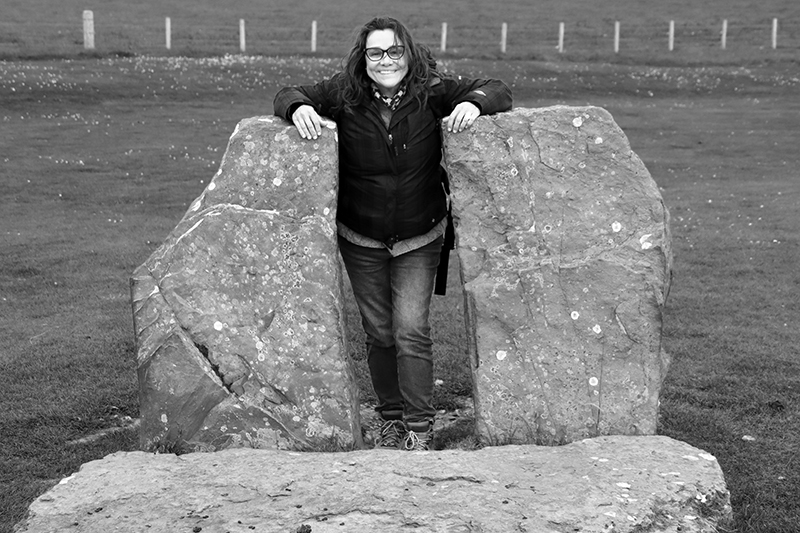
Standing Stones of Stenness
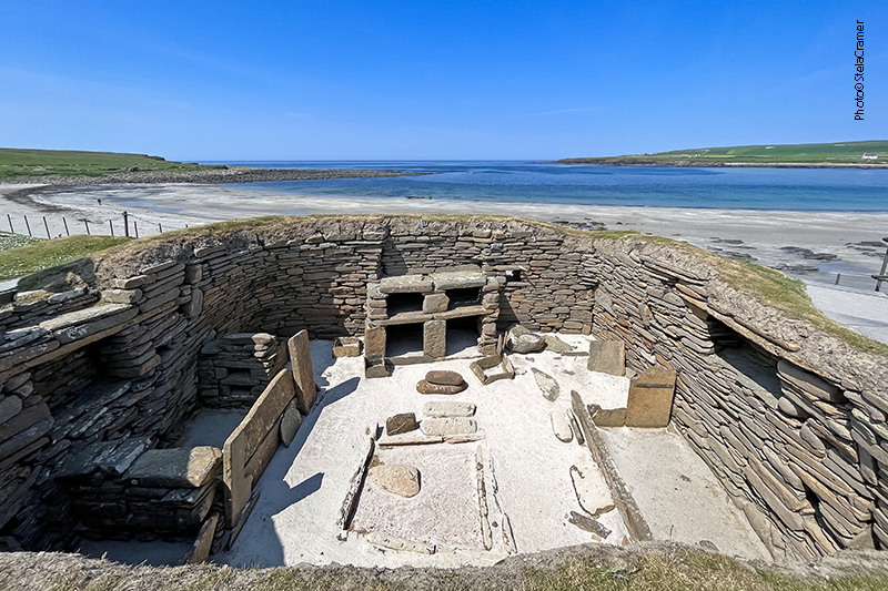
Skara Brae, mais antigo que Stonehenge e Pirâmides de Gizé / A settlement older than Stonehenge and the Great Pyramids of Giza.
Quando comecei a escrever este blog, estava unicamente fascinada pela história do Rei Arthur, pela sua carga mitológica e arquetípica. À medida que fui viajando, lendo e aprendendo, meu foco foi mudando para o conteúdo de realidade que poderia estar contido nos mitos, e as descobertas arqueológicas que os embasavam.
Orkney é um verdadeiro paraíso para pesquisadores e arqueólogos. As 70 ilhas deste arquipélago que agora parece tão remoto já foram um centro de civilização e desenvolvimento, justamente por estarem localizadas ao longo da rota do Mar do Norte, que povos pré históricos trilharam indo do norte da Europa para o atual Reino Unido. Por exemplo, a sofisticada cerâmica de fundo chato, com sulcos (grooved-ware pottery) teria sua origem em Orkney, 5,100 / 5,300 anos atrás, e esta “tecnologia” dali teria se espalhado para todo o resto da Britânia – assim como outras tecnologias, idéias e estilos de arte. Outro exemplo é o grau de complexidade das habitações em Skara Brae – que possuíam isolamento térmico, mobília e mesmo o mais antigo sanitário britânico. Este cantinho da Escócia não era apenas um centro de civilização Neolítica. Bem pode ter sido OCentro.
Mapa do Ártico destacando as Orkneys, ao norte da Escócia, Reino Unido / Arctic Map highlighting the Orkneys, North of Scotland, UK
When I started writing this blog, I was utterly fascinated by King Arthur’s legends, by their mythologic and archetypal contents. As I went on travelling, reading and learning, my focus shifted to the reality that could have been behind the myths, and the archaeological discoveries that supported those.
Orkney is a paradise for researchers. Today, the remote location of the archipelago’s 70 islands seem so remote but, once, it was this very location that made them a centre of civilization. The islands were along the North Sea route that prehistoric people would have taken from northern Europe to Britain and back. Archaeologists have already found, for example, that Orkney invented grooved-ware pottery some 5,100 to 5,300 years ago – a development that later made its way all across Britain, probably accompanied by other types of technology, art and ideas. For example, the buildings of startling sophistication at Skara Brae – the setttlement had insulation, furniture and even what’s thought to be Britain’s earliest toilet ever discovered. This corner of Scotland wasn’t just a centre of Neolithic civilization in Britain. It may have been the centre.
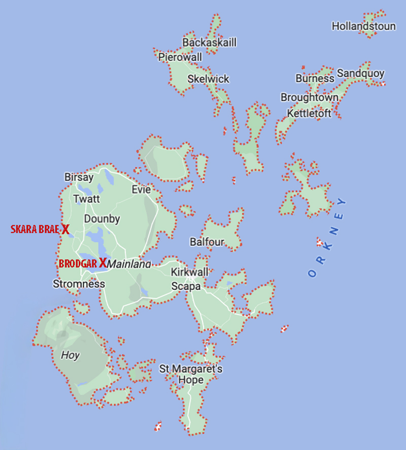
Mapa das Ilhas Orkney destacando Skara Brae e Brodgar / Orkney Islands map highlighting Skara Brae and Brodgar
Entre o anel de Brodgar e os monolitos de Stenness, há outro importante sítio arqueológico: Ness of Brodgar. Embora não esteja incluído no Patrimônio Mundial, está conectado aos demais monumentos. Estive lá também e breve compartilharei as fotos aqui.
Between the Ring of Brodgar and the Stones of Stenness there’s another important archaeological site: the Ness of Brodgar. It’s connected to the World Heritage Site, although it’s not part of it. I’ve been there too, and the photos will be shared here very soon.
Compartilhe meu blog se você gostou.Share my blog if you liked it!


