Feeds:
Posts
Comentários

Posts Tagged ‘Orkneys’


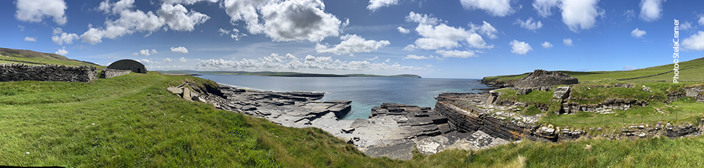
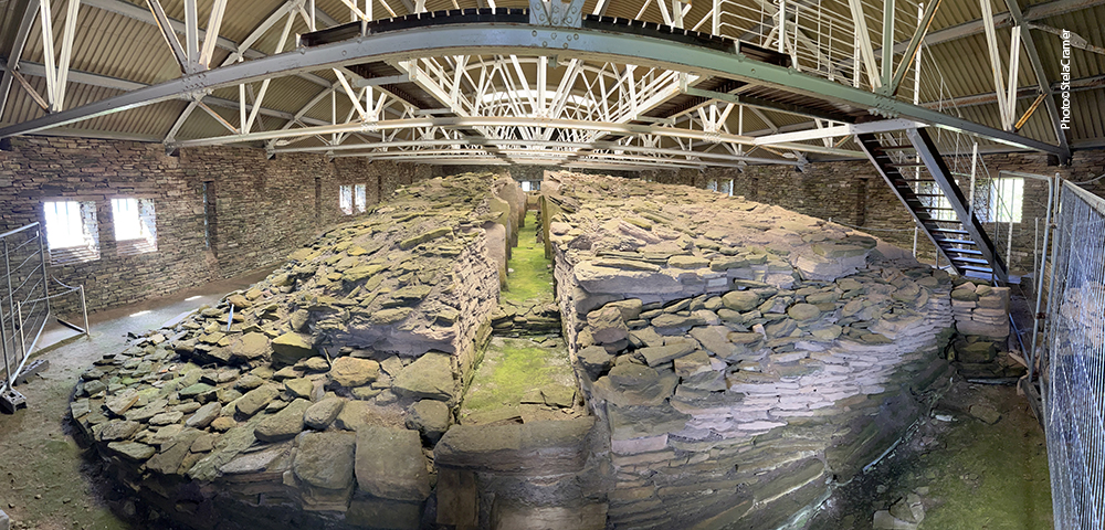
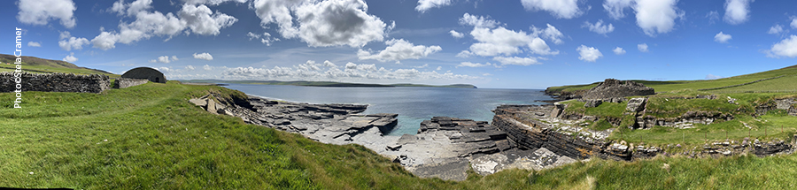
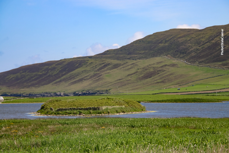
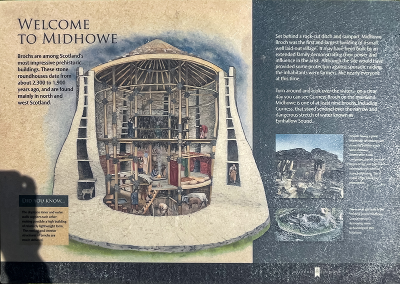
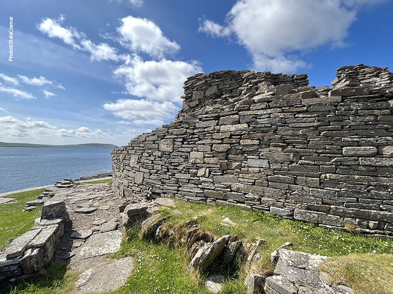
Midhowe Broch foi construído num estreito promontório em Eynhallow Sound há mais de 2000 anos atrás. “Midhowe” significa o monte do meio, sendo este um de três Brochs próximos: North Howe Broch e South Howe Broch, como o nome diz, um a noroeste e um ao sudeste. Há mais quatro outros Brochs ao longo dos 12 km de litoral entre este ponto e o Pier onde atraca o ferryboat vindo de Kirkwall. Parece que estes ainda não foram escavados.

Midhowe Broch was built on a narrow promontory beside Eynhallow Sound more than 2,000 years ago. The name “Midhowe” means middle mound and this is just one of three brochs closely grouped together: North Howe Broch to the north-west, and South Howe Broch to the south-east. There are remains of another four brochs along the five miles of shoreline between these and Trumland Pier, where the ferry from Kirkwakk moors. Apparently, these haven’t been excavated yet.

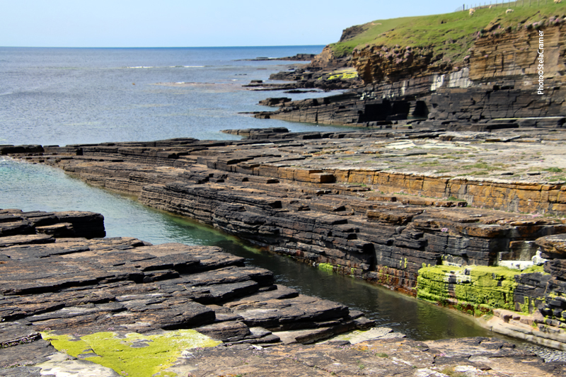
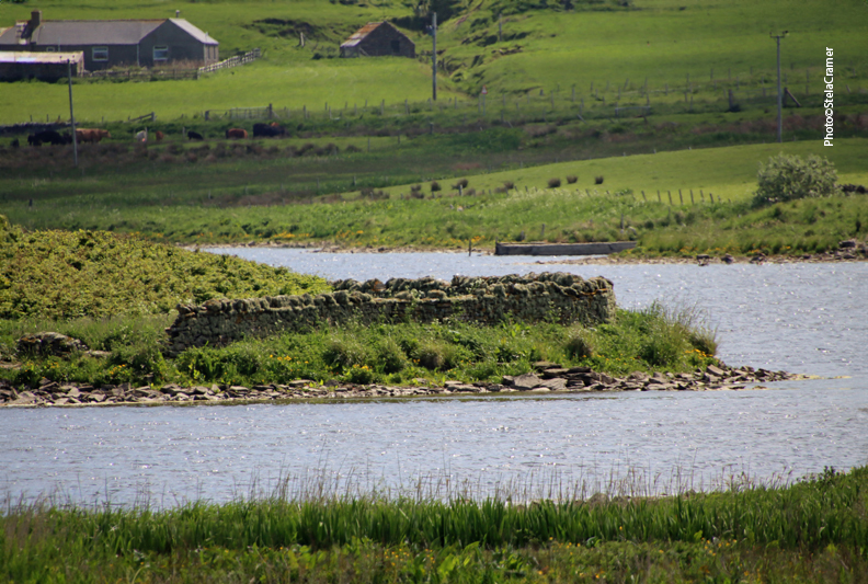
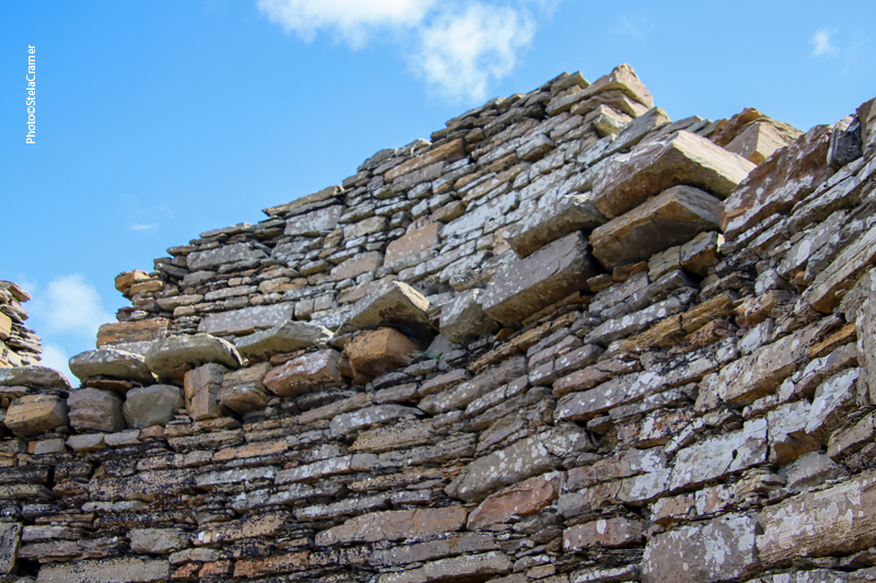
O promontório sobre o qual o Broch se ergue foi acentuado por canais cortados na pedra, dificultando o acesso pela costa. Por terra, as defesas consistiam em dois fossos e uma muralha. Outro muro (o que parece uma paliçada, mais ou menos no meio da foto acima) foi construído em 1930 para proteger o sítio da erosão.

The promontory on which the broch stands has been emphasised by channels cut into the rock making access along the shore much more difficult. Access from the landward side was deterred by two ditches and a rampart. A wall that today encloses the seaward side of the broch ( vertical spikes , more or less in the middle of the photo above) was built to defend it from the sea in the 1930s.

Vista com o fosso sudoeste, cortado na rocha, em primeiro plano. Ao fundo, cruzando o Eynhallow Sound, se encontra quase oposto o Broch de Gurness.
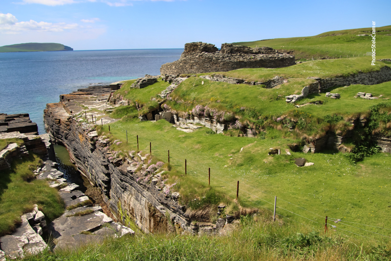
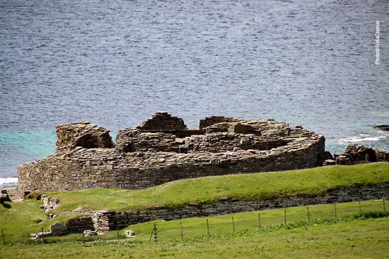
The Broch with the South-Eastern rock cut ditch in the foreground. In the background, across Eynhallow Sound, stands the Broch of Gurness, Brochs are almost opposite one another.
Vista do litoral (nordeste) / Northeast view, from the shore
Muro externo / Outer wall
Entrada / Entrance
Como teria sido o interior do Broch / How it should have been inside the Broch
Primeiro salão principal / Main room One
A cisterna é abastecida por uma fonte e, mais de 2000 anos depois, ainda funciona ! / The spring-fed water cistern, after more than 2,000 years, still seems to work as the original builders intended.
Vala para esgoto / Trench for water sewage
Segundo salão principal. Grandes lajes dividem o espaço em áreas para trabalho e armazenagem. / Main room Two. Large flags divide the space into two smaller areas used for working and storage.

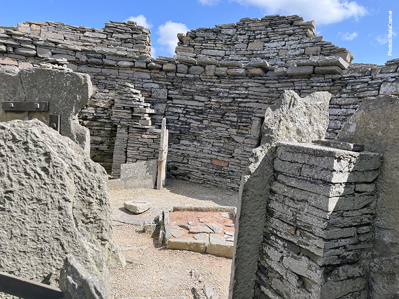
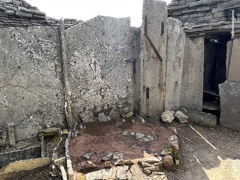
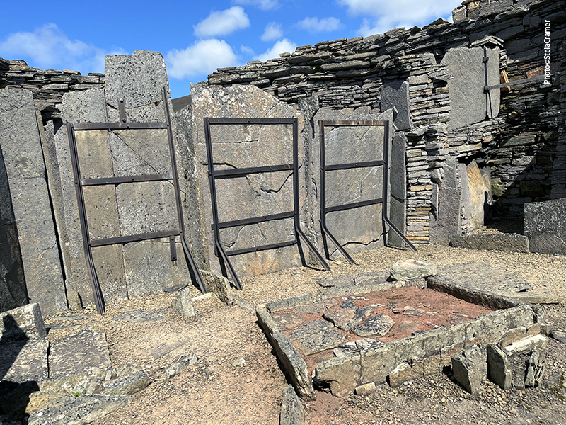
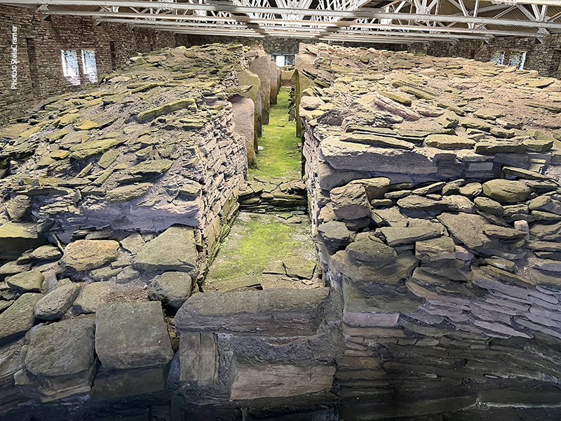
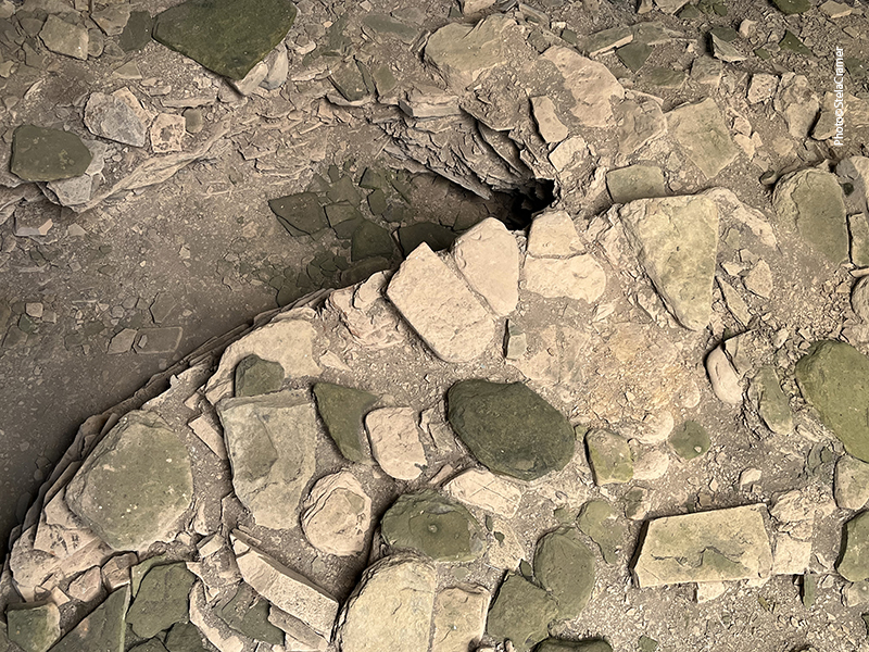
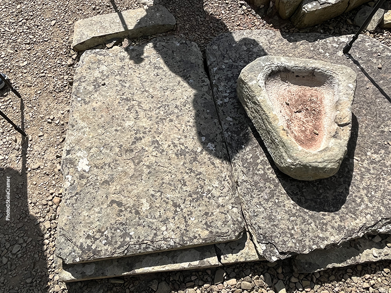
Estas lajes maiores também foram usadas para construir “mobília” / These large slabs have been used to build various items of “furniture”.

Edificações externas / Outer buildings

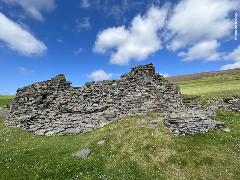
As estruturas externas para acomodação, armazenagem e ferraria foram acrescentadas posteriormente, pois foram construídas por cima do fosso interno original.

External additional structures used for accommodation, storage and iron working. These were added at a later date, as some were built over the original inner ditch of the landward defences.

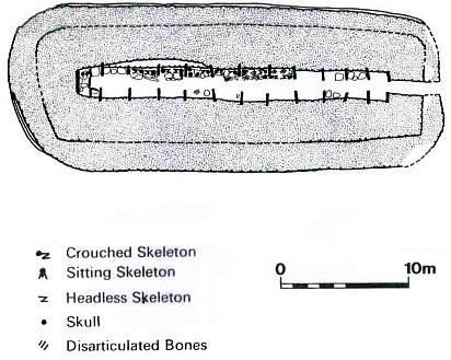
Escavações em 1930 encontraram uma notável quantidade de artefatos, incluindo ferramentas de pedra e de osso, associadas ao processamento de grãos, fiação e tecelagem; fragmentos de cadinhos e moldes indicativos de trabalho em bronze. Cerâmica e pedaços de tigelas Romanas foram especialmente importantes para os arqueólogos, como prova de que estes Brochs estavam habitados na época em que a região tinha ligações comerciais com o Império Romano. Isto confirma o que escreveu o historiador romano Eutropius: que o Rei de Orkney havia se submetido ao Imperador Claudius em 43 DC.

Archaeologists digging here in the 1930s found a remarkable array of everyday artefacts, including stone and bone tools, associated with grain processing, spinning and weaving; pieces from crucibles and moulds, indicating bronze-working. Pottery and fragments from Roman vessels had special interest to archaeologists, as evidence that these Brochs were still in use by the time the area had trading links with the Roman Empire. This corroborates Roman historian Eutropius, who wrote that the king of Orkney had submitted to Emperor Claudius in AD 43.

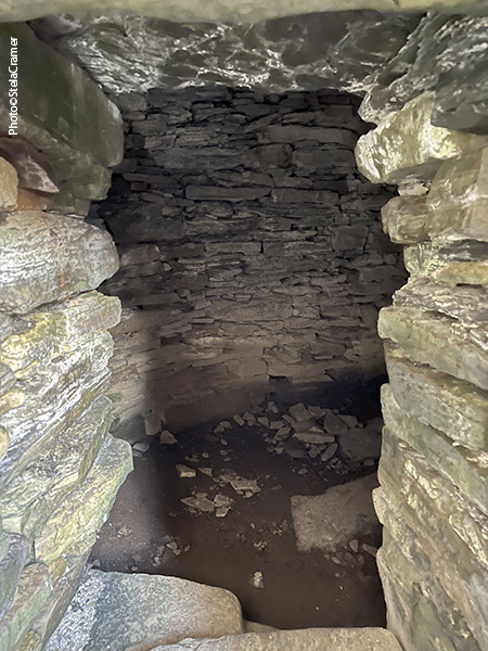
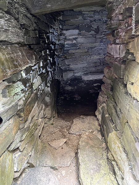
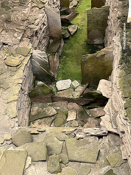
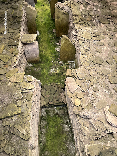
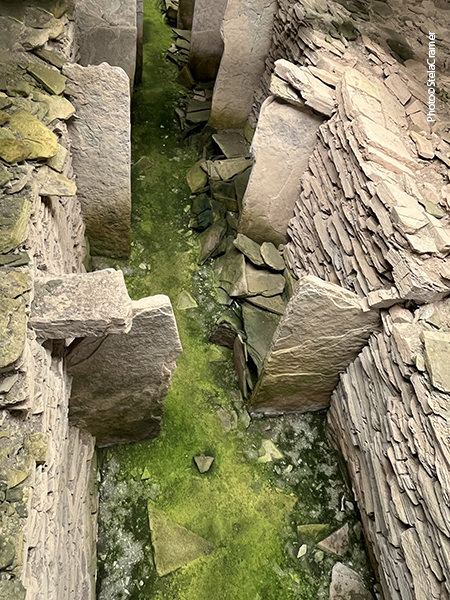
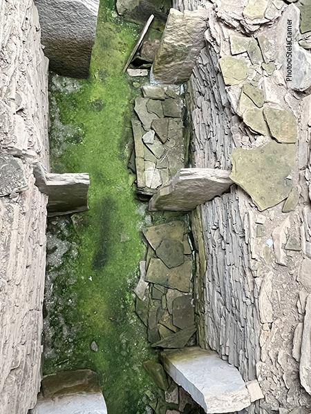
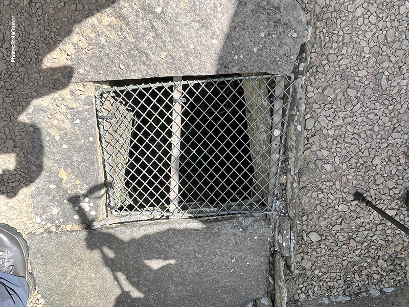
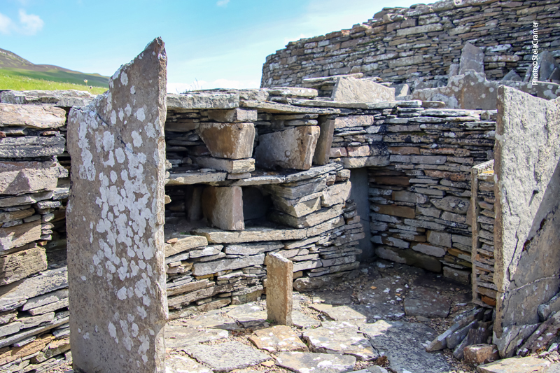
Câmaras no interior das paredes / Chambers inside the walls

As grossas paredes continham escadas para os andares superiores.

Within the thickness of the walls, stairs gave access to the top level and upper floors of the broch.

A torre tem 9 m de diâmetro interno, cercada por paredes de 4,5m de espessura, atualmente com 4,5m de altura. Originalmente teria o dobro ou mesmo o triplo dessa altura. /
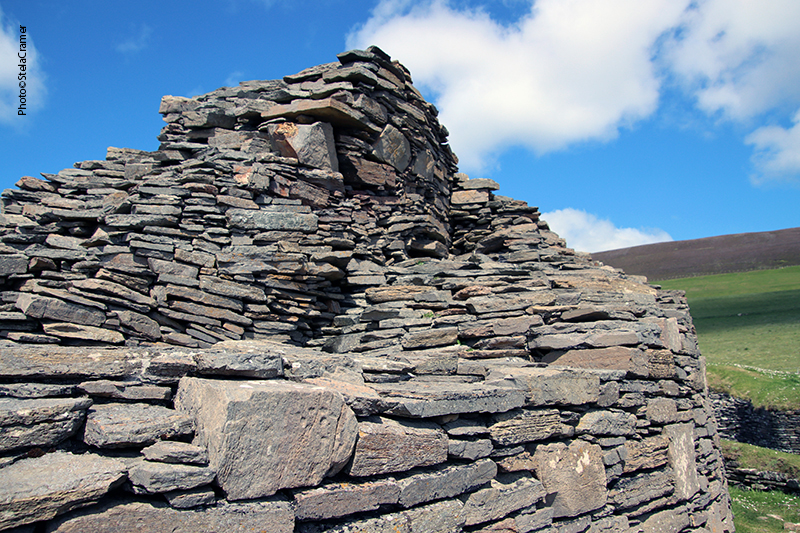
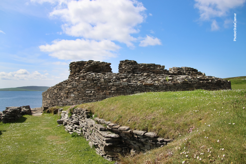
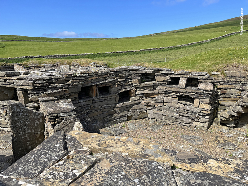
The Broch tower has an internal diameter of 9 metres within a wall 4.5 metres thick, which still stands to a height of over 4 metres. Originally it would have risen to two or three times this height.
Patrick e senhoras do grupo / Mr. Patrick and some of the ladies in the group
A impressionante alvenaria que se mantém firme através dos séculos / Impressive stonemasonry, keeping strong throughout the centuries

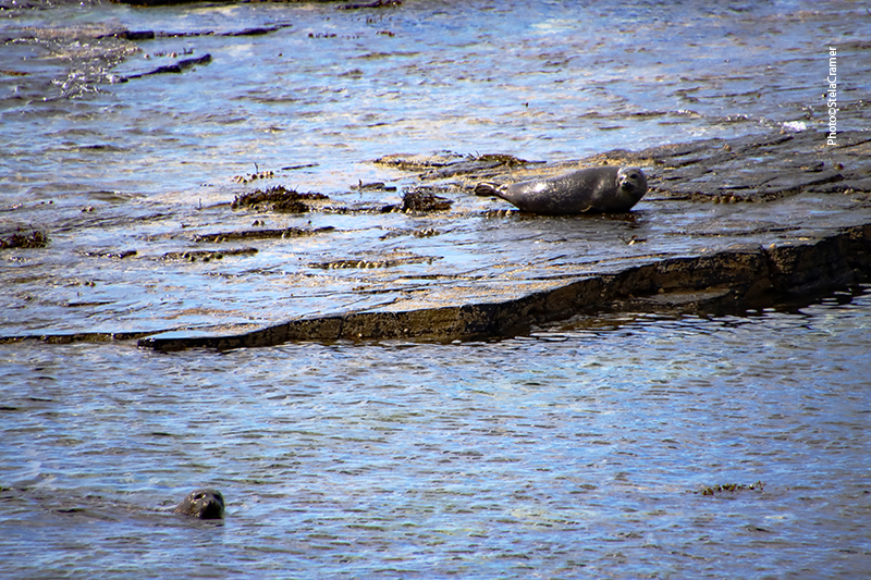
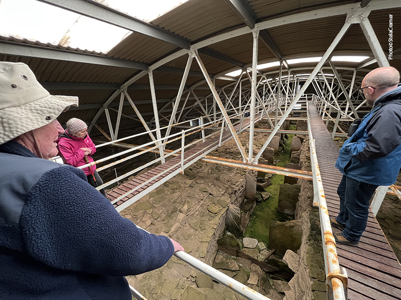
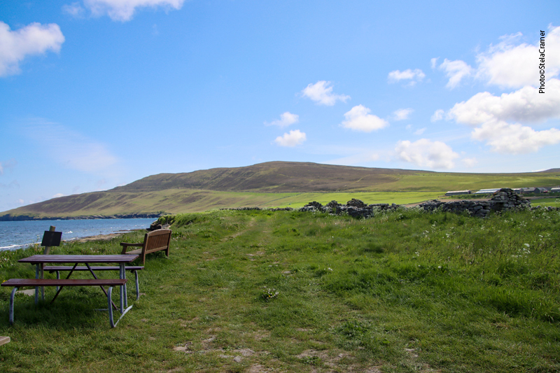
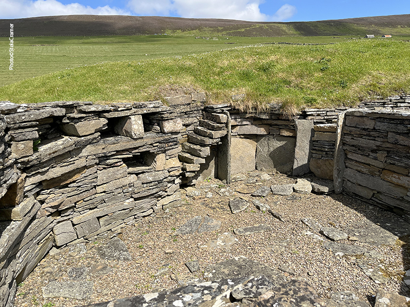
Vamos prosseguir pela costa, rumo às demais escavações existentes em Midhowe. Adivinha quem nos espera no caminho???

Let’s move on by the shore, towards Midhowe’s other excavations. Guess who’s waiting for us on the way?

Hello, lovely!

Read Full Post »


O melhor do tour estava reservado para depois do almoço: o sítio arqueológico de Midhowe. A partir de um pequeno estacionamento na beira da estrada, é preciso descer quase 2km. até a beira-mar, atravessando pastos com uma considerável inclinação. O problema seria subir depois! Faziam parte do grupo duas senhoras idosas, uma inclusive de muletas (que podem ser vistas na foto acima) e confesso que achei que seria preciso alguém carregá-las na volta. Só que não! Devagar e sempre , foram e voltaram felizes e contentes, sem bufar nem reclamar.

The best part had been saved for the afternoon, after lunch: Midhowe archaeological site. From a small parking lot by the road you go down to the coastline, a steep descent half a mile across fields, quite a strenuous climb back to car park. There were two elderly ladies in the group, one on crutches ( as you can see in the photo above), I must confess I thought they would need to be carried back somehow. But no! Slowly but unrelenting they happily went, never complaining.

Midhowe: To the right, the Broch. To the left, the Chambered Cairn and the remains of a 13th century ceremonial hall, 16th century church and ongoing dig site where neolithic and viking buildings are being uncovered. / à direita, o Broch. `A esquerda, a câmara funerária, e as ruínas de um salão do séc. XIII, de uma igreja do séc. XVI e uma escavação em progresso de construções neolíticas e vikings.

O Cairn tem cerca de 4000 anos e foi escavado em 1932/ The Cairn dates from around 4000 years ago and was excavated in 1932.

O túmulo fica dentro de um enorme galpão, construído para protegê-lo dos elementos em 1932 após a escavação. Ao entrar você vê uma pilha de pedras cujo formato se assemelha ao casco de um navio virado. Uma escada dá acesso a uma passarela suspensa, permitindo ao visitante andar ao longo de toda a estrutura, vendo os 24 compartimentos da câmara mortuária. Midhowe Cairn ganhou o apelido de “Navio dos Mortos” devido à semelhança com um navio viking, em formato e tamanho.

The massive structure is inside a large hangar, built after the excavation of the cairn in 1932 to protect it from the elements. Once inside it, you see a mound of stones that look like an upturned boat hull. You can then climb onto a gantry frame above it to walk the length of the cairn whilst looking down at the 24 “stalls” of burial chambers. It is easy to understand why it is known as the “Ship of the Dead”. It resembles a Viking galley ship in size and shape.

Diferente de muitas das câmaras mortuárias escavadas na região, aqui foram encontrados de fato 25 esqueletos humanos, nos diversos compartimentos, além de cerâmica, ferramentas de pedra, conchas, chifres e ossos de animais – ovelhas e gado. Arqueólogos acreditam que sejam vestígios de rituais, ou então objetos colocados junto aos corpos. Mais dois corpos foram encontrados enterrados em entulho, sugerindo que o lugar continuou sendo usado mesmo depois do colapso do telhado.

Unlike other similar cairns, here remains of at least 25 human skeletons were found in the stalls, plus stone tools, pottery, cattle and sheep bones as well as antlers, fish bones and shells. To the archaeologists, that suggests either ritual feasting or that these items were placed with the bodies. Two further bodies were found buried in the rubble of the cairn which would suggest that the use of the cairn continued for a while after the roof caved in.

Enormes lascas de pedra dividem a câmara em compartimentos. Acredita-se que os mortos eram inicialmente postos perto da entrada e, uma vez a carne decomposta, os ossos eram movidos para a câmara central.
Large stone slabs create stalls within the large tomb. It is thought the dead were initially kept near the entrance and the bones later moved into the main body of the cairn once the flesh had rotted.

Mapa com a localização dos corpos encontrados / Map with the spots were bodies were found

Um modelo 3D pode ser acessado pelo link abaixo./ Link to a 3D model of the Cairn:

https://skfb.ly/6BzIG

Prosseguimos… / Moving on…

Read Full Post »


Midhowe, Isle of Rousay, Mainland in the background

O dia do tour em Rousay – 8 de junho de 2023 – amanheceu lindo e ensolarado; estava até quente! Aliás os póprios escoceses estavam surpresos com o calor. Meu guia, Patrick, brincou que eu havia trazido o sol do Brasil. A luz e o céu azul, não muito comuns no Reino Unido, propiciaram algumas fotos de paisagens desta ilha habitada por pouco mais de 200 pessoas.

June 8th / 2023, the day of the Rousay Tour, was a hot sunny day! Even the Scots were astonished with the heat. My guide, Patrick joked that I had brought the sun from Brazil. The bright blue sky, unusual in the UK, made possible some landscape photos of this isle inhabited by few more than 200 people.

Casas curiosas / Odd houses

Patrick Macguire, o guia / Patrick Macguire, the guide. Rousay Tours, phone +44 1856 821234

Verão na Escócia! Summertime in Scotland !

Após buscar alguns passageiros que chegaram de ferry, o tour seguiu a estreita estrada B9064, que contorna a ilha num total de 20 km, ao longo dos quais se encontram os sítios pré-históricos. Dos 100 já identificados, apenas alguns foram escavados e descritos.

After picking up some passengers that arrived with the ferry, the tour followed a single narrow lane, B9064, that makes a 13-mile circuit of the island, along which are the prehistoric sites. Over 100 have been identified but only a few have been excavated and characterized.

Yetnasteen Stone

Passamos por um megalito de 2m de altura, chamado Yetnasteen Stone (“pedra gigante” em nórdico antigo): diz a lenda que trata-se de um gigante que foi transformado em pedra pela exposição à luz do dia. Mas toda noite de Ano Novo, quando o relógio bate meia-noite, ele é liberado o tempo necessário para ir beber um gole de água fresca no lago próximo. Como a pedra fica dentro de uma propriedade privada, só pudemos avistá-la de passagem, pela janela da van.

Yetnasteen Stone: in Old Norse, Jotunna-steinn means “giant stone”; the legend says it’s a giant who’s been turned to stone when exposed to daylight, but at the stroke of midnight at New Year he’s released for just long enough to take a drink from the nearby freshwater loch. We could only see the 2m-tall slab from the van’s window, because it stands in private land.

A escultura “Deuses da Terra, Deuses do Mar”, de Ian Hamilton Finlay, no penhasco de onde se avista a Baía de Saviskaill, e a ilha de Westray ao longe. Foi esculpida numa pedra de 15 toneladas trazida da Cornualha! Me pergunto porque escolheram trazer uma pedra do outro extremo do Reino Unido, a 1.368 km de distância.

The sculpture ‘Gods of the Earth, Gods of the Sea’, by Ian Hamilton Finlay, overlooking Saviskaill Bay, and Isle of Westray in the distance. It’s carved out of 15 tonnes of Portland Stone… from Cornwall ! I wonder why they chose to bring a stone from the other extreme of UK…850 miles away.

A Baía de Saviskaill e, na foto abaixo, o Lago Wasbister. Pode-se ver uma ilhota ao longe no lago. Saviskaill Bay and Wasbister Lake (photo below). You can see an islet in the far side of the lake.

As ruínas que se vê na ilhota , segundo Patrick, são Vikings, mas ainda não foram escavadas.
In the islet there are viking ruins, non yet excavated, according to Patrick.

Seguimos para um picnic junto ao mar, em Saviskaill Bay, onde uma surpresa nos aguardava, além da bela paisagem. Rousay é um “Local de Interesse Científico Especial” devido à sua geologia, fauna e vida selvagem, colônias de pássaros e animais marinhos como lontras e focas. Elas estavam lá esperando por nós. Mas o melhor ainda estava por vir.

We stopped for a picnic by the sea, in Saviskaill Bay, where we had a surprise. Rousay is a Site of Special Scientific Interest because of its geology, wildflowers and bird life. Its wildlife includes otters and seals. And there they were, waiting for us. But the best was yet to come.

Seals / Focas em Saviskaill Bay

Read Full Post »